 Aerial imagery: USGS National Map (public domain)
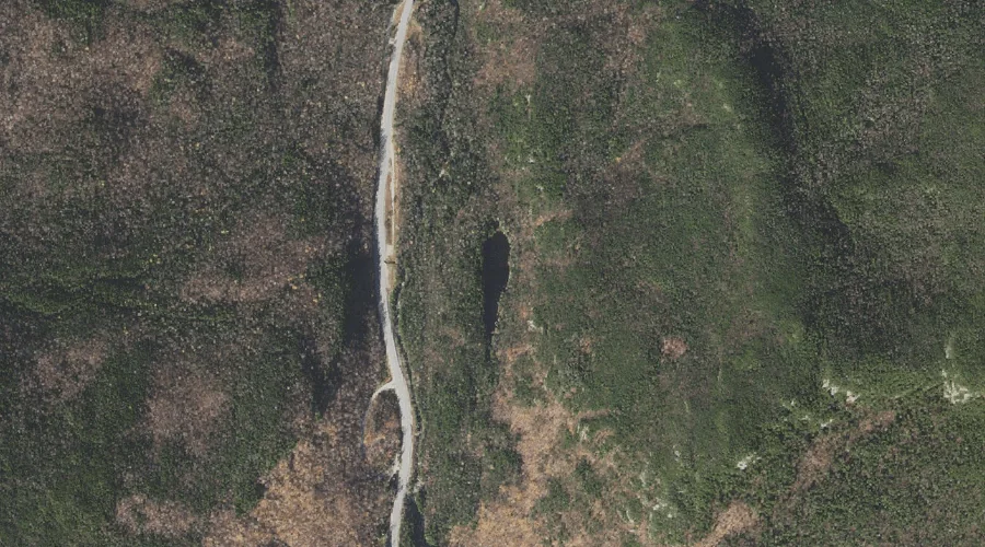
Lost Pond — Lakes 25.2 Miles WSW of Chapman Inn
Coos County, New Hampshire · USGS Stairs Mountain Quadrangle · GNIS 873017
Within Coos County, New Hampshire, on the USGS Stairs Mountain quadrangle, the lake known as Lost Pond sits 25.2 miles west-southwest of Chapman Inn.
Landmark Profile
Classification & USGS reference
Within Coos County, New Hampshire, the U.S. Geological Survey lists Lost Pond as a lake on the Stairs Mountain topographic quadrangle (FIPS 33/007), under Feature ID 873017. Last revised by the Board on Geographic Names on 05/15/2018.
Coordinates & physical setting
Lost Pond sits at 44.24973° N, 71.25079° W (DMS 44°14′59″ N, 71°15′03″ W).
Other lakes in Coos County, New Hampshire
Coos County, NH contains 99 lakes catalogued in the USGS Geographic Names Information System, counting Lost Pond itself. The ones closest to Lost Pond:
| Feature | USGS Quadrangle | Distance |
|---|---|---|
| Hermit Lake | Mount Washington | 2 mi |
| Emerald Pool | Carter Dome | 2.3 mi |
| Lakes of the Clouds | Mount Washington | 3.4 mi |
| Spaulding Lake | Mount Washington | 3.7 mi |
| Garnet Pool | Carter Dome | 4 mi |
| Desolation Pond | Stairs Mountain | 4.2 mi |
| No Ketchum Pond | Jackson | 5.3 mi |
| Star Lake | Mount Washington | 5.5 mi |
| Saco Lake | Crawford Notch | 8.2 mi |
| Ammonoosuc Lake | Crawford Notch | 8.5 mi |
Features on the USGS Stairs Mountain Quadrangle
The Stairs Mountain 7.5-minute topographic quadrangle holds 28 catalogued natural features alongside Lost Pond. A sampling nearest to this location:
| Feature | Type | County | Offset |
|---|---|---|---|
| Glen Ellis Falls | Waterfalls | Coos County, NH | 0.4 mi |
| Glen Boulder | Pillars | Coos County, NH | 1.5 mi |
| Gulf of Slides | Valleys | Coos County, NH | 1.7 mi |
| Rocky Branch Ridge | Ridges | Coos County, NH | 2 mi |
| Gulf Peak | Summits | Coos County, NH | 2 mi |
| Montalban Ridge | Ridges | Coos County, NH | 2.9 mi |
| Oakes Gulf | Valleys | Coos County, NH | 3 mi |
| Engine Hill | Summits | Coos County, NH | 3.6 mi |
| Mount Isolation | Summits | Coos County, NH | 3.8 mi |
| Desolation Pond | Lakes | Coos County, NH | 4.2 mi |
Visiting from Chapman Inn
Distance, bearing & drive time
Follow the compass bearing WSW out of Bethel for 25.2 miles (west-southwest) and you reach Lost Pond; at typical rural speeds the trip runs roughly 43 minutes.
Best time to visit
June through September for paddling and swimming; January through March for ice fishing. Being this far north (lat 44.250°), first snows typically arrive by mid-October and linger into early May — narrow the window accordingly. At 25.2 miles from the Inn, block the full day — sunrise start, late return, packed meals. Conditions at Lost Pond track the nearby Glen Ellis Falls waterfall (0.4 mi away) closely — if that is runnable, so is this.
Nearest features to Lost Pond
| Feature | Type | County | Distance |
|---|---|---|---|
| Glen Ellis Falls | Waterfalls | Coos County, NH | 0.4 mi |
| New River | Streams | Coos County, NH | 0.4 mi |
| Pinkham Notch | Gaps | Coos County, NH | 0.6 mi |
| Cutler River | Streams | Coos County, NH | 1 mi |
| Wildcat Ridge | Ridges | Coos County, NH | 1.2 mi |
Frequently Asked Questions
Where is Lost Pond located?
Lost Pond is in Coos County, New Hampshire, approximately 25.2 miles west-southwest of Chapman Inn in Bethel, Maine. It appears on the USGS Stairs Mountain topographic quadrangle.
How far is Lost Pond from Chapman Inn?
The drive runs about 43 minutes, 25.2 miles west-southwest (bearing WSW) of the Inn.
What type of natural feature is Lost Pond?
The U.S. Geological Survey classifies Lost Pond as a lake, catalogued under GNIS Feature ID 873017 on the Stairs Mountain quadrangle.
When is the best time to visit Lost Pond?
June through September for paddling and swimming; January through March for ice fishing.
How many other lakes are in Coos County, New Hampshire?
GNIS lists 98 other lakes in Coos County, New Hampshire.