 Aerial imagery: USGS National Map (public domain)
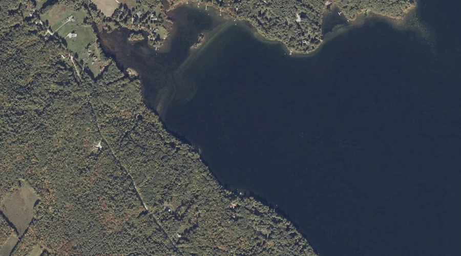
Otisfield Cove — Bays 25.9 Miles SSE of Chapman Inn
Oxford County, Maine · USGS Casco Quadrangle · GNIS 572795
Within Oxford County, Maine, on the USGS Casco quadrangle, the bay known as Otisfield Cove sits 25.9 miles south-southeast of Chapman Inn.
Wikidata short description: “bay in Oxford County, Maine, United States of America”
Landmark Profile
Classification & USGS reference
Within Oxford County, Maine, the U.S. Geological Survey lists Otisfield Cove as a bay on the Casco topographic quadrangle (FIPS 23/017), under Feature ID 572795. Last revised by the Board on Geographic Names on 02/17/2012.
Coordinates & physical setting
Otisfield Cove sits at 44.08674° N, 70.51311° W (DMS 44°05′12″ N, 70°30′47″ W).
Other bays in Oxford County, Maine
Oxford County, ME contains 21 bays catalogued in the USGS Geographic Names Information System, counting Otisfield Cove itself. The ones closest to Otisfield Cove:
| Feature | USGS Quadrangle | Distance |
|---|---|---|
| Haynes Cove | Mechanic Falls | 1.5 mi |
| Middle Bay | Center Lovell | 20.5 mi |
| Lower Bay | Center Lovell | 21.2 mi |
| Fryeburg Harbor | Center Lovell | 21.3 mi |
| Upper Bay | Center Lovell | 21.5 mi |
| Northwest Cove | Center Lovell | 21.6 mi |
| South Arm Lower Richardson Lake | Metallak Mountain | 49.1 mi |
| Tyler Cove | Umbagog Lake South | 52.1 mi |
| B Brook Cove | Umbagog Lake North | 53.1 mi |
| Spaulding Cove | Middle Dam | 53.5 mi |
Features on the USGS Casco Quadrangle
The Casco 7.5-minute topographic quadrangle holds 46 catalogued natural features alongside Otisfield Cove. A sampling nearest to this location:
| Feature | Type | County | Offset |
|---|---|---|---|
| Sand Island | Islands | Oxford County, ME | 0.3 mi |
| The Cape | Capes | Oxford County, ME | 0.3 mi |
| Sucker Brook | Streams | Oxford County, ME | 0.5 mi |
| Long Point | Capes | Oxford County, ME | 0.6 mi |
| Knights Brook | Streams | Oxford County, ME | 0.7 mi |
| Goat Island | Islands | Oxford County, ME | 1 mi |
| Coon Road Swamp | Swamps | Oxford County, ME | 1.1 mi |
| Scribner Hill | Summits | Oxford County, ME | 1.4 mi |
| Canada Hill | Summits | Oxford County, ME | 1.4 mi |
| Nutting Ledge | Benches | Oxford County, ME | 1.6 mi |
Visiting from Chapman Inn
Distance, bearing & drive time
Follow the compass bearing SSE out of Bethel for 25.9 miles (south-southeast) and you reach Otisfield Cove; at typical rural speeds the trip runs roughly 44 minutes.
Best time to visit
June through September for paddling and swimming; January through March for ice fishing. At this latitude (44.087°), the shoulder seasons are workable — April and November can be comfortable on mild years. At 25.9 miles from the Inn, block the full day — sunrise start, late return, packed meals. Conditions at Otisfield Cove track the nearby Sand Island (0.3 mi away) closely — if that is runnable, so is this.
Nearest features to Otisfield Cove
| Feature | Type | County | Distance |
|---|---|---|---|
| Sand Island | Islands | Oxford County, ME | 0.3 mi |
| The Cape | Capes | Oxford County, ME | 0.3 mi |
| Sucker Brook | Streams | Oxford County, ME | 0.5 mi |
| Long Point | Capes | Oxford County, ME | 0.6 mi |
| Knights Brook | Streams | Oxford County, ME | 0.7 mi |
Frequently Asked Questions
Where is Otisfield Cove located?
Otisfield Cove is in Oxford County, Maine, approximately 25.9 miles south-southeast of Chapman Inn in Bethel, Maine. It appears on the USGS Casco topographic quadrangle.
How far is Otisfield Cove from Chapman Inn?
The drive runs about 44 minutes, 25.9 miles south-southeast (bearing SSE) of the Inn.
What type of natural feature is Otisfield Cove?
The U.S. Geological Survey classifies Otisfield Cove as a bay, catalogued under GNIS Feature ID 572795 on the Casco quadrangle.
When is the best time to visit Otisfield Cove?
June through September for paddling and swimming; January through March for ice fishing.
How many other bays are in Oxford County, Maine?
GNIS lists 20 other bays in Oxford County, Maine.
Wikidata: Q49387213.