 Aerial imagery: USGS National Map (public domain)
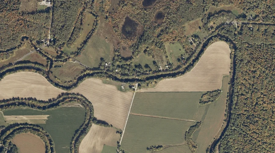
Fryeburg Harbor — Bays 20.5 Miles SSW of Chapman Inn
Oxford County, Maine · USGS Center Lovell Quadrangle · GNIS 581034
20.5 miles south-southwest of Chapman Inn, on the USGS Center Lovell topographic quadrangle, Fryeburg Harbor is a bay recorded in Oxford County, Maine by the federal Geographic Names Information System.
Wikidata short description: “bay in Oxford County, Maine, United States of America”
Landmark Profile
Classification & USGS reference
The USGS Center Lovell 7.5-minute topographic quadrangle places Fryeburg Harbor in Oxford County, Maine (FIPS 23/017), classified as a bay in the federal GNIS (Feature ID 581034). Catalogued in GNIS since 09/30/1980.
Coordinates & physical setting
Fryeburg Harbor sits at 44.12840° N, 70.93840° W (DMS 44°07′42″ N, 70°56′18″ W).
Other bays in Oxford County, Maine
Oxford County, ME contains 21 bays catalogued in the USGS Geographic Names Information System, counting Fryeburg Harbor itself. The ones closest to Fryeburg Harbor:
| Feature | USGS Quadrangle | Distance |
|---|---|---|
| Lower Bay | Center Lovell | 2 mi |
| Northwest Cove | Center Lovell | 2.7 mi |
| Middle Bay | Center Lovell | 4.6 mi |
| Upper Bay | Center Lovell | 7.7 mi |
| Otisfield Cove | Casco | 21.3 mi |
| Haynes Cove | Mechanic Falls | 22.4 mi |
| Tyler Cove | Umbagog Lake South | 42.8 mi |
| South Arm Lower Richardson Lake | Metallak Mountain | 43.5 mi |
| B Brook Cove | Umbagog Lake North | 44 mi |
| Glassby Cove | Umbagog Lake North | 45.2 mi |
Features on the USGS Center Lovell Quadrangle
The Center Lovell 7.5-minute topographic quadrangle holds 65 catalogued natural features alongside Fryeburg Harbor. A sampling nearest to this location:
| Feature | Type | County | Offset |
|---|---|---|---|
| Charles River | Streams | Oxford County, ME | 0.4 mi |
| Kezar Outlet | Streams | Oxford County, ME | 0.4 mi |
| Shave Hill | Summits | Oxford County, ME | 1.1 mi |
| Cold River | Streams | Oxford County, ME | 1.5 mi |
| Long Meadow Brook | Streams | Oxford County, ME | 1.5 mi |
| Charles Pond | Lakes | Oxford County, ME | 1.6 mi |
| Pigeon Point | Capes | Oxford County, ME | 1.6 mi |
| Lower Bay | Bays | Oxford County, ME | 2 mi |
| Christian Hill | Summits | Oxford County, ME | 2.2 mi |
| Little Cold River | Streams | Oxford County, NH | 2.3 mi |
Historical record
The U.S. Board on Geographic Names recorded a Official (Board Decision) on January 1, 1965 for this name.
Visiting from Chapman Inn
Distance, bearing & drive time
Chapman Inn sits 20.5 miles south-southwest (bearing SSW) of Fryeburg Harbor. At moderate back-road speeds the drive runs about 35 minutes — comfortably inside a half-day outing window after breakfast.
Best time to visit
June through September for paddling and swimming; January through March for ice fishing. At this latitude (44.128°), the shoulder seasons are workable — April and November can be comfortable on mild years. At 20.5 miles from the Inn, plan on a comfortable day trip with time for lunch on the road. Conditions at Fryeburg Harbor track the nearby Charles River stream (0.4 mi away) closely — if that is runnable, so is this.
Nearest features to Fryeburg Harbor
| Feature | Type | County | Distance |
|---|---|---|---|
| Charles River | Streams | Oxford County, ME | 0.4 mi |
| Kezar Outlet | Streams | Oxford County, ME | 0.4 mi |
| Shave Hill | Summits | Oxford County, ME | 1.1 mi |
| Cold River | Streams | Oxford County, ME | 1.5 mi |
| Horseshoe Pond | Lakes | Oxford County, ME | 1.5 mi |
Frequently Asked Questions
Where is Fryeburg Harbor located?
Fryeburg Harbor is in Oxford County, Maine, approximately 20.5 miles south-southwest of Chapman Inn in Bethel, Maine. It appears on the USGS Center Lovell topographic quadrangle.
How far is Fryeburg Harbor from Chapman Inn?
The drive runs about 35 minutes, 20.5 miles south-southwest (bearing SSW) of the Inn.
What type of natural feature is Fryeburg Harbor?
The U.S. Geological Survey classifies Fryeburg Harbor as a bay, catalogued under GNIS Feature ID 581034 on the Center Lovell quadrangle.
When is the best time to visit Fryeburg Harbor?
June through September for paddling and swimming; January through March for ice fishing.
How many other bays are in Oxford County, Maine?
GNIS lists 20 other bays in Oxford County, Maine.
Wikidata: Q33583628.