 Aerial imagery: USGS National Map (public domain)
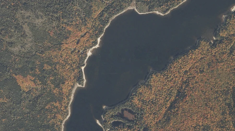
Spaulding Cove — Bays 28.6 Miles N of Chapman Inn
Oxford County, Maine · USGS Middle Dam Quadrangle · GNIS 575978
Within Oxford County, Maine, on the USGS Middle Dam quadrangle, the bay known as Spaulding Cove sits 28.6 miles north of Chapman Inn.
Wikidata short description: “bay in Oxford County, Maine, United States of America”
Landmark Profile
Classification & USGS reference
Within Oxford County, Maine, the U.S. Geological Survey lists Spaulding Cove as a bay on the Middle Dam topographic quadrangle (FIPS 23/017), under Feature ID 575978. Catalogued in GNIS since 09/30/1980.
Coordinates & physical setting
Spaulding Cove sits at 44.81061° N, 70.89841° W (DMS 44°48′38″ N, 70°53′54″ W).
Other bays in Oxford County, Maine
Oxford County, ME contains 21 bays catalogued in the USGS Geographic Names Information System, counting Spaulding Cove itself. The ones closest to Spaulding Cove:
| Feature | USGS Quadrangle | Distance |
|---|---|---|
| Halfmoon Cove | Middle Dam | 3 mi |
| Cranberry Cove | Middle Dam | 4.3 mi |
| South Arm Lower Richardson Lake | Metallak Mountain | 4.5 mi |
| West Arm Upper Richardson Lake | Richardson Pond | 5.1 mi |
| Sunday Cove | Umbagog Lake North | 5.2 mi |
| Sturtevant Cove | Umbagog Lake North | 5.7 mi |
| Sandy Cove | Oquossoc | 6.3 mi |
| Glassby Cove | Umbagog Lake North | 6.6 mi |
| Spillman Cove | Umbagog Lake North | 6.6 mi |
| B Brook Cove | Umbagog Lake North | 7.3 mi |
Features on the USGS Middle Dam Quadrangle
The Middle Dam 7.5-minute topographic quadrangle holds 27 catalogued natural features alongside Spaulding Cove. A sampling nearest to this location:
| Feature | Type | County | Offset |
|---|---|---|---|
| The Narrows | Other Natural Features | Oxford County, ME | 0.3 mi |
| Portland Point | Capes | Oxford County, ME | 0.3 mi |
| Horse Beef Point | Capes | Oxford County, ME | 0.7 mi |
| Jackson Point | Capes | Oxford County, ME | 1.3 mi |
| Rand Brook | Streams | Oxford County, ME | 1.5 mi |
| Moose Mountain | Summits | Oxford County, ME | 2 mi |
| Lower Richardson Lake | Reservoirs | Oxford County, ME | 2.2 mi |
| Rifle Point | Capes | Oxford County, ME | 2.4 mi |
| Hardscrabble Island | Islands | Oxford County, ME | 2.5 mi |
| Sunday Pond | Lakes | Oxford County, ME | 2.8 mi |
Visiting from Chapman Inn
Distance, bearing & drive time
Follow the compass bearing N out of Bethel for 28.6 miles (north) and you reach Spaulding Cove; at typical rural speeds the trip runs roughly 49 minutes.
Best time to visit
June through September for paddling and swimming; January through March for ice fishing. Being this far north (lat 44.811°), first snows typically arrive by mid-October and linger into early May — narrow the window accordingly. At 28.6 miles from the Inn, block the full day — sunrise start, late return, packed meals. Conditions at Spaulding Cove track the nearby The Narrows natural feature (0.3 mi away) closely — if that is runnable, so is this.
Nearest features to Spaulding Cove
| Feature | Type | County | Distance |
|---|---|---|---|
| The Narrows | Other Natural Features | Oxford County, ME | 0.3 mi |
| Portland Point | Capes | Oxford County, ME | 0.3 mi |
| Horse Beef Point | Capes | Oxford County, ME | 0.7 mi |
| Jackson Point | Capes | Oxford County, ME | 1.3 mi |
| Rand Brook | Streams | Oxford County, ME | 1.5 mi |
Frequently Asked Questions
Where is Spaulding Cove located?
Spaulding Cove is in Oxford County, Maine, approximately 28.6 miles north of Chapman Inn in Bethel, Maine. It appears on the USGS Middle Dam topographic quadrangle.
How far is Spaulding Cove from Chapman Inn?
The drive runs about 49 minutes, 28.6 miles north (bearing N) of the Inn.
What type of natural feature is Spaulding Cove?
The U.S. Geological Survey classifies Spaulding Cove as a bay, catalogued under GNIS Feature ID 575978 on the Middle Dam quadrangle.
When is the best time to visit Spaulding Cove?
June through September for paddling and swimming; January through March for ice fishing.
How many other bays are in Oxford County, Maine?
GNIS lists 20 other bays in Oxford County, Maine.
Wikidata: Q49392765.