 Aerial imagery: USGS National Map (public domain)
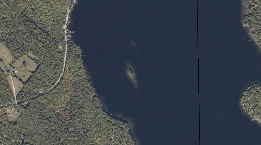
Goat Island — Islands 25.5 Miles SE of Chapman Inn
Oxford County, Maine · USGS Casco Quadrangle · GNIS 561016
Catalogued on the USGS Casco quadrangle in Oxford County, Maine, Goat Island — a island — lies 25.5 miles southeast of Chapman Inn.
Landmark Profile
Classification & USGS reference
Catalogued under GNIS Feature ID 561016, Goat Island is recorded as a island on the USGS Casco quadrangle in Oxford County, Maine (FIPS 23/017). Last revised by the Board on Geographic Names on 06/14/2018.
Coordinates & physical setting
Goat Island sits at 44.09865° N, 70.50279° W (DMS 44°05′55″ N, 70°30′10″ W).
Other islands in Oxford County, Maine
Oxford County, ME contains 44 islands catalogued in the USGS Geographic Names Information System, counting Goat Island itself. The ones closest to Goat Island:
| Feature | USGS Quadrangle | Distance |
|---|---|---|
| Sand Island | Casco | 0.8 mi |
| Wardwell Island | Casco | 1.2 mi |
| Wacipi Island | Mechanic Falls | 4 mi |
| Birch Island | Mechanic Falls | 4.1 mi |
| Crescent Island | Mechanic Falls | 4.2 mi |
| Squirrel Island | Mechanic Falls | 4.3 mi |
| Turtle Island | Mechanic Falls | 4.5 mi |
| Wood Island | Pleasant Mountain | 16.3 mi |
| Walker Island | Fryeburg | 20.8 mi |
| Timber Island | Center Lovell | 21 mi |
Features on the USGS Casco Quadrangle
The Casco 7.5-minute topographic quadrangle holds 46 catalogued natural features alongside Goat Island. A sampling nearest to this location:
| Feature | Type | County | Offset |
|---|---|---|---|
| Long Point | Capes | Oxford County, ME | 0.4 mi |
| The Cape | Capes | Oxford County, ME | 0.6 mi |
| Canada Hill | Summits | Oxford County, ME | 0.8 mi |
| Sand Island | Islands | Oxford County, ME | 0.8 mi |
| Otisfield Cove | Bays | Oxford County, ME | 1 mi |
| Sucker Brook | Streams | Oxford County, ME | 1 mi |
| Knights Brook | Streams | Oxford County, ME | 1.1 mi |
| Wardwell Island | Islands | Oxford County, ME | 1.2 mi |
| Greeley Hill | Summits | Oxford County, ME | 1.7 mi |
| The Pinnacle | Summits | Oxford County, ME | 1.8 mi |
Visiting from Chapman Inn
Distance, bearing & drive time
A 44-minute drive along back roads separates the front door of Chapman Inn from Goat Island — 25.5 miles southeast as the crow flies, on compass bearing SE.
Best time to visit
Late May through early October, when the water is safe for small-boat access. At this latitude (44.099°), the shoulder seasons are workable — April and November can be comfortable on mild years. At 25.5 miles from the Inn, block the full day — sunrise start, late return, packed meals. Conditions at Goat Island track the nearby Long Point cape (0.4 mi away) closely — if that is runnable, so is this.
Nearest features to Goat Island
| Feature | Type | County | Distance |
|---|---|---|---|
| Long Point | Capes | Oxford County, ME | 0.4 mi |
| The Cape | Capes | Oxford County, ME | 0.6 mi |
| Hayes Point | Capes | Oxford County, ME | 0.7 mi |
| Haynes Cove | Bays | Oxford County, ME | 0.7 mi |
| Canada Hill | Summits | Oxford County, ME | 0.8 mi |
Frequently Asked Questions
Where is Goat Island located?
Goat Island is in Oxford County, Maine, approximately 25.5 miles southeast of Chapman Inn in Bethel, Maine. It appears on the USGS Casco topographic quadrangle.
How far is Goat Island from Chapman Inn?
The drive runs about 44 minutes, 25.5 miles southeast (bearing SE) of the Inn.
What type of natural feature is Goat Island?
The U.S. Geological Survey classifies Goat Island as a island, catalogued under GNIS Feature ID 561016 on the Casco quadrangle.
When is the best time to visit Goat Island?
Late May through early October, when the water is safe for small-boat access.
How many other islands are in Oxford County, Maine?
GNIS lists 43 other islands in Oxford County, Maine.