 Aerial imagery: USGS National Map (public domain)
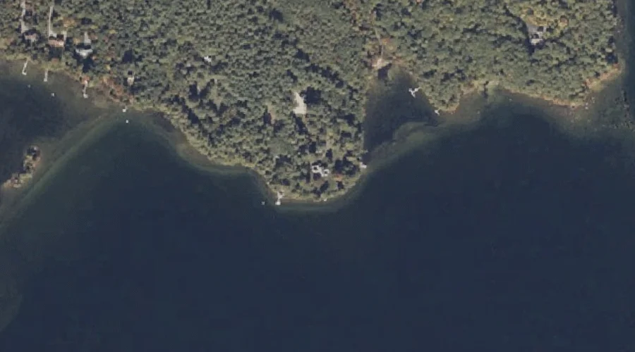
The Cape — Capes 25.8 Miles SSE of Chapman Inn
Oxford County, Maine · USGS Casco Quadrangle · GNIS 576777
25.8 miles south-southeast of Chapman Inn, on the USGS Casco topographic quadrangle, The Cape is a cape recorded in Oxford County, Maine by the federal Geographic Names Information System.
Landmark Profile
Classification & USGS reference
The USGS Casco 7.5-minute topographic quadrangle places The Cape in Oxford County, Maine (FIPS 23/017), classified as a cape in the federal GNIS (Feature ID 576777). Last revised by the Board on Geographic Names on 02/17/2012.
Coordinates & physical setting
The Cape sits at 44.09035° N, 70.50867° W (DMS 44°05′25″ N, 70°30′31″ W).
Other capes in Oxford County, Maine
Oxford County, ME contains 19 capes catalogued in the USGS Geographic Names Information System, counting The Cape itself. The ones closest to The Cape:
| Feature | USGS Quadrangle | Distance |
|---|---|---|
| Long Point | Casco | 0.3 mi |
| Hayes Point | Mechanic Falls | 1 mi |
| Lunt Point | Mechanic Falls | 1.5 mi |
| The Bar | Mechanic Falls | 1.9 mi |
| Blackburn Point | North Sebago | 15.7 mi |
| Pigeon Point | Center Lovell | 21.6 mi |
| Bailey Point | Metallak Mountain | 49.8 mi |
| Rifle Point | Middle Dam | 51.4 mi |
| Jackson Point | Middle Dam | 52.6 mi |
| Horse Beef Point | Middle Dam | 52.9 mi |
Features on the USGS Casco Quadrangle
The Casco 7.5-minute topographic quadrangle holds 46 catalogued natural features alongside The Cape. A sampling nearest to this location:
| Feature | Type | County | Offset |
|---|---|---|---|
| Sand Island | Islands | Oxford County, ME | 0.3 mi |
| Long Point | Capes | Oxford County, ME | 0.3 mi |
| Otisfield Cove | Bays | Oxford County, ME | 0.3 mi |
| Sucker Brook | Streams | Oxford County, ME | 0.6 mi |
| Goat Island | Islands | Oxford County, ME | 0.6 mi |
| Knights Brook | Streams | Oxford County, ME | 0.8 mi |
| Canada Hill | Summits | Oxford County, ME | 1.1 mi |
| Coon Road Swamp | Swamps | Oxford County, ME | 1.4 mi |
| Scribner Hill | Summits | Oxford County, ME | 1.7 mi |
| Wardwell Island | Islands | Oxford County, ME | 1.8 mi |
Visiting from Chapman Inn
Distance, bearing & drive time
Chapman Inn sits 25.8 miles south-southeast (bearing SSE) of The Cape. At moderate back-road speeds the drive runs about 44 minutes — comfortably inside a half-day outing window after breakfast.
Best time to visit
Generally accessible May through October; winter access depends on snow cover. At this latitude (44.090°), the shoulder seasons are workable — April and November can be comfortable on mild years. At 25.8 miles from the Inn, block the full day — sunrise start, late return, packed meals. Conditions at The Cape track the nearby Sand Island (0.3 mi away) closely — if that is runnable, so is this.
Nearest features to The Cape
| Feature | Type | County | Distance |
|---|---|---|---|
| Sand Island | Islands | Oxford County, ME | 0.3 mi |
| Long Point | Capes | Oxford County, ME | 0.3 mi |
| Otisfield Cove | Bays | Oxford County, ME | 0.3 mi |
| Sucker Brook | Streams | Oxford County, ME | 0.6 mi |
| Goat Island | Islands | Oxford County, ME | 0.6 mi |
Frequently Asked Questions
Where is The Cape located?
The Cape is in Oxford County, Maine, approximately 25.8 miles south-southeast of Chapman Inn in Bethel, Maine. It appears on the USGS Casco topographic quadrangle.
How far is The Cape from Chapman Inn?
The drive runs about 44 minutes, 25.8 miles south-southeast (bearing SSE) of the Inn.
What type of natural feature is The Cape?
The U.S. Geological Survey classifies The Cape as a cape, catalogued under GNIS Feature ID 576777 on the Casco quadrangle.
When is the best time to visit The Cape?
Generally accessible May through October; winter access depends on snow cover.
How many other capes are in Oxford County, Maine?
GNIS lists 18 other capes in Oxford County, Maine.