 Aerial imagery: USGS National Map (public domain)
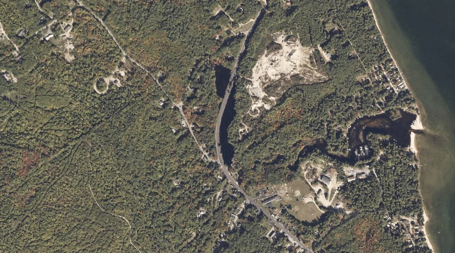
Fitch Mill Pond — Reservoirs 38.5 Miles S of Chapman Inn
Cumberland County, Maine · USGS Steep Falls Quadrangle · GNIS 1774499
Within Cumberland County, Maine, on the USGS Steep Falls quadrangle, the reservoir known as Fitch Mill Pond sits 38.5 miles south of Chapman Inn.
Landmark Profile
Classification & USGS reference
Within Cumberland County, Maine, the U.S. Geological Survey lists Fitch Mill Pond as a reservoir on the Steep Falls topographic quadrangle (FIPS 23/005), under Feature ID 1774499. Last revised by the Board on Geographic Names on 05/15/2018.
Coordinates & physical setting
Fitch Mill Pond sits at 43.85846° N, 70.64071° W (DMS 43°51′30″ N, 70°38′27″ W).
Other reservoirs in Cumberland County, Maine
Cumberland County, ME contains 29 reservoirs catalogued in the USGS Geographic Names Information System, counting Fitch Mill Pond itself. The ones closest to Fitch Mill Pond:
| Feature | USGS Quadrangle | Distance |
|---|---|---|
| Chub Pond | Steep Falls | 2.7 mi |
| Woods Millpond | Steep Falls | 3.3 mi |
| Sebago Lake | Sebago Lake | 4.6 mi |
| Upper Pond | Steep Falls | 5.1 mi |
| Bay of Naples | Naples | 5.7 mi |
| Rich Millpond | Sebago Lake | 5.7 mi |
| Sanborn Pond | Steep Falls | 5.9 mi |
| Peabody Pond | North Sebago | 6.4 mi |
| Thomas Pond | Naples | 8 mi |
| Watchic Pond | Standish | 8.5 mi |
Features on the USGS Steep Falls Quadrangle
The Steep Falls 7.5-minute topographic quadrangle holds 35 catalogued natural features alongside Fitch Mill Pond. A sampling nearest to this location:
| Feature | Type | County | Offset |
|---|---|---|---|
| Northwest River | Streams | Cumberland County, ME | 0.6 mi |
| Dyke Mountain | Summits | Cumberland County, ME | 1.3 mi |
| Davis Spring | Springs | Cumberland County, ME | 1.8 mi |
| Rainbow Pond | Lakes | Cumberland County, ME | 1.9 mi |
| Decker Mountain | Summits | Cumberland County, ME | 2.2 mi |
| Heath Brook | Streams | Cumberland County, ME | 2.4 mi |
| Heath Brook | Streams | Cumberland County, ME | 2.4 mi |
| Adams Pond | Lakes | Cumberland County, ME | 2.5 mi |
| Chub Pond | Reservoirs | Cumberland County, ME | 2.7 mi |
| Saddleback Hills | Summits | Cumberland County, ME | 2.9 mi |
Visiting from Chapman Inn
Distance, bearing & drive time
Follow the compass bearing S out of Bethel for 38.5 miles (south) and you reach Fitch Mill Pond; at typical rural speeds the trip runs roughly 66 minutes.
Best time to visit
June through September for paddling and swimming; January through March for ice fishing. At this latitude (43.858°), the shoulder seasons are workable — April and November can be comfortable on mild years. At 38.5 miles from the Inn, block the full day — sunrise start, late return, packed meals. Conditions at Fitch Mill Pond track the nearby Northwest River stream (0.6 mi away) closely — if that is runnable, so is this.
Nearest features to Fitch Mill Pond
| Feature | Type | County | Distance |
|---|---|---|---|
| Northwest River | Streams | Cumberland County, ME | 0.6 mi |
| Dyke Mountain | Summits | Cumberland County, ME | 1.3 mi |
| Sanborns Point | Capes | Cumberland County, ME | 1.7 mi |
| Davis Spring | Springs | Cumberland County, ME | 1.8 mi |
| Nason Brook | Streams | Cumberland County, ME | 1.8 mi |
Frequently Asked Questions
Where is Fitch Mill Pond located?
Fitch Mill Pond is in Cumberland County, Maine, approximately 38.5 miles south of Chapman Inn in Bethel, Maine. It appears on the USGS Steep Falls topographic quadrangle.
How far is Fitch Mill Pond from Chapman Inn?
The drive runs about 66 minutes, 38.5 miles south (bearing S) of the Inn.
What type of natural feature is Fitch Mill Pond?
The U.S. Geological Survey classifies Fitch Mill Pond as a reservoir, catalogued under GNIS Feature ID 1774499 on the Steep Falls quadrangle.
When is the best time to visit Fitch Mill Pond?
June through September for paddling and swimming; January through March for ice fishing.
How many other reservoirs are in Cumberland County, Maine?
GNIS lists 28 other reservoirs in Cumberland County, Maine.