 Aerial imagery: USGS National Map (public domain)
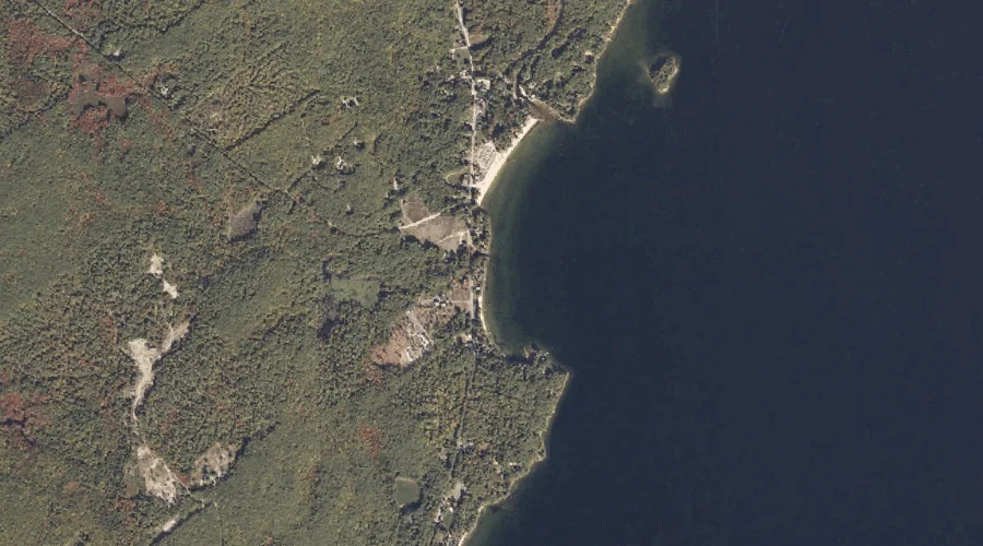
Nason Brook — Streams 36.8 Miles SSE of Chapman Inn
Cumberland County, Maine · USGS North Sebago Quadrangle · GNIS 572065
Catalogued on the USGS North Sebago quadrangle in Cumberland County, Maine, Nason Brook — a stream — lies 36.8 miles south-southeast of Chapman Inn.
Landmark Profile
Classification & USGS reference
Catalogued under GNIS Feature ID 572065, Nason Brook is recorded as a stream on the USGS North Sebago quadrangle in Cumberland County, Maine (FIPS 23/005). Catalogued in GNIS since 09/30/1980.
Coordinates & physical setting
Nason Brook sits at 43.88369° N, 70.63145° W (DMS 43°53′01″ N, 70°37′53″ W).
As a linear feature its source lies near 43.90750° N, 70.65778° W (DMS 43°54′27″ N, 70°39′28″ W) — useful for anglers and paddlers tracing the upstream end.
Other streams in Cumberland County, Maine
Cumberland County, ME contains 110 streams catalogued in the USGS Geographic Names Information System, counting Nason Brook itself. The ones closest to Nason Brook:
| Feature | USGS Quadrangle | Distance |
|---|---|---|
| Bachelder Brook | North Sebago | 0.4 mi |
| Northwest River | Steep Falls | 1.8 mi |
| Mill Brook | North Sebago | 2.4 mi |
| Whitney Brook | Naples | 2.9 mi |
| Douglass Brook | North Sebago | 3.4 mi |
| Songo River | Naples | 3.5 mi |
| Leavitt Brook | North Sebago | 3.9 mi |
| Hill Brook | North Sebago | 3.9 mi |
| Heath Brook | Steep Falls | 4.1 mi |
| Heath Brook | Steep Falls | 4.1 mi |
Features on the USGS North Sebago Quadrangle
The North Sebago 7.5-minute topographic quadrangle holds 59 catalogued natural features alongside Nason Brook. A sampling nearest to this location:
| Feature | Type | County | Offset |
|---|---|---|---|
| Sanborns Point | Capes | Cumberland County, ME | 0.2 mi |
| Cox Point | Capes | Cumberland County, ME | 0.4 mi |
| Bachelder Brook | Streams | Cumberland County, ME | 0.4 mi |
| Philip Mountain | Summits | Cumberland County, ME | 1.6 mi |
| White Mountain | Summits | Cumberland County, ME | 1.8 mi |
| Perley Pond | Lakes | Cumberland County, ME | 2.2 mi |
| Peaked Mountain | Summits | Cumberland County, ME | 2.4 mi |
| Mill Brook | Streams | Cumberland County, ME | 2.4 mi |
| Larrabee Mountain | Summits | Cumberland County, ME | 2.8 mi |
| Mariner Mountain | Summits | Cumberland County, ME | 3 mi |
Visiting from Chapman Inn
Distance, bearing & drive time
A 63-minute drive along back roads separates the front door of Chapman Inn from Nason Brook — 36.8 miles south-southeast as the crow flies, on compass bearing SSE.
Best time to visit
Best observed in late spring and early summer when flow is strong and banks are visible. At this latitude (43.884°), the shoulder seasons are workable — April and November can be comfortable on mild years. At 36.8 miles from the Inn, block the full day — sunrise start, late return, packed meals. Conditions at Nason Brook track the nearby Sanborns Point cape (0.2 mi away) closely — if that is runnable, so is this.
Nearest features to Nason Brook
| Feature | Type | County | Distance |
|---|---|---|---|
| Sanborns Point | Capes | Cumberland County, ME | 0.2 mi |
| Cox Point | Capes | Cumberland County, ME | 0.4 mi |
| Bachelder Brook | Streams | Cumberland County, ME | 0.4 mi |
| Spider Island | Islands | Cumberland County, ME | 0.7 mi |
| Wards Point | Capes | Cumberland County, ME | 1.1 mi |
Frequently Asked Questions
Where is Nason Brook located?
Nason Brook is in Cumberland County, Maine, approximately 36.8 miles south-southeast of Chapman Inn in Bethel, Maine. It appears on the USGS North Sebago topographic quadrangle.
How far is Nason Brook from Chapman Inn?
The drive runs about 63 minutes, 36.8 miles south-southeast (bearing SSE) of the Inn.
What type of natural feature is Nason Brook?
The U.S. Geological Survey classifies Nason Brook as a stream, catalogued under GNIS Feature ID 572065 on the North Sebago quadrangle.
When is the best time to visit Nason Brook?
Best observed in late spring and early summer when flow is strong and banks are visible.
How many other streams are in Cumberland County, Maine?
GNIS lists 109 other streams in Cumberland County, Maine.