 Aerial imagery: USGS National Map (public domain)
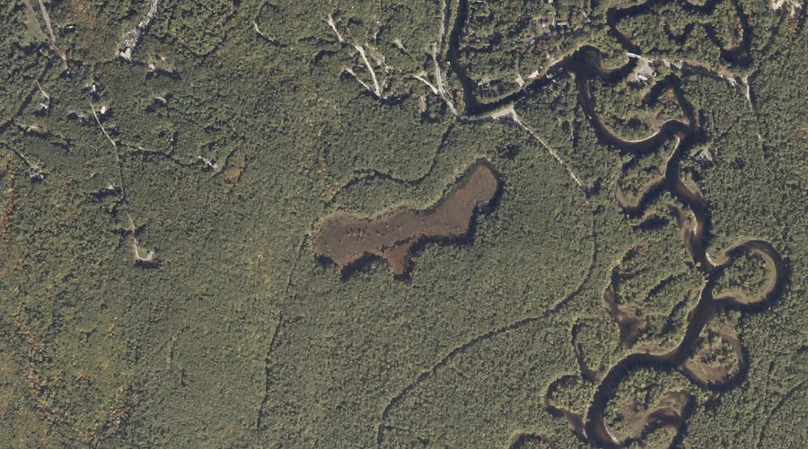
Bay of Naples — Reservoirs 34.5 Miles SSE of Chapman Inn
Cumberland County, Maine · USGS Naples Quadrangle · GNIS 1774144
Catalogued on the USGS Naples quadrangle in Cumberland County, Maine, Bay of Naples — a reservoir — lies 34.5 miles south-southeast of Chapman Inn.
Landmark Profile
Classification & USGS reference
Catalogued under GNIS Feature ID 1774144, Bay of Naples is recorded as a reservoir on the USGS Naples quadrangle in Cumberland County, Maine (FIPS 23/005). Last revised by the Board on Geographic Names on 05/15/2018.
Coordinates & physical setting
Bay of Naples sits at 43.92865° N, 70.58208° W (DMS 43°55′43″ N, 70°34′55″ W).
Other reservoirs in Cumberland County, Maine
Cumberland County, ME contains 29 reservoirs catalogued in the USGS Geographic Names Information System, counting Bay of Naples itself. The ones closest to Bay of Naples:
| Feature | USGS Quadrangle | Distance |
|---|---|---|
| Thomas Pond | Naples | 3.8 mi |
| Sebago Lake | Sebago Lake | 5.3 mi |
| Peabody Pond | North Sebago | 5.3 mi |
| Fitch Mill Pond | Steep Falls | 5.7 mi |
| Panther Pond | Raymond | 5.7 mi |
| Adams Pond | North Sebago | 7.9 mi |
| Chub Pond | Steep Falls | 8 mi |
| Willett Brook | Bridgton | 8.9 mi |
| Woods Millpond | Steep Falls | 8.9 mi |
| Sebago Lake Basin | North Windham | 9 mi |
Features on the USGS Naples Quadrangle
The Naples 7.5-minute topographic quadrangle holds 65 catalogued natural features alongside Bay of Naples. A sampling nearest to this location:
| Feature | Type | County | Offset |
|---|---|---|---|
| Crooked River | Streams | Cumberland County, ME | 0.4 mi |
| Songo River | Streams | Cumberland County, ME | 1.1 mi |
| Whitney Brook | Streams | Cumberland County, ME | 1.1 mi |
| Thompson Point | Capes | Cumberland County, ME | 1.1 mi |
| Breezy Point | Capes | Cumberland County, ME | 1.2 mi |
| Witch Cove | Bays | Cumberland County, ME | 1.2 mi |
| Inner Island | Islands | Cumberland County, ME | 1.5 mi |
| Trickey Pond | Lakes | Cumberland County, ME | 1.5 mi |
| Cub Point | Capes | Cumberland County, ME | 1.6 mi |
| Outer Island | Islands | Cumberland County, ME | 1.7 mi |
Visiting from Chapman Inn
Distance, bearing & drive time
A 59-minute drive along back roads separates the front door of Chapman Inn from Bay of Naples — 34.5 miles south-southeast as the crow flies, on compass bearing SSE.
Best time to visit
June through September for paddling and swimming; January through March for ice fishing. At this latitude (43.929°), the shoulder seasons are workable — April and November can be comfortable on mild years. At 34.5 miles from the Inn, block the full day — sunrise start, late return, packed meals. Conditions at Bay of Naples track the nearby Crooked River stream (0.4 mi away) closely — if that is runnable, so is this.
Nearest features to Bay of Naples
| Feature | Type | County | Distance |
|---|---|---|---|
| Crooked River | Streams | Cumberland County, ME | 0.4 mi |
| Songo River | Streams | Cumberland County, ME | 1.1 mi |
| Whitney Brook | Streams | Cumberland County, ME | 1.1 mi |
| Thompson Point | Capes | Cumberland County, ME | 1.1 mi |
| Breezy Point | Capes | Cumberland County, ME | 1.2 mi |
Frequently Asked Questions
Where is Bay of Naples located?
Bay of Naples is in Cumberland County, Maine, approximately 34.5 miles south-southeast of Chapman Inn in Bethel, Maine. It appears on the USGS Naples topographic quadrangle.
How far is Bay of Naples from Chapman Inn?
The drive runs about 59 minutes, 34.5 miles south-southeast (bearing SSE) of the Inn.
What type of natural feature is Bay of Naples?
The U.S. Geological Survey classifies Bay of Naples as a reservoir, catalogued under GNIS Feature ID 1774144 on the Naples quadrangle.
When is the best time to visit Bay of Naples?
June through September for paddling and swimming; January through March for ice fishing.
How many other reservoirs are in Cumberland County, Maine?
GNIS lists 28 other reservoirs in Cumberland County, Maine.