Meadow Brook is a stream in Oxford County, Maine, located about 7.6 miles north-northeast of Chapman Inn in Bethel, Maine. It appears on the USGS East Andover topographic…
Halls Ridge is a ridge in Oxford County, Maine, located about 7.7 miles southeast of Chapman Inn in Bethel, Maine. It appears on the USGS Greenwood topographic quadrangle.
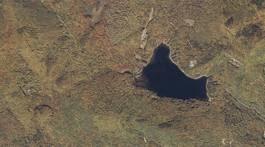
Indian Pond is a lake in Oxford County, Maine, located about 7.7 miles east-southeast of Chapman Inn in Bethel, Maine. It appears on the USGS Greenwood topographic quadrangle.
Howard Pond is a lake in Oxford County, Maine, located about 7.7 miles north-northeast of Chapman Inn in Bethel, Maine. It appears on the USGS East Andover topographic…
Barkers High Ledge is a summit in Oxford County, Maine, located about 7.8 miles east-northeast of Chapman Inn in Bethel, Maine. It appears on the USGS Bryant Pond…
Parsonage Hill is a summit in Oxford County, Maine, located about 7.4 miles south of Chapman Inn in Bethel, Maine. It appears on the USGS East Stoneham topographic…
Pond Stream is a stream in Oxford County, Maine, located about 7.8 miles northeast of Chapman Inn in Bethel, Maine. It appears on the USGS Bryant Pond topographic…
Bald Bluff is a summit in Oxford County, Maine, located about 7.4 miles southeast of Chapman Inn in Bethel, Maine. It appears on the USGS Greenwood topographic quadrangle.
Bryant Mountain is a summit in Oxford County, Maine, located about 7.9 miles east-northeast of Chapman Inn in Bethel, Maine. It appears on the USGS Bryant Pond topographic…
Round Pond is a lake in Oxford County, Maine, located about 7.4 miles south of Chapman Inn in Bethel, Maine. It appears on the USGS East Stoneham topographic…