Moose Brook is a stream in Coos County, New Hampshire, located about 20.1 miles west of Chapman Inn in Bethel, Maine. It appears on the USGS Berlin topographic…
Oak Hill is a summit in Coos County, New Hampshire, located about 20.4 miles west-northwest of Chapman Inn in Bethel, Maine. It appears on the USGS Milan topographic…
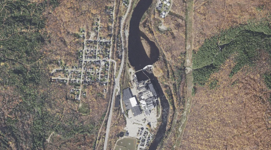
Androscoggin River Reservoir is a reservoir in Coos County, New Hampshire, located about 19.9 miles west of Chapman Inn in Bethel, Maine. It appears on the USGS Berlin…
Dead River is a stream in Coos County, New Hampshire, located about 20.0 miles west-northwest of Chapman Inn in Bethel, Maine. It appears on the USGS Berlin topographic…
Tinker Brook is a stream in Coos County, New Hampshire, located about 20.0 miles west of Chapman Inn in Bethel, Maine. It appears on the USGS Berlin topographic…
Middle Carter Mountain is a summit in Coos County, New Hampshire, located about 20.0 miles west-southwest of Chapman Inn in Bethel, Maine. It appears on the USGS Carter…
Androscoggin River Reservoir is a reservoir in Coos County, New Hampshire, located about 20.0 miles west of Chapman Inn in Bethel, Maine. It appears on the USGS Berlin…
North Carter Mountain is a summit in Coos County, New Hampshire, located about 19.6 miles west-southwest of Chapman Inn in Bethel, Maine. It appears on the USGS Carter…
Moose River is a stream in Coos County, New Hampshire, located about 19.7 miles west of Chapman Inn in Bethel, Maine. It appears on the USGS Berlin topographic…
Horne Brook is a stream in Coos County, New Hampshire, located about 19.7 miles west-northwest of Chapman Inn in Bethel, Maine. It appears on the USGS Milan topographic…