 Aerial imagery: USGS National Map (public domain)
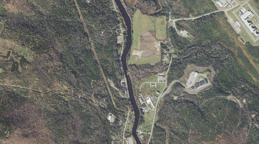
Horne Brook — Streams 19.7 Miles WNW of Chapman Inn
Coos County, New Hampshire · USGS Milan Quadrangle · GNIS 872051
Within Coos County, New Hampshire, on the USGS Milan quadrangle, the stream known as Horne Brook sits 19.7 miles west-northwest of Chapman Inn.
Landmark Profile
Classification & USGS reference
Within Coos County, New Hampshire, the U.S. Geological Survey lists Horne Brook as a stream on the Milan topographic quadrangle (FIPS 33/007), under Feature ID 872051. Catalogued in GNIS since 08/27/2002.
Coordinates & physical setting
Horne Brook sits at 44.51422° N, 71.15869° W (DMS 44°30′51″ N, 71°09′31″ W).
As a linear feature its source lies near 44.48700° N, 71.10313° W (DMS 44°29′13″ N, 71°06′11″ W) — useful for anglers and paddlers tracing the upstream end.
Other streams in Coos County, New Hampshire
Coos County, NH contains 300 streams catalogued in the USGS Geographic Names Information System, counting Horne Brook itself. The ones closest to Horne Brook:
| Feature | USGS Quadrangle | Distance |
|---|---|---|
| Bean Brook | Berlin | 1.9 mi |
| Red Brook | Shelburne | 2.1 mi |
| Stearns Brook | Milan | 2.2 mi |
| Alder Brook | Success Pond | 2.6 mi |
| North Branch Stearns Brook | Success Pond | 2.9 mi |
| South Branch Stearns Brook | Success Pond | 2.9 mi |
| North Branch Horne Brook | Shelburne | 3.1 mi |
| South Branch Horne Brook | Shelburne | 3.2 mi |
| Jericho Brook | Berlin | 3.3 mi |
| Dead River | Berlin | 3.3 mi |
Features on the USGS Milan Quadrangle
The Milan 7.5-minute topographic quadrangle holds 14 catalogued natural features alongside Horne Brook. A sampling nearest to this location:
| Feature | Type | County | Offset |
|---|---|---|---|
| Cates Hill | Summits | Coos County, NH | 1.3 mi |
| Stearns Brook | Streams | Coos County, NH | 2.2 mi |
| Oak Hill | Summits | Coos County, NH | 3 mi |
| Head Pond | Lakes | Coos County, NH | 3.4 mi |
| Leavitt Stream | Streams | Coos County, NH | 3.9 mi |
| Milan Hill | Summits | Coos County, NH | 5.1 mi |
| Chickwolnepy Stream | Streams | Coos County, NH | 5.2 mi |
| Mud Pond Lake | Lakes | Coos County, NH | 5.7 mi |
| Jodrie Hill | Summits | Coos County, NH | 5.8 mi |
| Closton Hill | Summits | Coos County, NH | 6.8 mi |
Historical record
The U.S. Board on Geographic Names recorded a Official (Board Decision) on January 1, 1971 for this name.
Visiting from Chapman Inn
Distance, bearing & drive time
Follow the compass bearing WNW out of Bethel for 19.7 miles (west-northwest) and you reach Horne Brook; at typical rural speeds the trip runs roughly 34 minutes.
Best time to visit
Best observed in late spring and early summer when flow is strong and banks are visible. Being this far north (lat 44.514°), first snows typically arrive by mid-October and linger into early May — narrow the window accordingly. At 19.7 miles from the Inn, plan on a comfortable day trip with time for lunch on the road. Conditions at Horne Brook track the nearby Cates Hill summit (1.3 mi away) closely — if that is runnable, so is this.
Nearest features to Horne Brook
| Feature | Type | County | Distance |
|---|---|---|---|
| Cates Hill | Summits | Coos County, NH | 1.3 mi |
| Anderson Reservoir | Reservoirs | Coos County, NH | 1.8 mi |
| Bean Brook | Streams | Coos County, NH | 1.9 mi |
| Androscoggin River Reservoir | Reservoirs | Coos County, NH | 1.9 mi |
| Red Brook | Streams | Coos County, NH | 2.1 mi |
Frequently Asked Questions
Where is Horne Brook located?
Horne Brook is in Coos County, New Hampshire, approximately 19.7 miles west-northwest of Chapman Inn in Bethel, Maine. It appears on the USGS Milan topographic quadrangle.
How far is Horne Brook from Chapman Inn?
The drive runs about 34 minutes, 19.7 miles west-northwest (bearing WNW) of the Inn.
What type of natural feature is Horne Brook?
The U.S. Geological Survey classifies Horne Brook as a stream, catalogued under GNIS Feature ID 872051 on the Milan quadrangle.
When is the best time to visit Horne Brook?
Best observed in late spring and early summer when flow is strong and banks are visible.
How many other streams are in Coos County, New Hampshire?
GNIS lists 299 other streams in Coos County, New Hampshire.