 Aerial imagery: USGS National Map (public domain)
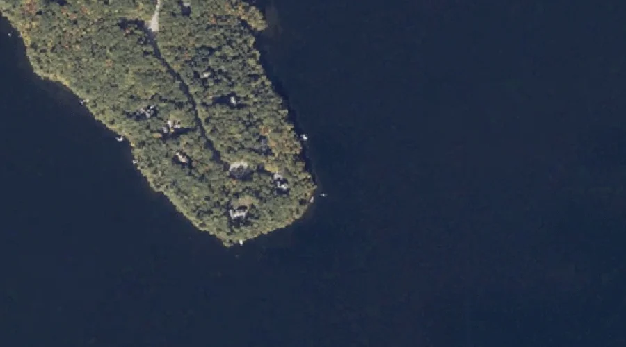
Knolls Point — Capes 21.7 Miles S of Chapman Inn
Cumberland County, Maine · USGS Bridgton Quadrangle · GNIS 1913290
Catalogued on the USGS Bridgton quadrangle in Cumberland County, Maine, Knolls Point — a cape — lies 21.7 miles south of Chapman Inn.
Wikidata short description: “cape in Cumberland County, Maine, United States of America”
Landmark Profile
Classification & USGS reference
Catalogued under GNIS Feature ID 1913290, Knolls Point is recorded as a cape on the USGS Bridgton quadrangle in Cumberland County, Maine (FIPS 23/005). Catalogued in GNIS since 05/08/2001.
Coordinates & physical setting
Knolls Point sits at 44.09174° N, 70.74867° W (DMS 44°05′30″ N, 70°44′55″ W).
Other capes in Cumberland County, Maine
Cumberland County, ME contains 35 capes catalogued in the USGS Geographic Names Information System, counting Knolls Point itself. The ones closest to Knolls Point:
| Feature | USGS Quadrangle | Distance |
|---|---|---|
| Bells Point | Bridgton | 3 mi |
| Bluff Point | Bridgton | 3.5 mi |
| Monk Point | Bridgton | 4 mi |
| Salmon Point | Bridgton | 4.5 mi |
| Cape Monday | Bridgton | 4.5 mi |
| Abners Nose | Bridgton | 5.2 mi |
| Adams Point | Bridgton | 5.2 mi |
| Bear Point | Bridgton | 7.3 mi |
| Long Point | Bridgton | 8.3 mi |
| Kellys Point | Bridgton | 8.7 mi |
Features on the USGS Bridgton Quadrangle
The Bridgton 7.5-minute topographic quadrangle holds 49 catalogued natural features alongside Knolls Point. A sampling nearest to this location:
| Feature | Type | County | Offset |
|---|---|---|---|
| Oak Knoll Island | Islands | Cumberland County, ME | 0.7 mi |
| Penny Island | Islands | Cumberland County, ME | 0.8 mi |
| Highland Lake | Reservoirs | Cumberland County, ME | 0.8 mi |
| Fowler Island | Islands | Cumberland County, ME | 0.9 mi |
| Brigham Hill | Summits | Cumberland County, ME | 1.4 mi |
| Upper Ridge | Ridges | Cumberland County, ME | 1.6 mi |
| Shorey Island | Islands | Cumberland County, ME | 1.6 mi |
| Mile Island | Islands | Cumberland County, ME | 1.7 mi |
| Sunset Rock | Summits | Cumberland County, ME | 2.3 mi |
| Lower Ridge | Ridges | Cumberland County, ME | 2.3 mi |
Visiting from Chapman Inn
Distance, bearing & drive time
A 37-minute drive along back roads separates the front door of Chapman Inn from Knolls Point — 21.7 miles south as the crow flies, on compass bearing S.
Best time to visit
Generally accessible May through October; winter access depends on snow cover. At this latitude (44.092°), the shoulder seasons are workable — April and November can be comfortable on mild years. At 21.7 miles from the Inn, plan on a comfortable day trip with time for lunch on the road. Conditions at Knolls Point track the nearby Oak Knoll Island (0.7 mi away) closely — if that is runnable, so is this.
Nearest features to Knolls Point
| Feature | Type | County | Distance |
|---|---|---|---|
| Oak Knoll Island | Islands | Cumberland County, ME | 0.7 mi |
| Penny Island | Islands | Cumberland County, ME | 0.8 mi |
| Highland Lake | Reservoirs | Cumberland County, ME | 0.8 mi |
| Fowler Island | Islands | Cumberland County, ME | 0.9 mi |
| Brigham Hill | Summits | Cumberland County, ME | 1.4 mi |
Frequently Asked Questions
Where is Knolls Point located?
Knolls Point is in Cumberland County, Maine, approximately 21.7 miles south of Chapman Inn in Bethel, Maine. It appears on the USGS Bridgton topographic quadrangle.
How far is Knolls Point from Chapman Inn?
The drive runs about 37 minutes, 21.7 miles south (bearing S) of the Inn.
What type of natural feature is Knolls Point?
The U.S. Geological Survey classifies Knolls Point as a cape, catalogued under GNIS Feature ID 1913290 on the Bridgton quadrangle.
When is the best time to visit Knolls Point?
Generally accessible May through October; winter access depends on snow cover.
How many other capes are in Cumberland County, Maine?
GNIS lists 34 other capes in Cumberland County, Maine.
Wikidata: Q34970481.