 Aerial imagery: USGS National Map (public domain)
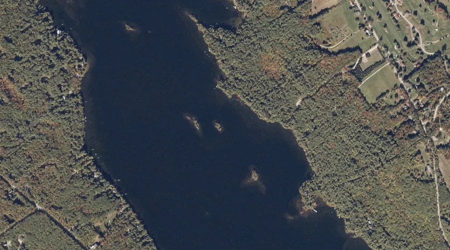
Shorey Island — Islands 23.1 Miles S of Chapman Inn
Cumberland County, Maine · USGS Bridgton Quadrangle · GNIS 1913055
23.1 miles south of Chapman Inn, on the USGS Bridgton topographic quadrangle, Shorey Island is a island recorded in Cumberland County, Maine by the federal Geographic Names Information System.
Wikidata short description: “island in Cumberland County, Maine, United States”
Landmark Profile
Classification & USGS reference
The USGS Bridgton 7.5-minute topographic quadrangle places Shorey Island in Cumberland County, Maine (FIPS 23/005), classified as a island in the federal GNIS (Feature ID 1913055). Catalogued in GNIS since 05/08/2001.
Coordinates & physical setting
Shorey Island sits at 44.07257° N, 70.73201° W (DMS 44°04′21″ N, 70°43′55″ W).
Other islands in Cumberland County, Maine
Cumberland County, ME contains 52 islands catalogued in the USGS Geographic Names Information System, counting Shorey Island itself. The ones closest to Shorey Island:
| Feature | USGS Quadrangle | Distance |
|---|---|---|
| Mile Island | Bridgton | 0.2 mi |
| Fowler Island | Bridgton | 0.7 mi |
| Penny Island | Bridgton | 0.8 mi |
| Oak Knoll Island | Bridgton | 0.9 mi |
| Loon Island | Bridgton | 3 mi |
| Zakelo Island | Bridgton | 3.4 mi |
| Mosquito Island | Bridgton | 3.9 mi |
| Pine Island | North Sebago | 7.1 mi |
| Inner Island | Naples | 12.7 mi |
| Outer Island | Naples | 13.1 mi |
Features on the USGS Bridgton Quadrangle
The Bridgton 7.5-minute topographic quadrangle holds 49 catalogued natural features alongside Shorey Island. A sampling nearest to this location:
| Feature | Type | County | Offset |
|---|---|---|---|
| Mile Island | Islands | Cumberland County, ME | 0.2 mi |
| Fowler Island | Islands | Cumberland County, ME | 0.7 mi |
| Highland Lake | Reservoirs | Cumberland County, ME | 0.8 mi |
| Sunset Rock | Summits | Cumberland County, ME | 0.8 mi |
| Lower Ridge | Ridges | Cumberland County, ME | 0.8 mi |
| Penny Island | Islands | Cumberland County, ME | 0.8 mi |
| Oak Knoll Island | Islands | Cumberland County, ME | 0.9 mi |
| Knolls Point | Capes | Cumberland County, ME | 1.6 mi |
| Willett Brook | Streams | Cumberland County, ME | 1.9 mi |
| Brigham Hill | Summits | Cumberland County, ME | 2.1 mi |
Visiting from Chapman Inn
Distance, bearing & drive time
Chapman Inn sits 23.1 miles south (bearing S) of Shorey Island. At moderate back-road speeds the drive runs about 40 minutes — comfortably inside a half-day outing window after breakfast.
Best time to visit
Late May through early October, when the water is safe for small-boat access. At this latitude (44.073°), the shoulder seasons are workable — April and November can be comfortable on mild years. At 23.1 miles from the Inn, plan on a comfortable day trip with time for lunch on the road. Conditions at Shorey Island track the nearby Mile Island (0.2 mi away) closely — if that is runnable, so is this.
Nearest features to Shorey Island
| Feature | Type | County | Distance |
|---|---|---|---|
| Mile Island | Islands | Cumberland County, ME | 0.2 mi |
| Fowler Island | Islands | Cumberland County, ME | 0.7 mi |
| Highland Lake | Reservoirs | Cumberland County, ME | 0.8 mi |
| Sunset Rock | Summits | Cumberland County, ME | 0.8 mi |
| Lower Ridge | Ridges | Cumberland County, ME | 0.8 mi |
Frequently Asked Questions
Where is Shorey Island located?
Shorey Island is in Cumberland County, Maine, approximately 23.1 miles south of Chapman Inn in Bethel, Maine. It appears on the USGS Bridgton topographic quadrangle.
How far is Shorey Island from Chapman Inn?
The drive runs about 40 minutes, 23.1 miles south (bearing S) of the Inn.
What type of natural feature is Shorey Island?
The U.S. Geological Survey classifies Shorey Island as a island, catalogued under GNIS Feature ID 1913055 on the Bridgton quadrangle.
When is the best time to visit Shorey Island?
Late May through early October, when the water is safe for small-boat access.
How many other islands are in Cumberland County, Maine?
GNIS lists 51 other islands in Cumberland County, Maine.
Wikidata: Q130311260.