 Aerial imagery: USGS National Map (public domain)
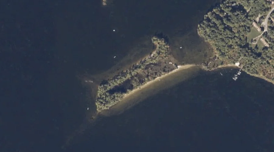
Long Point — Capes 28.7 Miles SSE of Chapman Inn
Cumberland County, Maine · USGS Bridgton Quadrangle · GNIS 570268
Catalogued on the USGS Bridgton quadrangle in Cumberland County, Maine, Long Point — a cape — lies 28.7 miles south-southeast of Chapman Inn.
Landmark Profile
Classification & USGS reference
Catalogued under GNIS Feature ID 570268, Long Point is recorded as a cape on the USGS Bridgton quadrangle in Cumberland County, Maine (FIPS 23/005). Catalogued in GNIS since 09/30/1980.
Coordinates & physical setting
Long Point sits at 44.00396° N, 70.63450° W (DMS 44°00′14″ N, 70°38′04″ W).
Other capes in Cumberland County, Maine
Cumberland County, ME contains 35 capes catalogued in the USGS Geographic Names Information System, counting Long Point itself. The ones closest to Long Point:
| Feature | USGS Quadrangle | Distance |
|---|---|---|
| Kellys Point | Bridgton | 0.5 mi |
| Keoka Point | Naples | 1.1 mi |
| Bear Point | Bridgton | 1.1 mi |
| Stimpsons Point | North Sebago | 1.2 mi |
| Arrowhead Point | Naples | 1.4 mi |
| Birch Point | Naples | 2.2 mi |
| Abners Nose | Bridgton | 3.1 mi |
| Adams Point | Bridgton | 3.4 mi |
| Salmon Point | Bridgton | 3.9 mi |
| Breezy Point | Naples | 4.7 mi |
Features on the USGS Bridgton Quadrangle
The Bridgton 7.5-minute topographic quadrangle holds 49 catalogued natural features alongside Long Point. A sampling nearest to this location:
| Feature | Type | County | Offset |
|---|---|---|---|
| Kellys Point | Capes | Cumberland County, ME | 0.5 mi |
| Bear Point | Capes | Cumberland County, ME | 1.1 mi |
| Long Lake | Lakes | Cumberland County, ME | 1.5 mi |
| Thomes Brook | Streams | Cumberland County, ME | 1.8 mi |
| Packard Hill | Summits | Cumberland County, ME | 2.1 mi |
| Otter Pond | Lakes | Cumberland County, ME | 2.5 mi |
| Choate Hill | Summits | Cumberland County, ME | 3 mi |
| Abners Nose | Capes | Cumberland County, ME | 3.1 mi |
| Mosquito Island | Islands | Cumberland County, ME | 3.2 mi |
| Little Cove | Bays | Cumberland County, ME | 3.3 mi |
Visiting from Chapman Inn
Distance, bearing & drive time
A 49-minute drive along back roads separates the front door of Chapman Inn from Long Point — 28.7 miles south-southeast as the crow flies, on compass bearing SSE.
Best time to visit
Generally accessible May through October; winter access depends on snow cover. At this latitude (44.004°), the shoulder seasons are workable — April and November can be comfortable on mild years. At 28.7 miles from the Inn, block the full day — sunrise start, late return, packed meals. Conditions at Long Point track the nearby Kellys Point cape (0.5 mi away) closely — if that is runnable, so is this.
Nearest features to Long Point
| Feature | Type | County | Distance |
|---|---|---|---|
| Kellys Point | Capes | Cumberland County, ME | 0.5 mi |
| Pine Island | Islands | Cumberland County, ME | 0.8 mi |
| Tingley Brook | Streams | Cumberland County, ME | 0.9 mi |
| Mast Cove | Bays | Cumberland County, ME | 1 mi |
| Keoka Point | Capes | Cumberland County, ME | 1.1 mi |
Frequently Asked Questions
Where is Long Point located?
Long Point is in Cumberland County, Maine, approximately 28.7 miles south-southeast of Chapman Inn in Bethel, Maine. It appears on the USGS Bridgton topographic quadrangle.
How far is Long Point from Chapman Inn?
The drive runs about 49 minutes, 28.7 miles south-southeast (bearing SSE) of the Inn.
What type of natural feature is Long Point?
The U.S. Geological Survey classifies Long Point as a cape, catalogued under GNIS Feature ID 570268 on the Bridgton quadrangle.
When is the best time to visit Long Point?
Generally accessible May through October; winter access depends on snow cover.
How many other capes are in Cumberland County, Maine?
GNIS lists 34 other capes in Cumberland County, Maine.