 Aerial imagery: USGS National Map (public domain)
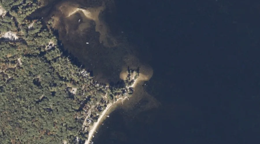
Salmon Point — Capes 25.0 Miles SSE of Chapman Inn
Cumberland County, Maine · USGS Bridgton Quadrangle · GNIS 1913013
25.0 miles south-southeast of Chapman Inn, on the USGS Bridgton topographic quadrangle, Salmon Point is a cape recorded in Cumberland County, Maine by the federal Geographic Names Information System.
Landmark Profile
Classification & USGS reference
The USGS Bridgton 7.5-minute topographic quadrangle places Salmon Point in Cumberland County, Maine (FIPS 23/005), classified as a cape in the federal GNIS (Feature ID 1913013). Catalogued in GNIS since 05/08/2001.
Coordinates & physical setting
Salmon Point sits at 44.05146° N, 70.67728° W (DMS 44°03′05″ N, 70°40′38″ W).
Other capes in Cumberland County, Maine
Cumberland County, ME contains 35 capes catalogued in the USGS Geographic Names Information System, counting Salmon Point itself. The ones closest to Salmon Point:
| Feature | USGS Quadrangle | Distance |
|---|---|---|
| Adams Point | Bridgton | 0.7 mi |
| Abners Nose | Bridgton | 0.8 mi |
| Monk Point | Bridgton | 1.2 mi |
| Cape Monday | Bridgton | 1.4 mi |
| Bluff Point | Bridgton | 1.9 mi |
| Bear Point | Bridgton | 2.8 mi |
| Bells Point | Bridgton | 3.4 mi |
| Long Point | Bridgton | 3.9 mi |
| Kellys Point | Bridgton | 4.3 mi |
| Knolls Point | Bridgton | 4.5 mi |
Features on the USGS Bridgton Quadrangle
The Bridgton 7.5-minute topographic quadrangle holds 49 catalogued natural features alongside Salmon Point. A sampling nearest to this location:
| Feature | Type | County | Offset |
|---|---|---|---|
| Stevens Brook | Streams | Cumberland County, ME | 0.2 mi |
| Sandy Cove | Bays | Cumberland County, ME | 0.6 mi |
| Adams Point | Capes | Cumberland County, ME | 0.7 mi |
| Mosquito Island | Islands | Cumberland County, ME | 0.8 mi |
| Abners Nose | Capes | Cumberland County, ME | 0.8 mi |
| Stevens Pond | Reservoirs | Cumberland County, ME | 0.9 mi |
| Mount Henry | Summits | Cumberland County, ME | 0.9 mi |
| Little Cove | Bays | Cumberland County, ME | 1 mi |
| Monk Point | Capes | Cumberland County, ME | 1.2 mi |
| Zakelo Island | Islands | Cumberland County, ME | 1.4 mi |
Visiting from Chapman Inn
Distance, bearing & drive time
Chapman Inn sits 25.0 miles south-southeast (bearing SSE) of Salmon Point. At moderate back-road speeds the drive runs about 43 minutes — comfortably inside a half-day outing window after breakfast.
Best time to visit
Generally accessible May through October; winter access depends on snow cover. At this latitude (44.051°), the shoulder seasons are workable — April and November can be comfortable on mild years. At 25.0 miles from the Inn, block the full day — sunrise start, late return, packed meals. Conditions at Salmon Point track the nearby Stevens Brook stream (0.2 mi away) closely — if that is runnable, so is this.
Nearest features to Salmon Point
| Feature | Type | County | Distance |
|---|---|---|---|
| Stevens Brook | Streams | Cumberland County, ME | 0.2 mi |
| Sandy Cove | Bays | Cumberland County, ME | 0.6 mi |
| Adams Point | Capes | Cumberland County, ME | 0.7 mi |
| Mosquito Island | Islands | Cumberland County, ME | 0.8 mi |
| Abners Nose | Capes | Cumberland County, ME | 0.8 mi |
Frequently Asked Questions
Where is Salmon Point located?
Salmon Point is in Cumberland County, Maine, approximately 25.0 miles south-southeast of Chapman Inn in Bethel, Maine. It appears on the USGS Bridgton topographic quadrangle.
How far is Salmon Point from Chapman Inn?
The drive runs about 43 minutes, 25.0 miles south-southeast (bearing SSE) of the Inn.
What type of natural feature is Salmon Point?
The U.S. Geological Survey classifies Salmon Point as a cape, catalogued under GNIS Feature ID 1913013 on the Bridgton quadrangle.
When is the best time to visit Salmon Point?
Generally accessible May through October; winter access depends on snow cover.
How many other capes are in Cumberland County, Maine?
GNIS lists 34 other capes in Cumberland County, Maine.