 Aerial imagery: USGS National Map (public domain)
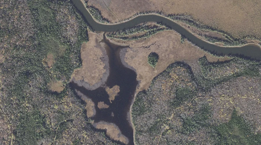
Sweat Meadows — Swamps 29.9 Miles NNW of Chapman Inn
Coos County, New Hampshire · USGS Umbagog Lake North Quadrangle · GNIS 870307
Catalogued on the USGS Umbagog Lake North quadrangle in Coos County, New Hampshire, Sweat Meadows — a swamp — lies 29.9 miles north-northwest of Chapman Inn.
Landmark Profile
Classification & USGS reference
Catalogued under GNIS Feature ID 870307, Sweat Meadows is recorded as a swamp on the USGS Umbagog Lake North quadrangle in Coos County, New Hampshire (FIPS 33/007). Last revised by the Board on Geographic Names on 08/01/2022.
Coordinates & physical setting
Sweat Meadows sits at 44.78082° N, 71.08778° W (DMS 44°46′51″ N, 71°05′16″ W).
Other swamps in Coos County, New Hampshire
Coos County, NH contains 6 swamps catalogued in the USGS Geographic Names Information System, counting Sweat Meadows itself. The ones closest to Sweat Meadows:
| Feature | USGS Quadrangle | Distance |
|---|---|---|
| Goose Pond | Teakettle Ridge | 9.9 mi |
| The Bog | Dixville Notch | 10.2 mi |
| Blueberry Swamp | Bunnell Mountain | 16.4 mi |
| Bear Rock Bog | Lovering Mountain | 18 mi |
| Mile Swamp | Stark | 22.2 mi |
Features on the USGS Umbagog Lake North Quadrangle
The Umbagog Lake North 7.5-minute topographic quadrangle holds 29 catalogued natural features alongside Sweat Meadows. A sampling nearest to this location:
| Feature | Type | County | Offset |
|---|---|---|---|
| Mountain Pond | Lakes | Coos County, NH | 0.8 mi |
| Magalloway River | Streams | Oxford County, NH | 1.1 mi |
| Pininsula Molls Rock | Pillars | Coos County, NH | 1.6 mi |
| Errol Hill | Summits | Coos County, NH | 1.7 mi |
| Leonard Pond | Lakes | Coos County, NH | 1.7 mi |
| Black Island Cove | Bays | Coos County, NH | 2 mi |
| Mill Mountain | Summits | Coos County, NH | 2.2 mi |
| Round Pond Lake | Lakes | Coos County, NH | 2.2 mi |
| Long Pond | Lakes | Coos County, NH | 2.4 mi |
| Pine Point | Capes | Oxford County, ME | 2.5 mi |
Visiting from Chapman Inn
Distance, bearing & drive time
A 51-minute drive along back roads separates the front door of Chapman Inn from Sweat Meadows — 29.9 miles north-northwest as the crow flies, on compass bearing NNW.
Best time to visit
Late May through October; avoid black-fly peak in late May. Being this far north (lat 44.781°), first snows typically arrive by mid-October and linger into early May — narrow the window accordingly. At 29.9 miles from the Inn, block the full day — sunrise start, late return, packed meals. Conditions at Sweat Meadows track the nearby Mountain Pond lake (0.8 mi away) closely — if that is runnable, so is this.
Nearest features to Sweat Meadows
| Feature | Type | County | Distance |
|---|---|---|---|
| Mountain Pond | Lakes | Coos County, NH | 0.8 mi |
| Magalloway River | Streams | Oxford County, NH | 1.1 mi |
| Pininsula Molls Rock | Pillars | Coos County, NH | 1.6 mi |
| Errol Hill | Summits | Coos County, NH | 1.7 mi |
| Leonard Pond | Lakes | Coos County, NH | 1.7 mi |
Frequently Asked Questions
Where is Sweat Meadows located?
Sweat Meadows is in Coos County, New Hampshire, approximately 29.9 miles north-northwest of Chapman Inn in Bethel, Maine. It appears on the USGS Umbagog Lake North topographic quadrangle.
How far is Sweat Meadows from Chapman Inn?
The drive runs about 51 minutes, 29.9 miles north-northwest (bearing NNW) of the Inn.
What type of natural feature is Sweat Meadows?
The U.S. Geological Survey classifies Sweat Meadows as a swamp, catalogued under GNIS Feature ID 870307 on the Umbagog Lake North quadrangle.
When is the best time to visit Sweat Meadows?
Late May through October; avoid black-fly peak in late May.
How many other swamps are in Coos County, New Hampshire?
GNIS lists 5 other swamps in Coos County, New Hampshire.
Wikidata: Q34665672.