 Aerial imagery: USGS National Map (public domain)
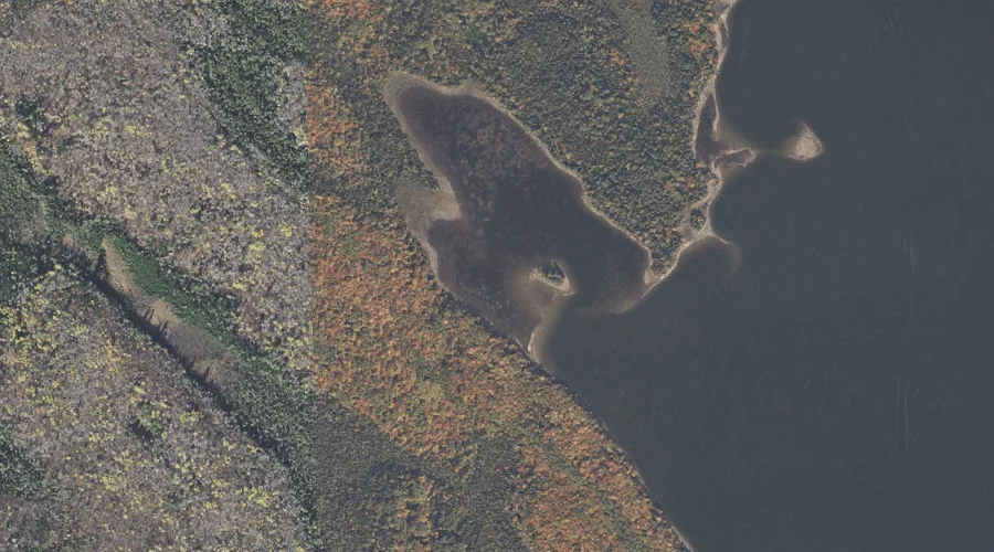
Black Island Cove — Bays 27.9 Miles NNW of Chapman Inn
Coos County, New Hampshire · USGS Umbagog Lake North Quadrangle · GNIS 865627
Catalogued on the USGS Umbagog Lake North quadrangle in Coos County, New Hampshire, Black Island Cove — a bay — lies 27.9 miles north-northwest of Chapman Inn.
Wikidata short description: “bay in Coös County, New Hampshire, United States of America”
Landmark Profile
Classification & USGS reference
Catalogued under GNIS Feature ID 865627, Black Island Cove is recorded as a bay on the USGS Umbagog Lake North quadrangle in Coos County, New Hampshire (FIPS 33/007). Catalogued in GNIS since 08/27/1980.
Coordinates & physical setting
Black Island Cove sits at 44.75950° N, 71.06091° W (DMS 44°45′34″ N, 71°03′39″ W).
Features on the USGS Umbagog Lake North Quadrangle
The Umbagog Lake North 7.5-minute topographic quadrangle holds 29 catalogued natural features alongside Black Island Cove. A sampling nearest to this location:
| Feature | Type | County | Offset |
|---|---|---|---|
| Umbagog Lake | Lakes | Coos County, NH | 0.9 mi |
| Tyler Point | Capes | Coos County, NH | 1.1 mi |
| Pininsula Molls Rock | Pillars | Coos County, NH | 1.2 mi |
| B Brook Cove | Bays | Oxford County, ME | 1.5 mi |
| Magalloway River | Streams | Oxford County, NH | 1.7 mi |
| B Brook | Streams | Oxford County, ME | 1.8 mi |
| Mountain Pond | Lakes | Coos County, NH | 1.9 mi |
| Sweat Meadows | Swamps | Coos County, NH | 2 mi |
| Mill Mountain | Summits | Coos County, NH | 2.2 mi |
| Glassby Cove | Bays | Oxford County, ME | 2.2 mi |
Visiting from Chapman Inn
Distance, bearing & drive time
A 48-minute drive along back roads separates the front door of Chapman Inn from Black Island Cove — 27.9 miles north-northwest as the crow flies, on compass bearing NNW.
Best time to visit
June through September for paddling and swimming; January through March for ice fishing. Being this far north (lat 44.759°), first snows typically arrive by mid-October and linger into early May — narrow the window accordingly. At 27.9 miles from the Inn, block the full day — sunrise start, late return, packed meals. Conditions at Black Island Cove track the nearby Umbagog Lake (0.9 mi away) closely — if that is runnable, so is this.
Nearest features to Black Island Cove
| Feature | Type | County | Distance |
|---|---|---|---|
| Umbagog Lake | Lakes | Coos County, NH | 0.9 mi |
| Tyler Point | Capes | Coos County, NH | 1.1 mi |
| Pininsula Molls Rock | Pillars | Coos County, NH | 1.2 mi |
| Metallak Island | Islands | Coos County, NH | 1.3 mi |
| Bear Island | Islands | Coos County, NH | 1.5 mi |
Frequently Asked Questions
Where is Black Island Cove located?
Black Island Cove is in Coos County, New Hampshire, approximately 27.9 miles north-northwest of Chapman Inn in Bethel, Maine. It appears on the USGS Umbagog Lake North topographic quadrangle.
How far is Black Island Cove from Chapman Inn?
The drive runs about 48 minutes, 27.9 miles north-northwest (bearing NNW) of the Inn.
What type of natural feature is Black Island Cove?
The U.S. Geological Survey classifies Black Island Cove as a bay, catalogued under GNIS Feature ID 865627 on the Umbagog Lake North quadrangle.
When is the best time to visit Black Island Cove?
June through September for paddling and swimming; January through March for ice fishing.
Wikidata: Q49373873.