 Aerial imagery: USGS National Map (public domain)
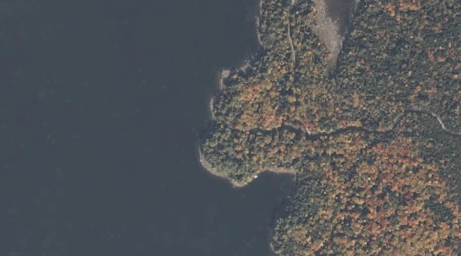
Pine Point — Capes 29.3 Miles NNW of Chapman Inn
Oxford County, Maine · USGS Umbagog Lake North Quadrangle · GNIS 573395
Within Oxford County, Maine, on the USGS Umbagog Lake North quadrangle, the cape known as Pine Point sits 29.3 miles north-northwest of Chapman Inn.
Landmark Profile
Classification & USGS reference
Within Oxford County, Maine, the U.S. Geological Survey lists Pine Point as a cape on the Umbagog Lake North topographic quadrangle (FIPS 23/017), under Feature ID 573395. Catalogued in GNIS since 09/30/1980.
Coordinates & physical setting
Pine Point sits at 44.78950° N, 71.03785° W (DMS 44°47′22″ N, 71°02′16″ W).
Other capes in Oxford County, Maine
Oxford County, ME contains 19 capes catalogued in the USGS Geographic Names Information System, counting Pine Point itself. The ones closest to Pine Point:
| Feature | USGS Quadrangle | Distance |
|---|---|---|
| Jackson Point | Middle Dam | 6.1 mi |
| Rifle Point | Middle Dam | 6.2 mi |
| Horse Beef Point | Middle Dam | 6.5 mi |
| Portland Point | Middle Dam | 6.9 mi |
| Bailey Point | Metallak Mountain | 8.8 mi |
| Black Point | Metallak Mountain | 9.7 mi |
| Whitneys Point | Metallak Mountain | 10.3 mi |
| Black Point | Oquossoc | 11.5 mi |
| Brandy Point | Oquossoc | 12.6 mi |
| Birch Point | Oquossoc | 13.2 mi |
Features on the USGS Umbagog Lake North Quadrangle
The Umbagog Lake North 7.5-minute topographic quadrangle holds 29 catalogued natural features alongside Pine Point. A sampling nearest to this location:
| Feature | Type | County | Offset |
|---|---|---|---|
| Spillman Cove | Bays | Oxford County, ME | 0.6 mi |
| Glassby Cove | Bays | Oxford County, ME | 0.9 mi |
| Rapid River | Streams | Oxford County, ME | 1 mi |
| Leonard Pond | Lakes | Coos County, NH | 1.1 mi |
| Pininsula Molls Rock | Pillars | Coos County, NH | 1.3 mi |
| Magalloway River | Streams | Oxford County, NH | 1.4 mi |
| Sunday Cove | Bays | Oxford County, ME | 1.8 mi |
| Umbagog Lake | Lakes | Coos County, NH | 1.8 mi |
| B Brook Cove | Bays | Oxford County, ME | 2 mi |
| Sturtevant Cove | Bays | Oxford County, ME | 2 mi |
Visiting from Chapman Inn
Distance, bearing & drive time
Follow the compass bearing NNW out of Bethel for 29.3 miles (north-northwest) and you reach Pine Point; at typical rural speeds the trip runs roughly 50 minutes.
Best time to visit
Generally accessible May through October; winter access depends on snow cover. At this latitude (44.789°), the shoulder seasons are workable — April and November can be comfortable on mild years. At 29.3 miles from the Inn, block the full day — sunrise start, late return, packed meals. Conditions at Pine Point track the nearby Spillman Cove bay (0.6 mi away) closely — if that is runnable, so is this.
Nearest features to Pine Point
| Feature | Type | County | Distance |
|---|---|---|---|
| Spillman Cove | Bays | Oxford County, ME | 0.6 mi |
| Glassby Cove | Bays | Oxford County, ME | 0.9 mi |
| Rapid River | Streams | Oxford County, ME | 1 mi |
| Leonard Pond | Lakes | Coos County, NH | 1.1 mi |
| Pininsula Molls Rock | Pillars | Coos County, NH | 1.3 mi |
Frequently Asked Questions
Where is Pine Point located?
Pine Point is in Oxford County, Maine, approximately 29.3 miles north-northwest of Chapman Inn in Bethel, Maine. It appears on the USGS Umbagog Lake North topographic quadrangle.
How far is Pine Point from Chapman Inn?
The drive runs about 50 minutes, 29.3 miles north-northwest (bearing NNW) of the Inn.
What type of natural feature is Pine Point?
The U.S. Geological Survey classifies Pine Point as a cape, catalogued under GNIS Feature ID 573395 on the Umbagog Lake North quadrangle.
When is the best time to visit Pine Point?
Generally accessible May through October; winter access depends on snow cover.
How many other capes are in Oxford County, Maine?
GNIS lists 18 other capes in Oxford County, Maine.