 Aerial imagery: USGS National Map (public domain)
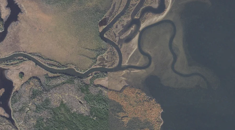
Magalloway River — Streams 29.5 Miles NNW of Chapman Inn
Oxford County, New Hampshire · USGS Umbagog Lake North Quadrangle · GNIS 570648
29.5 miles north-northwest of Chapman Inn, on the USGS Umbagog Lake North topographic quadrangle, Magalloway River is a stream recorded in Oxford County, New Hampshire by the federal Geographic Names Information System.
Landmark Profile
Classification & USGS reference
The USGS Umbagog Lake North 7.5-minute topographic quadrangle places Magalloway River in Oxford County, New Hampshire (FIPS 23/017), classified as a stream in the federal GNIS (Feature ID 570648). Last revised by the Board on Geographic Names on 08/29/2019.
Coordinates & physical setting
Magalloway River sits at 44.78338° N, 71.06480° W (DMS 44°47′00″ N, 71°03′53″ W).
As a linear feature its source lies near 45.25699° N, 71.02813° W (DMS 45°15′25″ N, 71°01′41″ W) — useful for anglers and paddlers tracing the upstream end.
Other streams in Oxford County, New Hampshire
Oxford County, NH contains 26 streams catalogued in the USGS Geographic Names Information System, counting Magalloway River itself. The ones closest to Magalloway River:
| Feature | USGS Quadrangle | Distance |
|---|---|---|
| Sturtevant Stream | Umbagog Lake North | 3.9 mi |
| Bennett Brook | Wilsons Mills | 9.2 mi |
| Abbott Brook | Wilsons Mills | 10.8 mi |
| Silver Stream | Success Pond | 13.6 mi |
| Sucker Brook | Success Pond | 15.1 mi |
| Shelter Brook | Success Pond | 16.7 mi |
| North Hammond Brook | Bosebuck Mountain | 17.6 mi |
| Meadow Brook | Bosebuck Mountain | 18.6 mi |
| Big Brook | Bosebuck Mountain | 19.7 mi |
| Little Magalloway River | Lincoln Pond | 22.3 mi |
Features on the USGS Umbagog Lake North Quadrangle
The Umbagog Lake North 7.5-minute topographic quadrangle holds 29 catalogued natural features alongside Magalloway River. A sampling nearest to this location:
| Feature | Type | County | Offset |
|---|---|---|---|
| Pininsula Molls Rock | Pillars | Coos County, NH | 0.6 mi |
| Leonard Pond | Lakes | Coos County, NH | 0.8 mi |
| Sweat Meadows | Swamps | Coos County, NH | 1.1 mi |
| Pine Point | Capes | Oxford County, ME | 1.4 mi |
| Black Island Cove | Bays | Coos County, NH | 1.7 mi |
| Mountain Pond | Lakes | Coos County, NH | 1.7 mi |
| Umbagog Lake | Lakes | Coos County, NH | 1.8 mi |
| Spillman Cove | Bays | Oxford County, ME | 1.8 mi |
| Glassby Cove | Bays | Oxford County, ME | 1.9 mi |
| B Brook Cove | Bays | Oxford County, ME | 2.3 mi |
Visiting from Chapman Inn
Distance, bearing & drive time
Chapman Inn sits 29.5 miles north-northwest (bearing NNW) of Magalloway River. At moderate back-road speeds the drive runs about 51 minutes — comfortably inside a half-day outing window after breakfast.
Best time to visit
Best observed in late spring and early summer when flow is strong and banks are visible. At this latitude (44.783°), the shoulder seasons are workable — April and November can be comfortable on mild years. At 29.5 miles from the Inn, block the full day — sunrise start, late return, packed meals. Conditions at Magalloway River track the nearby Pininsula Molls Rock rock pillar (0.6 mi away) closely — if that is runnable, so is this.
Nearest features to Magalloway River
| Feature | Type | County | Distance |
|---|---|---|---|
| Pininsula Molls Rock | Pillars | Coos County, NH | 0.6 mi |
| Leonard Pond | Lakes | Coos County, NH | 0.8 mi |
| Sweat Meadows | Swamps | Coos County, NH | 1.1 mi |
| Pine Point | Capes | Oxford County, ME | 1.4 mi |
| Black Island Cove | Bays | Coos County, NH | 1.7 mi |
Frequently Asked Questions
Where is Magalloway River located?
Magalloway River is in Oxford County, New Hampshire, approximately 29.5 miles north-northwest of Chapman Inn in Bethel, Maine. It appears on the USGS Umbagog Lake North topographic quadrangle.
How far is Magalloway River from Chapman Inn?
The drive runs about 51 minutes, 29.5 miles north-northwest (bearing NNW) of the Inn.
What type of natural feature is Magalloway River?
The U.S. Geological Survey classifies Magalloway River as a stream, catalogued under GNIS Feature ID 570648 on the Umbagog Lake North quadrangle.
When is the best time to visit Magalloway River?
Best observed in late spring and early summer when flow is strong and banks are visible.
How many other streams are in Oxford County, New Hampshire?
GNIS lists 25 other streams in Oxford County, New Hampshire.