 Aerial imagery: USGS National Map (public domain)
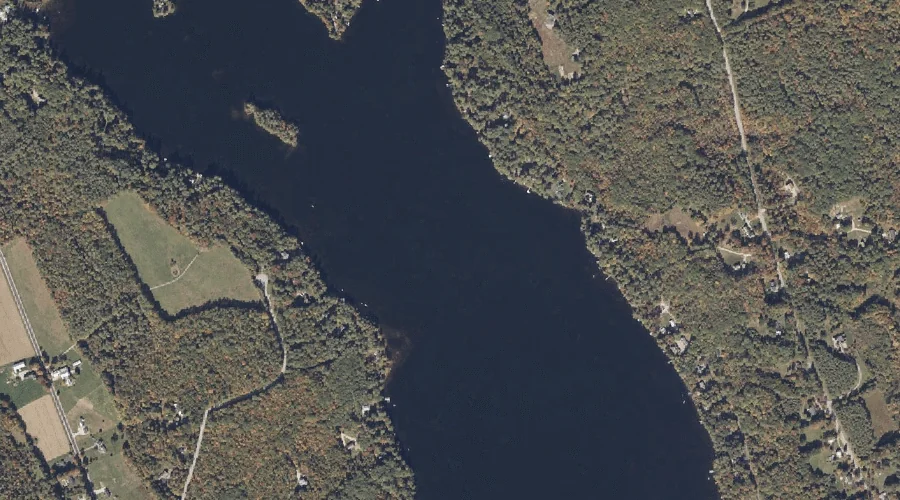
Pennesseewassee Lake — Reservoirs 15.9 Miles SE of Chapman Inn
Oxford County, Maine · USGS Norway Quadrangle · GNIS 573165
15.9 miles southeast of Chapman Inn, on the USGS Norway topographic quadrangle, Pennesseewassee Lake is a reservoir recorded in Oxford County, Maine by the federal Geographic Names Information System.
Landmark Profile
Classification & USGS reference
The USGS Norway 7.5-minute topographic quadrangle places Pennesseewassee Lake in Oxford County, Maine (FIPS 23/017), classified as a reservoir in the federal GNIS (Feature ID 573165). Last revised by the Board on Geographic Names on 05/12/2018.
Coordinates & physical setting
Pennesseewassee Lake sits at 44.22961° N, 70.58205° W (DMS 44°13′47″ N, 70°34′55″ W).
Other reservoirs in Oxford County, Maine
Oxford County, ME contains 51 reservoirs catalogued in the USGS Geographic Names Information System, counting Pennesseewassee Lake itself. The ones closest to Pennesseewassee Lake:
| Feature | USGS Quadrangle | Distance |
|---|---|---|
| Little Pennesseewassee Pond | Norway | 1.7 mi |
| Sand Pond | Norway | 2.5 mi |
| North Pond | West Paris | 2.6 mi |
| Little Androscoggin River Reservoir | Norway | 3.6 mi |
| Hall Pond | Oxford | 6.2 mi |
| Little Androscoggin River Reservoir | West Paris | 6.5 mi |
| Hicks Pond | Greenwood | 6.7 mi |
| Saturday Pond | Casco | 8.4 mi |
| Bear Pond | Waterford Flat | 8.6 mi |
| Little Androscoggin River Reservoir | Oxford | 9 mi |
Features on the USGS Norway Quadrangle
The Norway 7.5-minute topographic quadrangle holds 32 catalogued natural features alongside Pennesseewassee Lake. A sampling nearest to this location:
| Feature | Type | County | Offset |
|---|---|---|---|
| Crockett Ridge | Ridges | Oxford County, ME | 0.7 mi |
| Witt Swamp | Swamps | Oxford County, ME | 0.9 mi |
| Bogg Brook | Streams | Oxford County, ME | 1.2 mi |
| Hathaway Hill | Summits | Oxford County, ME | 1.3 mi |
| The Nubble | Summits | Oxford County, ME | 1.4 mi |
| Little Pennesseewassee Pond | Reservoirs | Oxford County, ME | 1.7 mi |
| Bird Pond | Lakes | Oxford County, ME | 1.8 mi |
| Jim Hill | Summits | Oxford County, ME | 2 mi |
| Isaiah Hill | Summits | Oxford County, ME | 2 mi |
| Round Pond | Lakes | Oxford County, ME | 2.2 mi |
Visiting from Chapman Inn
Distance, bearing & drive time
Chapman Inn sits 15.9 miles southeast (bearing SE) of Pennesseewassee Lake. At moderate back-road speeds the drive runs about 27 minutes — comfortably inside a half-day outing window after breakfast.
Best time to visit
June through September for paddling and swimming; January through March for ice fishing. At this latitude (44.230°), the shoulder seasons are workable — April and November can be comfortable on mild years. At 15.9 miles from the Inn, plan on a comfortable day trip with time for lunch on the road. Conditions at Pennesseewassee Lake track the nearby Crockett Ridge (0.7 mi away) closely — if that is runnable, so is this.
Nearest features to Pennesseewassee Lake
| Feature | Type | County | Distance |
|---|---|---|---|
| Crockett Ridge | Ridges | Oxford County, ME | 0.7 mi |
| Witt Swamp | Swamps | Oxford County, ME | 0.9 mi |
| Bogg Brook | Streams | Oxford County, ME | 1.2 mi |
| Hathaway Hill | Summits | Oxford County, ME | 1.3 mi |
| The Nubble | Summits | Oxford County, ME | 1.4 mi |
Frequently Asked Questions
Where is Pennesseewassee Lake located?
Pennesseewassee Lake is in Oxford County, Maine, approximately 15.9 miles southeast of Chapman Inn in Bethel, Maine. It appears on the USGS Norway topographic quadrangle.
How far is Pennesseewassee Lake from Chapman Inn?
The drive runs about 27 minutes, 15.9 miles southeast (bearing SE) of the Inn.
What type of natural feature is Pennesseewassee Lake?
The U.S. Geological Survey classifies Pennesseewassee Lake as a reservoir, catalogued under GNIS Feature ID 573165 on the Norway quadrangle.
When is the best time to visit Pennesseewassee Lake?
June through September for paddling and swimming; January through March for ice fishing.
How many other reservoirs are in Oxford County, Maine?
GNIS lists 50 other reservoirs in Oxford County, Maine.