 Aerial imagery: USGS National Map (public domain)
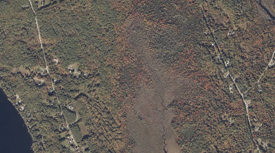
Witt Swamp — Swamps 16.5 Miles SE of Chapman Inn
Oxford County, Maine · USGS Norway Quadrangle · GNIS 578635
Catalogued on the USGS Norway quadrangle in Oxford County, Maine, Witt Swamp — a swamp — lies 16.5 miles southeast of Chapman Inn.
Wikidata short description: “swamp in Oxford County, Maine, United States of America”
Landmark Profile
Classification & USGS reference
Catalogued under GNIS Feature ID 578635, Witt Swamp is recorded as a swamp on the USGS Norway quadrangle in Oxford County, Maine (FIPS 23/017). Catalogued in GNIS since 09/30/1980.
Coordinates & physical setting
Witt Swamp sits at 44.22979° N, 70.56339° W (DMS 44°13′47″ N, 70°33′48″ W).
Other swamps in Oxford County, Maine
Oxford County, ME contains 16 swamps catalogued in the USGS Geographic Names Information System, counting Witt Swamp itself. The ones closest to Witt Swamp:
| Feature | USGS Quadrangle | Distance |
|---|---|---|
| Mud Pond | Waterford Flat | 3.3 mi |
| Baker Bog | Waterford Flat | 5.3 mi |
| Bearce Bog | Norway | 7.1 mi |
| Harlan Swamp | Casco | 7.6 mi |
| Town Farm Swamp | Waterford Flat | 7.8 mi |
| College Swamp | Casco | 10.3 mi |
| Coon Road Swamp | Casco | 10.4 mi |
| Middle Brook Bog | Casco | 11.7 mi |
| Long Meadows | Casco | 13.3 mi |
| Waterfowl Marsh | East Stoneham | 14.1 mi |
Features on the USGS Norway Quadrangle
The Norway 7.5-minute topographic quadrangle holds 32 catalogued natural features alongside Witt Swamp. A sampling nearest to this location:
| Feature | Type | County | Offset |
|---|---|---|---|
| Bogg Brook | Streams | Oxford County, ME | 0.6 mi |
| Crockett Ridge | Ridges | Oxford County, ME | 0.7 mi |
| The Nubble | Summits | Oxford County, ME | 0.7 mi |
| Pennesseewassee Lake | Reservoirs | Oxford County, ME | 0.9 mi |
| Bird Pond | Lakes | Oxford County, ME | 1.3 mi |
| Elm Hill | Summits | Oxford County, ME | 1.8 mi |
| Pike Hill | Summits | Oxford County, ME | 1.8 mi |
| Bird Brook | Streams | Oxford County, ME | 1.8 mi |
| Hathaway Hill | Summits | Oxford County, ME | 2 mi |
| Steep Falls | Waterfalls | Oxford County, ME | 2.2 mi |
Visiting from Chapman Inn
Distance, bearing & drive time
A 28-minute drive along back roads separates the front door of Chapman Inn from Witt Swamp — 16.5 miles southeast as the crow flies, on compass bearing SE.
Best time to visit
Late May through October; avoid black-fly peak in late May. At this latitude (44.230°), the shoulder seasons are workable — April and November can be comfortable on mild years. At 16.5 miles from the Inn, plan on a comfortable day trip with time for lunch on the road. Conditions at Witt Swamp track the nearby Bogg Brook stream (0.6 mi away) closely — if that is runnable, so is this.
Nearest features to Witt Swamp
| Feature | Type | County | Distance |
|---|---|---|---|
| Bogg Brook | Streams | Oxford County, ME | 0.6 mi |
| Crockett Ridge | Ridges | Oxford County, ME | 0.7 mi |
| The Nubble | Summits | Oxford County, ME | 0.7 mi |
| Pennesseewassee Lake | Reservoirs | Oxford County, ME | 0.9 mi |
| Bird Pond | Lakes | Oxford County, ME | 1.3 mi |
Frequently Asked Questions
Where is Witt Swamp located?
Witt Swamp is in Oxford County, Maine, approximately 16.5 miles southeast of Chapman Inn in Bethel, Maine. It appears on the USGS Norway topographic quadrangle.
How far is Witt Swamp from Chapman Inn?
The drive runs about 28 minutes, 16.5 miles southeast (bearing SE) of the Inn.
What type of natural feature is Witt Swamp?
The U.S. Geological Survey classifies Witt Swamp as a swamp, catalogued under GNIS Feature ID 578635 on the Norway quadrangle.
When is the best time to visit Witt Swamp?
Late May through October; avoid black-fly peak in late May.
How many other swamps are in Oxford County, Maine?
GNIS lists 15 other swamps in Oxford County, Maine.
Wikidata: Q33176779.