 Aerial imagery: USGS National Map (public domain)
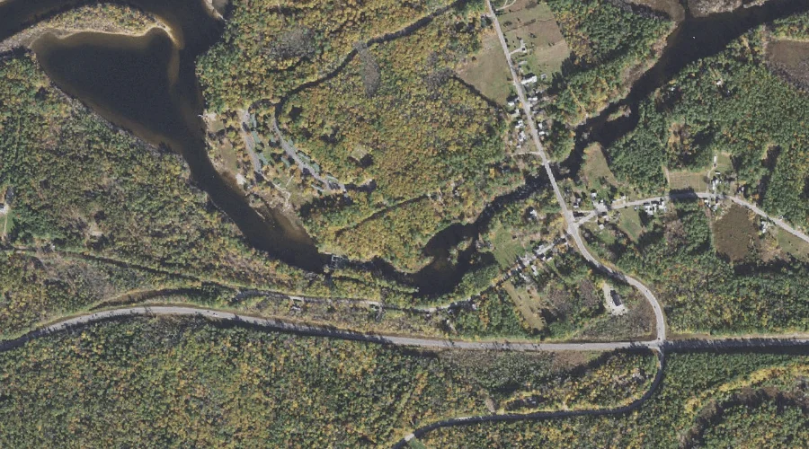
Berry Bay — Reservoirs 44.2 Miles SSW of Chapman Inn
Carroll County, New Hampshire · USGS Freedom Quadrangle · GNIS 1775346
44.2 miles south-southwest of Chapman Inn, on the USGS Freedom topographic quadrangle, Berry Bay is a reservoir recorded in Carroll County, New Hampshire by the federal Geographic Names Information System.
Wikidata short description: “dam in Carroll County, New Hampshire, United States of America”
Landmark Profile
Classification & USGS reference
The USGS Freedom 7.5-minute topographic quadrangle places Berry Bay in Carroll County, New Hampshire (FIPS 33/003), classified as a reservoir in the federal GNIS (Feature ID 1775346). Catalogued in GNIS since 01/09/1998.
Coordinates & physical setting
Berry Bay sits at 43.79508° N, 71.06118° W (DMS 43°47′42″ N, 71°03′40″ W).
Other reservoirs in Carroll County, New Hampshire
Carroll County, NH contains 11 reservoirs catalogued in the USGS Geographic Names Information System, counting Berry Bay itself. The ones closest to Berry Bay:
| Feature | USGS Quadrangle | Distance |
|---|---|---|
| Purity Lake | Freedom | 4.9 mi |
| Hutchins Pond | Ossipee | 5.1 mi |
| Silver Lake | Ossipee Lake | 7.4 mi |
| Little Pea Porridge Pond | Silver Lake | 10.5 mi |
| Conway Lake | Conway | 11.5 mi |
| Pequawket Pond | Silver Lake | 12.7 mi |
| Great Hill Pond | Mount Chocorua | 15 mi |
| Upper Kimball Lake | North Conway East | 21 mi |
| Ellis River Reservoir | Jackson | 23.8 mi |
| Basin Brook Reservoir | Wild River | 32.9 mi |
Features on the USGS Freedom Quadrangle
The Freedom 7.5-minute topographic quadrangle holds 43 catalogued natural features alongside Berry Bay. A sampling nearest to this location:
| Feature | Type | County | Offset |
|---|---|---|---|
| Lovering Brook | Streams | Carroll County, NH | 0.6 mi |
| Leavitt Brook | Streams | Carroll County, NH | 0.9 mi |
| Berry Bay | Bays | Carroll County, NH | 1 mi |
| Hodgedon Brook | Streams | Carroll County, NH | 1 mi |
| Leavitt Bay | Bays | Carroll County, NH | 1.2 mi |
| Square Brook | Streams | Carroll County, NH | 1.4 mi |
| Phillips Brook | Streams | Carroll County, NH | 1.4 mi |
| Loon Lake | Lakes | Carroll County, NH | 2 mi |
| Flanders Brook | Streams | Carroll County, NH | 2 mi |
| Bennett Brook | Streams | Carroll County, NH | 2 mi |
Visiting from Chapman Inn
Distance, bearing & drive time
Chapman Inn sits 44.2 miles south-southwest (bearing SSW) of Berry Bay. At moderate back-road speeds the drive runs about 76 minutes — comfortably inside a half-day outing window after breakfast.
Best time to visit
June through September for paddling and swimming; January through March for ice fishing. At this latitude (43.795°), the shoulder seasons are workable — April and November can be comfortable on mild years. At 44.2 miles from the Inn, block the full day — sunrise start, late return, packed meals. Conditions at Berry Bay track the nearby Lovering Brook stream (0.6 mi away) closely — if that is runnable, so is this.
Nearest features to Berry Bay
| Feature | Type | County | Distance |
|---|---|---|---|
| Lovering Brook | Streams | Carroll County, NH | 0.6 mi |
| Leavitt Brook | Streams | Carroll County, NH | 0.9 mi |
| Berry Bay | Bays | Carroll County, NH | 1 mi |
| Hodgedon Brook | Streams | Carroll County, NH | 1 mi |
| Leavitt Bay | Bays | Carroll County, NH | 1.2 mi |
Frequently Asked Questions
Where is Berry Bay located?
Berry Bay is in Carroll County, New Hampshire, approximately 44.2 miles south-southwest of Chapman Inn in Bethel, Maine. It appears on the USGS Freedom topographic quadrangle.
How far is Berry Bay from Chapman Inn?
The drive runs about 76 minutes, 44.2 miles south-southwest (bearing SSW) of the Inn.
What type of natural feature is Berry Bay?
The U.S. Geological Survey classifies Berry Bay as a reservoir, catalogued under GNIS Feature ID 1775346 on the Freedom quadrangle.
When is the best time to visit Berry Bay?
June through September for paddling and swimming; January through March for ice fishing.
How many other reservoirs are in Carroll County, New Hampshire?
GNIS lists 10 other reservoirs in Carroll County, New Hampshire.
Wikidata: Q34805037.