 Aerial imagery: USGS National Map (public domain)
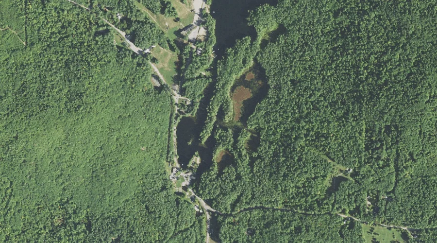
Purity Lake — Reservoirs 40.2 Miles SSW of Chapman Inn
Carroll County, New Hampshire · USGS Freedom Quadrangle · GNIS 872533
Catalogued on the USGS Freedom quadrangle in Carroll County, New Hampshire, Purity Lake — a reservoir — lies 40.2 miles south-southwest of Chapman Inn.
Wikidata short description: “dam in Carroll County, New Hampshire, United States of America”
Landmark Profile
Classification & USGS reference
Catalogued under GNIS Feature ID 872533, Purity Lake is recorded as a reservoir on the USGS Freedom quadrangle in Carroll County, New Hampshire (FIPS 33/003). Last revised by the Board on Geographic Names on 08/02/2022.
Coordinates & physical setting
Purity Lake sits at 43.86376° N, 71.08726° W (DMS 43°51′50″ N, 71°05′14″ W).
Other reservoirs in Carroll County, New Hampshire
Carroll County, NH contains 11 reservoirs catalogued in the USGS Geographic Names Information System, counting Purity Lake itself. The ones closest to Purity Lake:
| Feature | USGS Quadrangle | Distance |
|---|---|---|
| Silver Lake | Ossipee Lake | 4.2 mi |
| Berry Bay | Freedom | 4.9 mi |
| Little Pea Porridge Pond | Silver Lake | 5.7 mi |
| Conway Lake | Conway | 6.9 mi |
| Pequawket Pond | Silver Lake | 7.8 mi |
| Hutchins Pond | Ossipee | 9.8 mi |
| Great Hill Pond | Mount Chocorua | 12.4 mi |
| Upper Kimball Lake | North Conway East | 16.6 mi |
| Ellis River Reservoir | Jackson | 18.9 mi |
| Basin Brook Reservoir | Wild River | 28.3 mi |
Features on the USGS Freedom Quadrangle
The Freedom 7.5-minute topographic quadrangle holds 43 catalogued natural features alongside Purity Lake. A sampling nearest to this location:
| Feature | Type | County | Offset |
|---|---|---|---|
| Ferrin Brook | Streams | Carroll County, NH | 0.2 mi |
| Toll Hill | Summits | Carroll County, NH | 0.7 mi |
| Bald Ledge | Benches | Carroll County, NH | 1.1 mi |
| Blaisdell Brook | Streams | Carroll County, NH | 1.1 mi |
| Blazo Mountain | Summits | Carroll County, NH | 1.7 mi |
| Goe Hill | Summits | Carroll County, NH | 1.7 mi |
| Youngs Hill | Summits | Carroll County, NH | 2.7 mi |
| Shawtown Brook | Streams | Carroll County, NH | 2.7 mi |
| Watson Hill | Summits | Carroll County, NH | 2.8 mi |
| Danforth Ponds | Lakes | Carroll County, NH | 2.9 mi |
Visiting from Chapman Inn
Distance, bearing & drive time
A 69-minute drive along back roads separates the front door of Chapman Inn from Purity Lake — 40.2 miles south-southwest as the crow flies, on compass bearing SSW.
Best time to visit
June through September for paddling and swimming; January through March for ice fishing. At this latitude (43.864°), the shoulder seasons are workable — April and November can be comfortable on mild years. At 40.2 miles from the Inn, block the full day — sunrise start, late return, packed meals. Conditions at Purity Lake track the nearby Ferrin Brook stream (0.2 mi away) closely — if that is runnable, so is this.
Nearest features to Purity Lake
| Feature | Type | County | Distance |
|---|---|---|---|
| Ferrin Brook | Streams | Carroll County, NH | 0.2 mi |
| Toll Hill | Summits | Carroll County, NH | 0.7 mi |
| Bald Ledge | Benches | Carroll County, NH | 1.1 mi |
| Blaisdell Brook | Streams | Carroll County, NH | 1.1 mi |
| Long Pond | Lakes | Carroll County, NH | 1.6 mi |
Frequently Asked Questions
Where is Purity Lake located?
Purity Lake is in Carroll County, New Hampshire, approximately 40.2 miles south-southwest of Chapman Inn in Bethel, Maine. It appears on the USGS Freedom topographic quadrangle.
How far is Purity Lake from Chapman Inn?
The drive runs about 69 minutes, 40.2 miles south-southwest (bearing SSW) of the Inn.
What type of natural feature is Purity Lake?
The U.S. Geological Survey classifies Purity Lake as a reservoir, catalogued under GNIS Feature ID 872533 on the Freedom quadrangle.
When is the best time to visit Purity Lake?
June through September for paddling and swimming; January through March for ice fishing.
How many other reservoirs are in Carroll County, New Hampshire?
GNIS lists 10 other reservoirs in Carroll County, New Hampshire.
Wikidata: Q34907039.