 Aerial imagery: USGS National Map (public domain)
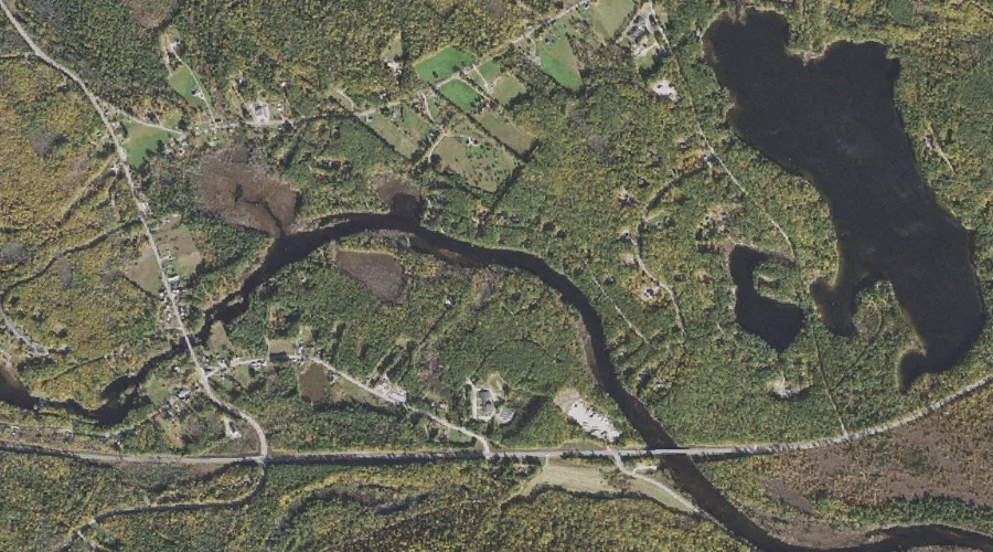
Hodgedon Brook — Streams 43.7 Miles SSW of Chapman Inn
Carroll County, New Hampshire · USGS Freedom Quadrangle · GNIS 867529
Catalogued on the USGS Freedom quadrangle in Carroll County, New Hampshire, Hodgedon Brook — a stream — lies 43.7 miles south-southwest of Chapman Inn.
Wikidata short description: “river in the United States of America”
Landmark Profile
Classification & USGS reference
Catalogued under GNIS Feature ID 867529, Hodgedon Brook is recorded as a stream on the USGS Freedom quadrangle in Carroll County, New Hampshire (FIPS 33/003). Catalogued in GNIS since 08/27/1980.
Coordinates & physical setting
Hodgedon Brook sits at 43.79869° N, 71.04090° W (DMS 43°47′55″ N, 71°02′27″ W).
As a linear feature its source lies near 43.77056° N, 71.03972° W (DMS 43°46′14″ N, 71°02′23″ W) — useful for anglers and paddlers tracing the upstream end.
Other streams in Carroll County, New Hampshire
Carroll County, NH contains 152 streams catalogued in the USGS Geographic Names Information System, counting Hodgedon Brook itself. The ones closest to Hodgedon Brook:
| Feature | USGS Quadrangle | Distance |
|---|---|---|
| Lovering Brook | Freedom | 0.5 mi |
| Bennett Brook | Freedom | 1 mi |
| Flanders Brook | Freedom | 1.1 mi |
| Moulton Brook | Freedom | 1.5 mi |
| Mastin Brook | Freedom | 1.9 mi |
| Leavitt Brook | Freedom | 1.9 mi |
| Cold Brook | Freedom | 2 mi |
| Square Brook | Freedom | 2.1 mi |
| Nason Brook | Freedom | 2.4 mi |
| Phillips Brook | Freedom | 2.4 mi |
Features on the USGS Freedom Quadrangle
The Freedom 7.5-minute topographic quadrangle holds 43 catalogued natural features alongside Hodgedon Brook. A sampling nearest to this location:
| Feature | Type | County | Offset |
|---|---|---|---|
| Lovering Brook | Streams | Carroll County, NH | 0.5 mi |
| Loon Lake | Lakes | Carroll County, NH | 0.9 mi |
| Bennett Brook | Streams | Carroll County, NH | 1 mi |
| Berry Bay | Reservoirs | Carroll County, NH | 1 mi |
| Flanders Brook | Streams | Carroll County, NH | 1.1 mi |
| Moulton Brook | Streams | Carroll County, NH | 1.5 mi |
| Berry Bay | Bays | Carroll County, NH | 1.7 mi |
| Mastin Brook | Streams | Carroll County, NH | 1.9 mi |
| Leavitt Brook | Streams | Carroll County, NH | 1.9 mi |
| Cold Brook | Streams | Carroll County, NH | 2 mi |
Visiting from Chapman Inn
Distance, bearing & drive time
A 75-minute drive along back roads separates the front door of Chapman Inn from Hodgedon Brook — 43.7 miles south-southwest as the crow flies, on compass bearing SSW.
Best time to visit
Best observed in late spring and early summer when flow is strong and banks are visible. At this latitude (43.799°), the shoulder seasons are workable — April and November can be comfortable on mild years. At 43.7 miles from the Inn, block the full day — sunrise start, late return, packed meals. Conditions at Hodgedon Brook track the nearby Lovering Brook stream (0.5 mi away) closely — if that is runnable, so is this.
Nearest features to Hodgedon Brook
| Feature | Type | County | Distance |
|---|---|---|---|
| Lovering Brook | Streams | Carroll County, NH | 0.5 mi |
| Loon Lake | Lakes | Carroll County, NH | 0.9 mi |
| Bennett Brook | Streams | Carroll County, NH | 1 mi |
| Berry Bay | Reservoirs | Carroll County, NH | 1 mi |
| Flanders Brook | Streams | Carroll County, NH | 1.1 mi |
Frequently Asked Questions
Where is Hodgedon Brook located?
Hodgedon Brook is in Carroll County, New Hampshire, approximately 43.7 miles south-southwest of Chapman Inn in Bethel, Maine. It appears on the USGS Freedom topographic quadrangle.
How far is Hodgedon Brook from Chapman Inn?
The drive runs about 75 minutes, 43.7 miles south-southwest (bearing SSW) of the Inn.
What type of natural feature is Hodgedon Brook?
The U.S. Geological Survey classifies Hodgedon Brook as a stream, catalogued under GNIS Feature ID 867529 on the Freedom quadrangle.
When is the best time to visit Hodgedon Brook?
Best observed in late spring and early summer when flow is strong and banks are visible.
How many other streams are in Carroll County, New Hampshire?
GNIS lists 151 other streams in Carroll County, New Hampshire.
Wikidata: Q34783680.