 Aerial imagery: USGS National Map (public domain)
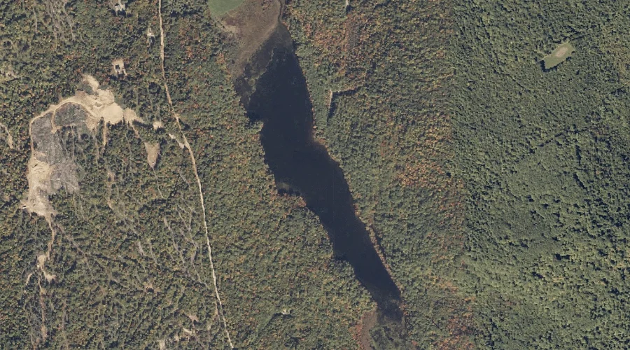
South Pond — Lakes 22.8 Miles ESE of Chapman Inn
Oxford County, Maine · USGS Buckfield Quadrangle · GNIS 575887
Catalogued on the USGS Buckfield quadrangle in Oxford County, Maine, South Pond — a lake — lies 22.8 miles east-southeast of Chapman Inn.
Landmark Profile
Classification & USGS reference
Catalogued under GNIS Feature ID 575887, South Pond is recorded as a lake on the USGS Buckfield quadrangle in Oxford County, Maine (FIPS 23/017). Last revised by the Board on Geographic Names on 05/12/2018.
Coordinates & physical setting
South Pond sits at 44.26518° N, 70.37093° W (DMS 44°15′55″ N, 70°22′15″ W).
Other lakes in Oxford County, Maine
Oxford County, ME contains 157 lakes catalogued in the USGS Geographic Names Information System, counting South Pond itself. The ones closest to South Pond:
| Feature | USGS Quadrangle | Distance |
|---|---|---|
| Mud Pond | Lake Auburn West | 3.3 mi |
| Swan Pond | Buckfield | 4.1 mi |
| Northeast Pond | Buckfield | 5.3 mi |
| Cushman Pond | West Sumner | 6.1 mi |
| Mud Pond | Oxford | 6.9 mi |
| Little Bear Pond | Buckfield | 7.3 mi |
| Barnett Pond | Oxford | 7.4 mi |
| Bunganock Pond | Canton | 8.5 mi |
| Little Labrador Pond | Worthley Pond | 8.6 mi |
| Pleasant Pond | West Sumner | 8.7 mi |
Features on the USGS Buckfield Quadrangle
The Buckfield 7.5-minute topographic quadrangle holds 35 catalogued natural features alongside South Pond. A sampling nearest to this location:
| Feature | Type | County | Offset |
|---|---|---|---|
| East Branch Nezinscot River | Streams | Oxford County, ME | 1.8 mi |
| West Branch Nezinscot River | Streams | Oxford County, ME | 1.8 mi |
| Swan Pond Brook | Streams | Oxford County, ME | 2.1 mi |
| Irish Hill | Summits | Oxford County, ME | 2.1 mi |
| Bog Brook | Streams | Oxford County, ME | 2.7 mi |
| Teague Hill | Summits | Androscoggin County, ME | 3.6 mi |
| Mount Oxford Spring | Springs | Oxford County, ME | 3.8 mi |
| Jersey Bog | Lakes | Androscoggin County, ME | 3.8 mi |
| Drew Brook | Streams | Oxford County, ME | 4 mi |
| Swan Pond | Lakes | Oxford County, ME | 4.1 mi |
Visiting from Chapman Inn
Distance, bearing & drive time
A 39-minute drive along back roads separates the front door of Chapman Inn from South Pond — 22.8 miles east-southeast as the crow flies, on compass bearing ESE.
Best time to visit
June through September for paddling and swimming; January through March for ice fishing. At this latitude (44.265°), the shoulder seasons are workable — April and November can be comfortable on mild years. At 22.8 miles from the Inn, plan on a comfortable day trip with time for lunch on the road. Conditions at South Pond track the nearby Whitman Hill summit (1.3 mi away) closely — if that is runnable, so is this.
Nearest features to South Pond
| Feature | Type | County | Distance |
|---|---|---|---|
| Whitman Hill | Summits | Oxford County, ME | 1.3 mi |
| East Branch Nezinscot River | Streams | Oxford County, ME | 1.8 mi |
| West Branch Nezinscot River | Streams | Oxford County, ME | 1.8 mi |
| Cobb Brook | Streams | Oxford County, ME | 1.9 mi |
| Stone Hill | Summits | Oxford County, ME | 2.1 mi |
Frequently Asked Questions
Where is South Pond located?
South Pond is in Oxford County, Maine, approximately 22.8 miles east-southeast of Chapman Inn in Bethel, Maine. It appears on the USGS Buckfield topographic quadrangle.
How far is South Pond from Chapman Inn?
The drive runs about 39 minutes, 22.8 miles east-southeast (bearing ESE) of the Inn.
What type of natural feature is South Pond?
The U.S. Geological Survey classifies South Pond as a lake, catalogued under GNIS Feature ID 575887 on the Buckfield quadrangle.
When is the best time to visit South Pond?
June through September for paddling and swimming; January through March for ice fishing.
How many other lakes are in Oxford County, Maine?
GNIS lists 156 other lakes in Oxford County, Maine.