 Aerial imagery: USGS National Map (public domain)
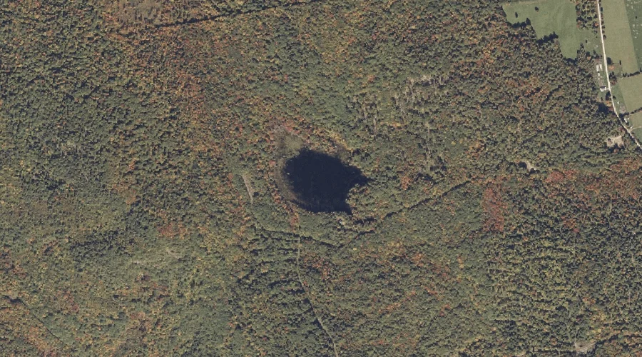
Cushman Pond — Lakes 19.1 Miles ESE of Chapman Inn
Oxford County, Maine · USGS West Sumner Quadrangle · GNIS 564702
19.1 miles east-southeast of Chapman Inn, on the USGS West Sumner topographic quadrangle, Cushman Pond is a lake recorded in Oxford County, Maine by the federal Geographic Names Information System.
Landmark Profile
Classification & USGS reference
The USGS West Sumner 7.5-minute topographic quadrangle places Cushman Pond in Oxford County, Maine (FIPS 23/017), classified as a lake in the federal GNIS (Feature ID 564702). Last revised by the Board on Geographic Names on 05/12/2018.
Coordinates & physical setting
Cushman Pond sits at 44.34855° N, 70.41130° W (DMS 44°20′55″ N, 70°24′41″ W).
Other lakes in Oxford County, Maine
Oxford County, ME contains 157 lakes catalogued in the USGS Geographic Names Information System, counting Cushman Pond itself. The ones closest to Cushman Pond:
| Feature | USGS Quadrangle | Distance |
|---|---|---|
| Little Labrador Pond | Worthley Pond | 2.5 mi |
| Northeast Pond | Buckfield | 2.9 mi |
| Pleasant Pond | West Sumner | 3.3 mi |
| Swan Pond | Buckfield | 4.1 mi |
| Bunganock Pond | Canton | 4.4 mi |
| Moose Pond | West Paris | 5.3 mi |
| Little Bear Pond | Buckfield | 6 mi |
| South Pond | Buckfield | 6.1 mi |
| Mud Pond | Worthley Pond | 6.9 mi |
| Halfmoon Pond | Mount Zircon | 7 mi |
Features on the USGS West Sumner Quadrangle
The West Sumner 7.5-minute topographic quadrangle holds 27 catalogued natural features alongside Cushman Pond. A sampling nearest to this location:
| Feature | Type | County | Offset |
|---|---|---|---|
| Cushman Hill | Summits | Oxford County, ME | 0.5 mi |
| Shack Hill | Summits | Oxford County, ME | 0.5 mi |
| Sumner Hill | Summits | Oxford County, ME | 0.6 mi |
| Parsonage Hill | Summits | Oxford County, ME | 1.3 mi |
| North Pond | Reservoirs | Oxford County, ME | 1.6 mi |
| Damon Hill | Summits | Oxford County, ME | 2 mi |
| Downs Hill | Summits | Oxford County, ME | 2.2 mi |
| Warren Hill | Summits | Oxford County, ME | 2.6 mi |
| Ryemoor Hill | Summits | Oxford County, ME | 2.6 mi |
| Mount Tom | Summits | Oxford County, ME | 3.1 mi |
Visiting from Chapman Inn
Distance, bearing & drive time
Chapman Inn sits 19.1 miles east-southeast (bearing ESE) of Cushman Pond. At moderate back-road speeds the drive runs about 33 minutes — comfortably inside a half-day outing window after breakfast.
Best time to visit
June through September for paddling and swimming; January through March for ice fishing. At this latitude (44.349°), the shoulder seasons are workable — April and November can be comfortable on mild years. At 19.1 miles from the Inn, plan on a comfortable day trip with time for lunch on the road. Conditions at Cushman Pond track the nearby Cushman Hill summit (0.5 mi away) closely — if that is runnable, so is this.
Nearest features to Cushman Pond
| Feature | Type | County | Distance |
|---|---|---|---|
| Cushman Hill | Summits | Oxford County, ME | 0.5 mi |
| Shack Hill | Summits | Oxford County, ME | 0.5 mi |
| Sumner Hill | Summits | Oxford County, ME | 0.6 mi |
| Parsonage Hill | Summits | Oxford County, ME | 1.3 mi |
| North Pond | Reservoirs | Oxford County, ME | 1.6 mi |
Frequently Asked Questions
Where is Cushman Pond located?
Cushman Pond is in Oxford County, Maine, approximately 19.1 miles east-southeast of Chapman Inn in Bethel, Maine. It appears on the USGS West Sumner topographic quadrangle.
How far is Cushman Pond from Chapman Inn?
The drive runs about 33 minutes, 19.1 miles east-southeast (bearing ESE) of the Inn.
What type of natural feature is Cushman Pond?
The U.S. Geological Survey classifies Cushman Pond as a lake, catalogued under GNIS Feature ID 564702 on the West Sumner quadrangle.
When is the best time to visit Cushman Pond?
June through September for paddling and swimming; January through March for ice fishing.
How many other lakes are in Oxford County, Maine?
GNIS lists 156 other lakes in Oxford County, Maine.