 Aerial imagery: USGS National Map (public domain)
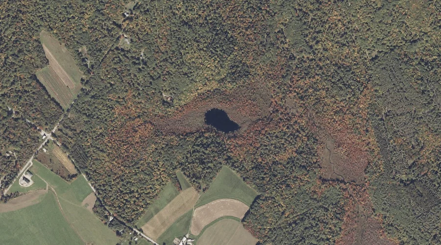
Barnett Pond — Lakes 23.3 Miles SE of Chapman Inn
Oxford County, Maine · USGS Oxford Quadrangle · GNIS 561627
23.3 miles southeast of Chapman Inn, on the USGS Oxford topographic quadrangle, Barnett Pond is a lake recorded in Oxford County, Maine by the federal Geographic Names Information System.
Landmark Profile
Classification & USGS reference
The USGS Oxford 7.5-minute topographic quadrangle places Barnett Pond in Oxford County, Maine (FIPS 23/017), classified as a lake in the federal GNIS (Feature ID 561627). Last revised by the Board on Geographic Names on 05/12/2018.
Coordinates & physical setting
Barnett Pond sits at 44.17270° N, 70.44811° W (DMS 44°10′22″ N, 70°26′53″ W).
Other lakes in Oxford County, Maine
Oxford County, ME contains 157 lakes catalogued in the USGS Geographic Names Information System, counting Barnett Pond itself. The ones closest to Barnett Pond:
| Feature | USGS Quadrangle | Distance |
|---|---|---|
| Mud Pond | Oxford | 1.5 mi |
| Whitney Pond | Mechanic Falls | 4 mi |
| Hogan Pond | Mechanic Falls | 4.1 mi |
| Green Pond | Mechanic Falls | 4.9 mi |
| Mud Pond | Mechanic Falls | 5.4 mi |
| Frog Pond | Mechanic Falls | 6.2 mi |
| Moose Pond | Norway | 6.6 mi |
| Little Pond | Norway | 7 mi |
| Bird Pond | Norway | 7.3 mi |
| South Pond | Buckfield | 7.4 mi |
Features on the USGS Oxford Quadrangle
The Oxford 7.5-minute topographic quadrangle holds 34 catalogued natural features alongside Barnett Pond. A sampling nearest to this location:
| Feature | Type | County | Offset |
|---|---|---|---|
| Thomas Hill | Summits | Oxford County, ME | 0.6 mi |
| Sam Rowe Hill | Summits | Oxford County, ME | 0.6 mi |
| Rock-O-Dundee Hill | Summits | Oxford County, ME | 1.4 mi |
| Dunham Brook | Streams | Oxford County, ME | 1.5 mi |
| Mud Pond | Lakes | Oxford County, ME | 1.5 mi |
| Marshall Pond | Reservoirs | Oxford County, ME | 1.7 mi |
| Willow Brook | Streams | Oxford County, ME | 1.7 mi |
| Robinson Hill | Summits | Oxford County, ME | 1.8 mi |
| Noble Brook | Streams | Oxford County, ME | 1.9 mi |
| Whitney Hill | Summits | Oxford County, ME | 2 mi |
Visiting from Chapman Inn
Distance, bearing & drive time
Chapman Inn sits 23.3 miles southeast (bearing SE) of Barnett Pond. At moderate back-road speeds the drive runs about 40 minutes — comfortably inside a half-day outing window after breakfast.
Best time to visit
June through September for paddling and swimming; January through March for ice fishing. At this latitude (44.173°), the shoulder seasons are workable — April and November can be comfortable on mild years. At 23.3 miles from the Inn, plan on a comfortable day trip with time for lunch on the road. Conditions at Barnett Pond track the nearby Thomas Hill summit (0.6 mi away) closely — if that is runnable, so is this.
Nearest features to Barnett Pond
| Feature | Type | County | Distance |
|---|---|---|---|
| Thomas Hill | Summits | Oxford County, ME | 0.6 mi |
| Sam Rowe Hill | Summits | Oxford County, ME | 0.6 mi |
| Rock-O-Dundee Hill | Summits | Oxford County, ME | 1.4 mi |
| Dunham Brook | Streams | Oxford County, ME | 1.5 mi |
| Mud Pond | Lakes | Oxford County, ME | 1.5 mi |
Frequently Asked Questions
Where is Barnett Pond located?
Barnett Pond is in Oxford County, Maine, approximately 23.3 miles southeast of Chapman Inn in Bethel, Maine. It appears on the USGS Oxford topographic quadrangle.
How far is Barnett Pond from Chapman Inn?
The drive runs about 40 minutes, 23.3 miles southeast (bearing SE) of the Inn.
What type of natural feature is Barnett Pond?
The U.S. Geological Survey classifies Barnett Pond as a lake, catalogued under GNIS Feature ID 561627 on the Oxford quadrangle.
When is the best time to visit Barnett Pond?
June through September for paddling and swimming; January through March for ice fishing.
How many other lakes are in Oxford County, Maine?
GNIS lists 156 other lakes in Oxford County, Maine.