 Aerial imagery: USGS National Map (public domain)
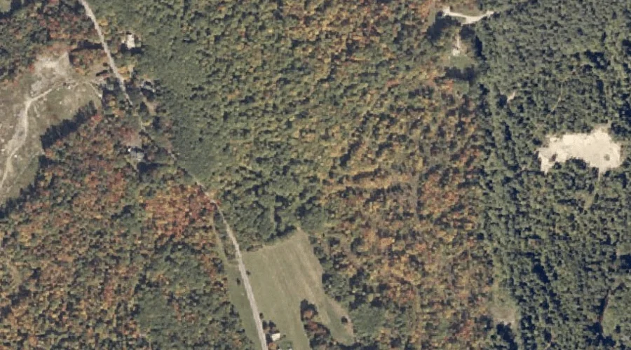
Mount Oxford Spring — Springs 21.5 Miles ESE of Chapman Inn
Oxford County, Maine · USGS Buckfield Quadrangle · GNIS 571771
One of only 11 springs catalogued within the 80 km reach of Chapman Inn, Mount Oxford Spring lies on the USGS Buckfield quadrangle in Oxford County, Maine — 21.5 miles east-southeast of the Inn.
Wikidata short description: “spring in Oxford County, Maine, United States of America”
Landmark Profile
Classification & USGS reference
Catalogued under GNIS Feature ID 571771, Mount Oxford Spring is recorded as a spring on the USGS Buckfield quadrangle in Oxford County, Maine (FIPS 23/017). Catalogued in GNIS since 09/30/1980.
Coordinates & physical setting
Mount Oxford Spring sits at 44.32035° N, 70.37006° W (DMS 44°19′13″ N, 70°22′12″ W).
Features on the USGS Buckfield Quadrangle
The Buckfield 7.5-minute topographic quadrangle holds 35 catalogued natural features alongside Mount Oxford Spring. A sampling nearest to this location:
| Feature | Type | County | Offset |
|---|---|---|---|
| Mount Oxford | Summits | Oxford County, ME | 0.4 mi |
| Cary Hill | Summits | Oxford County, ME | 1.3 mi |
| Swan Pond | Lakes | Oxford County, ME | 1.5 mi |
| Mitchell Brook | Streams | Oxford County, ME | 1.6 mi |
| Northeast Pond | Lakes | Oxford County, ME | 1.7 mi |
| Swan Pond Brook | Streams | Oxford County, ME | 2 mi |
| East Branch Nezinscot River | Streams | Oxford County, ME | 2.4 mi |
| West Branch Nezinscot River | Streams | Oxford County, ME | 2.4 mi |
| Deacon Pinnacle | Summits | Oxford County, ME | 2.5 mi |
| Bunganock Brook | Streams | Oxford County, ME | 2.5 mi |
Ranking & rarity
- Among the 11 springs catalogued within 80 km of Chapman Inn, Mount Oxford Spring ranks #4 by proximity to the Inn (closer than 64%).
- This is one of only 11 springs catalogued within Chapman Inn’s 80 km reach — a rare classification in the local landscape.
Visiting from Chapman Inn
Distance, bearing & drive time
A 37-minute drive along back roads separates the front door of Chapman Inn from Mount Oxford Spring — 21.5 miles east-southeast as the crow flies, on compass bearing ESE.
Best time to visit
Best observed in late spring and early summer when flow is strong and banks are visible. At this latitude (44.320°), the shoulder seasons are workable — April and November can be comfortable on mild years. At 21.5 miles from the Inn, plan on a comfortable day trip with time for lunch on the road. Conditions at Mount Oxford Spring track the nearby Mount Oxford summit (0.4 mi away) closely — if that is runnable, so is this.
Nearest features to Mount Oxford Spring
| Feature | Type | County | Distance |
|---|---|---|---|
| Mount Oxford | Summits | Oxford County, ME | 0.4 mi |
| Cary Hill | Summits | Oxford County, ME | 1.3 mi |
| Deans Hill | Summits | Oxford County, ME | 1.3 mi |
| North Pond | Reservoirs | Oxford County, ME | 1.5 mi |
| Swan Pond | Lakes | Oxford County, ME | 1.5 mi |
Frequently Asked Questions
Where is Mount Oxford Spring located?
Mount Oxford Spring is in Oxford County, Maine, approximately 21.5 miles east-southeast of Chapman Inn in Bethel, Maine. It appears on the USGS Buckfield topographic quadrangle.
How far is Mount Oxford Spring from Chapman Inn?
The drive runs about 37 minutes, 21.5 miles east-southeast (bearing ESE) of the Inn.
What type of natural feature is Mount Oxford Spring?
The U.S. Geological Survey classifies Mount Oxford Spring as a spring, catalogued under GNIS Feature ID 571771 on the Buckfield quadrangle.
When is the best time to visit Mount Oxford Spring?
Best observed in late spring and early summer when flow is strong and banks are visible.
How rare is springs as a classification near Chapman Inn?
Only 11 springs are catalogued within the 80 km radius of the Inn — a comparatively rare classification.
Wikidata: Q35491591.