 Aerial imagery: USGS National Map (public domain)
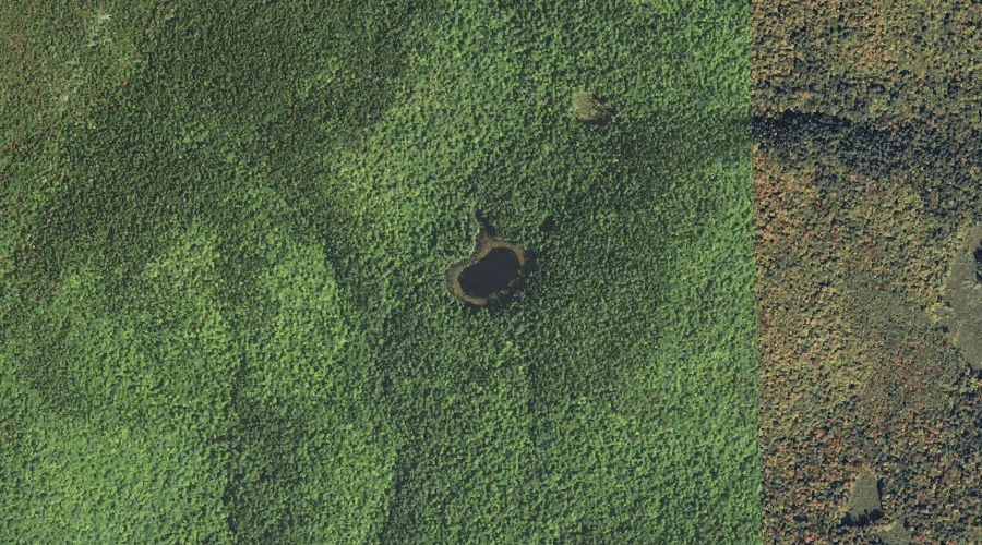
Shingle Pond — Lakes 25.5 Miles SW of Chapman Inn
Carroll County, New Hampshire · USGS North Conway East Quadrangle · GNIS 872656
Catalogued on the USGS North Conway East quadrangle in Carroll County, New Hampshire, Shingle Pond — a lake — lies 25.5 miles southwest of Chapman Inn.
Landmark Profile
Classification & USGS reference
Catalogued under GNIS Feature ID 872656, Shingle Pond is recorded as a lake on the USGS North Conway East quadrangle in Carroll County, New Hampshire (FIPS 33/003). Last revised by the Board on Geographic Names on 05/15/2018.
Coordinates & physical setting
Shingle Pond sits at 44.09777° N, 71.07438° W (DMS 44°05′52″ N, 71°04′28″ W).
Other lakes in Carroll County, New Hampshire
Carroll County, NH contains 62 lakes catalogued in the USGS Geographic Names Information System, counting Shingle Pond itself. The ones closest to Shingle Pond:
| Feature | USGS Quadrangle | Distance |
|---|---|---|
| Province Pond | Chatham | 2.6 mi |
| Upper Kimball Pond | North Conway East | 3.3 mi |
| Pudding Pond | North Conway East | 4.7 mi |
| Mountain Pond | Chatham | 5 mi |
| Echo Lake | North Conway West | 5.2 mi |
| Mirror Lake | Jackson | 6.9 mi |
| Kittredge Pond | North Conway West | 7.1 mi |
| Red Eagle Pond | Silver Lake | 8.2 mi |
| Snake Pond | Conway | 9.9 mi |
| Labrador Pond | Conway | 10.4 mi |
Features on the USGS North Conway East Quadrangle
The North Conway East 7.5-minute topographic quadrangle holds 27 catalogued natural features alongside Shingle Pond. A sampling nearest to this location:
| Feature | Type | County | Offset |
|---|---|---|---|
| Rickers Knoll | Summits | Carroll County, NH | 1 mi |
| Kearsarge North | Summits | Carroll County, NH | 1.1 mi |
| Hurricane Mountain | Summits | Carroll County, NH | 1.7 mi |
| Hoyt Brook | Streams | Carroll County, NH | 1.8 mi |
| Peaked Hill | Summits | Carroll County, NH | 1.9 mi |
| Barlett Mountain | Summits | Carroll County, NH | 1.9 mi |
| Mount Surprise | Summits | Carroll County, NH | 2.6 mi |
| Mack Hill | Summits | Carroll County, NH | 2.6 mi |
| Green Hills | Summits | Carroll County, NH | 2.9 mi |
| Cranmore Mountain | Summits | Carroll County, NH | 2.9 mi |
Historical record
The U.S. Board on Geographic Names recorded a Official (Board Decision) on March 7, 1928 for this name.
Visiting from Chapman Inn
Distance, bearing & drive time
A 44-minute drive along back roads separates the front door of Chapman Inn from Shingle Pond — 25.5 miles southwest as the crow flies, on compass bearing SW.
Best time to visit
June through September for paddling and swimming; January through March for ice fishing. At this latitude (44.098°), the shoulder seasons are workable — April and November can be comfortable on mild years. At 25.5 miles from the Inn, block the full day — sunrise start, late return, packed meals. Conditions at Shingle Pond track the nearby Rickers Knoll summit (1.0 mi away) closely — if that is runnable, so is this.
Nearest features to Shingle Pond
| Feature | Type | County | Distance |
|---|---|---|---|
| Rickers Knoll | Summits | Carroll County, NH | 1 mi |
| Kearsarge North | Summits | Carroll County, NH | 1.1 mi |
| Hurricane Mountain | Summits | Carroll County, NH | 1.7 mi |
| Hoyt Brook | Streams | Carroll County, NH | 1.8 mi |
| Peaked Hill | Summits | Carroll County, NH | 1.9 mi |
Frequently Asked Questions
Where is Shingle Pond located?
Shingle Pond is in Carroll County, New Hampshire, approximately 25.5 miles southwest of Chapman Inn in Bethel, Maine. It appears on the USGS North Conway East topographic quadrangle.
How far is Shingle Pond from Chapman Inn?
The drive runs about 44 minutes, 25.5 miles southwest (bearing SW) of the Inn.
What type of natural feature is Shingle Pond?
The U.S. Geological Survey classifies Shingle Pond as a lake, catalogued under GNIS Feature ID 872656 on the North Conway East quadrangle.
When is the best time to visit Shingle Pond?
June through September for paddling and swimming; January through March for ice fishing.
How many other lakes are in Carroll County, New Hampshire?
GNIS lists 61 other lakes in Carroll County, New Hampshire.