 Aerial imagery: USGS National Map (public domain)
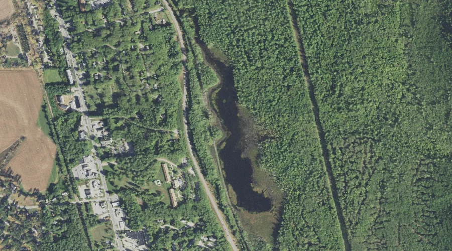
Pudding Pond — Lakes 30.2 Miles SSW of Chapman Inn
Carroll County, New Hampshire · USGS North Conway East Quadrangle · GNIS 872531
Within Carroll County, New Hampshire, on the USGS North Conway East quadrangle, the lake known as Pudding Pond sits 30.2 miles south-southwest of Chapman Inn.
Landmark Profile
Classification & USGS reference
Within Carroll County, New Hampshire, the U.S. Geological Survey lists Pudding Pond as a lake on the North Conway East topographic quadrangle (FIPS 33/003), under Feature ID 872531. Last revised by the Board on Geographic Names on 05/15/2018.
Coordinates & physical setting
Pudding Pond sits at 44.03516° N, 71.11335° W (DMS 44°02′07″ N, 71°06′48″ W).
Other lakes in Carroll County, New Hampshire
Carroll County, NH contains 62 lakes catalogued in the USGS Geographic Names Information System, counting Pudding Pond itself. The ones closest to Pudding Pond:
| Feature | USGS Quadrangle | Distance |
|---|---|---|
| Echo Lake | North Conway West | 2.7 mi |
| Red Eagle Pond | Silver Lake | 3.5 mi |
| Shingle Pond | North Conway East | 4.7 mi |
| Snake Pond | Conway | 5.4 mi |
| Upper Pequawket Pond | Silver Lake | 5.9 mi |
| Dollof Pond | Conway | 6.2 mi |
| Tight Pond | Silver Lake | 6.3 mi |
| Upper Kimball Pond | North Conway East | 6.3 mi |
| Ledge Pond | Silver Lake | 6.4 mi |
| Pea Porridge Pond | Conway | 6.6 mi |
Features on the USGS North Conway East Quadrangle
The North Conway East 7.5-minute topographic quadrangle holds 27 catalogued natural features alongside Pudding Pond. A sampling nearest to this location:
| Feature | Type | County | Offset |
|---|---|---|---|
| Artist Brook | Streams | Carroll County, NH | 0.8 mi |
| Rattlesnake Mountain | Summits | Carroll County, NH | 1.2 mi |
| Peaked Mountain | Summits | Carroll County, NH | 1.3 mi |
| Middle Mountain | Summits | Carroll County, NH | 1.3 mi |
| Redstone Ledge | Benches | Carroll County, NH | 1.4 mi |
| Cranmore Mountain | Summits | Carroll County, NH | 1.9 mi |
| Moat Brook | Streams | Carroll County, NH | 2.2 mi |
| Pine Hill | Summits | Carroll County, NH | 2.3 mi |
| Black Cap | Summits | Carroll County, NH | 2.7 mi |
| Green Hills | Summits | Carroll County, NH | 2.7 mi |
Visiting from Chapman Inn
Distance, bearing & drive time
Follow the compass bearing SSW out of Bethel for 30.2 miles (south-southwest) and you reach Pudding Pond; at typical rural speeds the trip runs roughly 52 minutes.
Best time to visit
June through September for paddling and swimming; January through March for ice fishing. At this latitude (44.035°), the shoulder seasons are workable — April and November can be comfortable on mild years. At 30.2 miles from the Inn, block the full day — sunrise start, late return, packed meals. Conditions at Pudding Pond track the nearby Artist Brook stream (0.8 mi away) closely — if that is runnable, so is this.
Nearest features to Pudding Pond
| Feature | Type | County | Distance |
|---|---|---|---|
| Artist Brook | Streams | Carroll County, NH | 0.8 mi |
| Kearsarge Brook | Streams | Carroll County, NH | 1.1 mi |
| Rattlesnake Mountain | Summits | Carroll County, NH | 1.2 mi |
| Peaked Mountain | Summits | Carroll County, NH | 1.3 mi |
| Middle Mountain | Summits | Carroll County, NH | 1.3 mi |
Frequently Asked Questions
Where is Pudding Pond located?
Pudding Pond is in Carroll County, New Hampshire, approximately 30.2 miles south-southwest of Chapman Inn in Bethel, Maine. It appears on the USGS North Conway East topographic quadrangle.
How far is Pudding Pond from Chapman Inn?
The drive runs about 52 minutes, 30.2 miles south-southwest (bearing SSW) of the Inn.
What type of natural feature is Pudding Pond?
The U.S. Geological Survey classifies Pudding Pond as a lake, catalogued under GNIS Feature ID 872531 on the North Conway East quadrangle.
When is the best time to visit Pudding Pond?
June through September for paddling and swimming; January through March for ice fishing.
How many other lakes are in Carroll County, New Hampshire?
GNIS lists 61 other lakes in Carroll County, New Hampshire.