 Aerial imagery: USGS National Map (public domain)
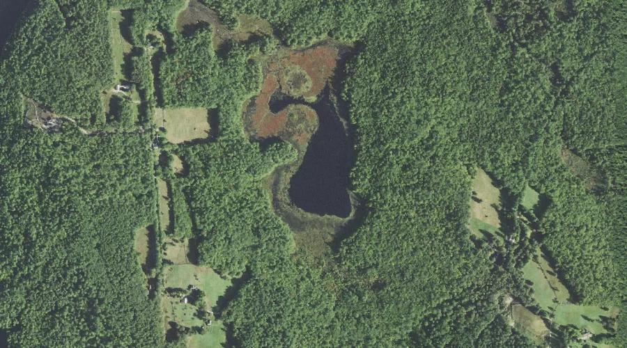
Labrador Pond — Lakes 34.0 Miles SSW of Chapman Inn
Carroll County, New Hampshire · USGS Conway Quadrangle · GNIS 872148
34.0 miles south-southwest of Chapman Inn, on the USGS Conway topographic quadrangle, Labrador Pond is a lake recorded in Carroll County, New Hampshire by the federal Geographic Names Information System.
Wikidata short description: “lake of the United States of America”
Landmark Profile
Classification & USGS reference
The USGS Conway 7.5-minute topographic quadrangle places Labrador Pond in Carroll County, New Hampshire (FIPS 33/003), classified as a lake in the federal GNIS (Feature ID 872148). Last revised by the Board on Geographic Names on 05/15/2018.
Coordinates & physical setting
Labrador Pond sits at 43.94823° N, 71.04503° W (DMS 43°56′54″ N, 71°02′42″ W).
Other lakes in Carroll County, New Hampshire
Carroll County, NH contains 62 lakes catalogued in the USGS Geographic Names Information System, counting Labrador Pond itself. The ones closest to Labrador Pond:
| Feature | USGS Quadrangle | Distance |
|---|---|---|
| Roberts Pond | Conway | 2.1 mi |
| Dollof Pond | Conway | 2.4 mi |
| Crystal Lake | Conway | 3.1 mi |
| Pickerel Pond | Conway | 3.3 mi |
| Snake Pond | Conway | 3.5 mi |
| Hatch Pond | Conway | 3.6 mi |
| Pea Porridge Pond | Conway | 3.8 mi |
| Loud Pond | Conway | 4.4 mi |
| Middle Pea Porridge Pond | Silver Lake | 4.4 mi |
| Long Pond | Conway | 4.6 mi |
Features on the USGS Conway Quadrangle
The Conway 7.5-minute topographic quadrangle holds 30 catalogued natural features alongside Labrador Pond. A sampling nearest to this location:
| Feature | Type | County | Offset |
|---|---|---|---|
| Willey Brook | Streams | Carroll County, NH | 0.7 mi |
| Clark Brook | Streams | Carroll County, NH | 1 mi |
| Conway Lake | Reservoirs | Carroll County, NH | 1.2 mi |
| Dundee Hill | Summits | Carroll County, NH | 1.6 mi |
| Birch Hill | Summits | Carroll County, NH | 1.6 mi |
| Libby Mountain | Summits | Carroll County, NH | 1.9 mi |
| Atkinson Mountain | Summits | Carroll County, NH | 2 mi |
| Davis Hill | Summits | Carroll County, NH | 2 mi |
| Roberts Pond | Lakes | Carroll County, NH | 2.1 mi |
| Crown Hill | Summits | Carroll County, NH | 2.2 mi |
Visiting from Chapman Inn
Distance, bearing & drive time
Chapman Inn sits 34.0 miles south-southwest (bearing SSW) of Labrador Pond. At moderate back-road speeds the drive runs about 58 minutes — comfortably inside a half-day outing window after breakfast.
Best time to visit
June through September for paddling and swimming; January through March for ice fishing. At this latitude (43.948°), the shoulder seasons are workable — April and November can be comfortable on mild years. At 34.0 miles from the Inn, block the full day — sunrise start, late return, packed meals. Conditions at Labrador Pond track the nearby Willey Brook stream (0.7 mi away) closely — if that is runnable, so is this.
Nearest features to Labrador Pond
| Feature | Type | County | Distance |
|---|---|---|---|
| Willey Brook | Streams | Carroll County, NH | 0.7 mi |
| Clark Brook | Streams | Carroll County, NH | 1 mi |
| Conway Lake | Reservoirs | Carroll County, NH | 1.2 mi |
| Dundee Hill | Summits | Carroll County, NH | 1.6 mi |
| Birch Hill | Summits | Carroll County, NH | 1.6 mi |
Frequently Asked Questions
Where is Labrador Pond located?
Labrador Pond is in Carroll County, New Hampshire, approximately 34.0 miles south-southwest of Chapman Inn in Bethel, Maine. It appears on the USGS Conway topographic quadrangle.
How far is Labrador Pond from Chapman Inn?
The drive runs about 58 minutes, 34.0 miles south-southwest (bearing SSW) of the Inn.
What type of natural feature is Labrador Pond?
The U.S. Geological Survey classifies Labrador Pond as a lake, catalogued under GNIS Feature ID 872148 on the Conway quadrangle.
When is the best time to visit Labrador Pond?
June through September for paddling and swimming; January through March for ice fishing.
How many other lakes are in Carroll County, New Hampshire?
GNIS lists 61 other lakes in Carroll County, New Hampshire.
Wikidata: Q35720895.