 Aerial imagery: USGS National Map (public domain)
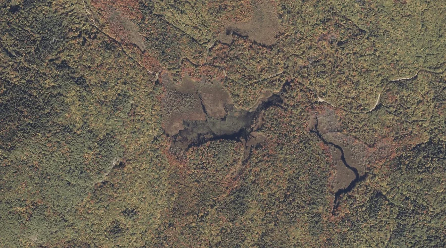
Mud Pond — Lakes 17.8 Miles E of Chapman Inn
Oxford County, Maine · USGS Worthley Pond Quadrangle · GNIS 571895
Within Oxford County, Maine, on the USGS Worthley Pond quadrangle, the lake known as Mud Pond sits 17.8 miles east of Chapman Inn.
Landmark Profile
Classification & USGS reference
Within Oxford County, Maine, the U.S. Geological Survey lists Mud Pond as a lake on the Worthley Pond topographic quadrangle (FIPS 23/017), under Feature ID 571895. Last revised by the Board on Geographic Names on 05/12/2018.
Coordinates & physical setting
Mud Pond sits at 44.44651° N, 70.43384° W (DMS 44°26′47″ N, 70°26′02″ W).
Other lakes in Oxford County, Maine
Oxford County, ME contains 157 lakes catalogued in the USGS Geographic Names Information System, counting Mud Pond itself. The ones closest to Mud Pond:
| Feature | USGS Quadrangle | Distance |
|---|---|---|
| Abbotts Pond | Mount Zircon | 4.2 mi |
| Little Labrador Pond | Worthley Pond | 4.4 mi |
| Halfmoon Pond | Mount Zircon | 4.7 mi |
| Washburn Pond | Mount Zircon | 4.7 mi |
| Shagg Pond | Mount Zircon | 5 mi |
| Little Concord Pond | Mount Zircon | 5.1 mi |
| Pleasant Pond | West Sumner | 5.7 mi |
| Concord Pond | Mount Zircon | 5.9 mi |
| Bunganock Pond | Canton | 6.2 mi |
| Cushman Pond | West Sumner | 6.9 mi |
Features on the USGS Worthley Pond Quadrangle
The Worthley Pond 7.5-minute topographic quadrangle holds 20 catalogued natural features alongside Mud Pond. A sampling nearest to this location:
| Feature | Type | County | Offset |
|---|---|---|---|
| Tumbledown Dick Mountain | Summits | Oxford County, ME | 0.9 mi |
| Black Mountain | Summits | Oxford County, ME | 1.5 mi |
| Allen Mountain | Summits | Oxford County, ME | 1.5 mi |
| The Pinnacle | Summits | Oxford County, ME | 1.7 mi |
| Ragged Jack Mountain | Summits | Oxford County, ME | 2.1 mi |
| Worthley Pond | Reservoirs | Oxford County, ME | 2.1 mi |
| The Saddleback | Summits | Oxford County, ME | 2.1 mi |
| Browns Mountain | Summits | Oxford County, ME | 2.2 mi |
| Thompson Mountain | Summits | Oxford County, ME | 2.3 mi |
| Hedgehog Hill | Summits | Oxford County, ME | 2.3 mi |
Visiting from Chapman Inn
Distance, bearing & drive time
Follow the compass bearing E out of Bethel for 17.8 miles (east) and you reach Mud Pond; at typical rural speeds the trip runs roughly 30 minutes.
Best time to visit
June through September for paddling and swimming; January through March for ice fishing. At this latitude (44.447°), the shoulder seasons are workable — April and November can be comfortable on mild years. At 17.8 miles from the Inn, plan on a comfortable day trip with time for lunch on the road. Conditions at Mud Pond track the nearby Tumbledown Dick Mountain summit (0.9 mi away) closely — if that is runnable, so is this.
Nearest features to Mud Pond
| Feature | Type | County | Distance |
|---|---|---|---|
| Tumbledown Dick Mountain | Summits | Oxford County, ME | 0.9 mi |
| Black Mountain | Summits | Oxford County, ME | 1.5 mi |
| Allen Mountain | Summits | Oxford County, ME | 1.5 mi |
| The Pinnacle | Summits | Oxford County, ME | 1.7 mi |
| Ragged Jack Mountain | Summits | Oxford County, ME | 2.1 mi |
Frequently Asked Questions
Where is Mud Pond located?
Mud Pond is in Oxford County, Maine, approximately 17.8 miles east of Chapman Inn in Bethel, Maine. It appears on the USGS Worthley Pond topographic quadrangle.
How far is Mud Pond from Chapman Inn?
The drive runs about 30 minutes, 17.8 miles east (bearing E) of the Inn.
What type of natural feature is Mud Pond?
The U.S. Geological Survey classifies Mud Pond as a lake, catalogued under GNIS Feature ID 571895 on the Worthley Pond quadrangle.
When is the best time to visit Mud Pond?
June through September for paddling and swimming; January through March for ice fishing.
How many other lakes are in Oxford County, Maine?
GNIS lists 156 other lakes in Oxford County, Maine.