 Aerial imagery: USGS National Map (public domain)
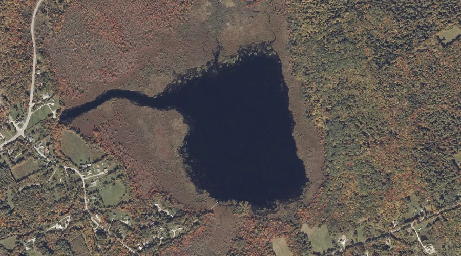
Moose Pond — Lakes 14.1 Miles ESE of Chapman Inn
Oxford County, Maine · USGS West Paris Quadrangle · GNIS 571615
Catalogued on the USGS West Paris quadrangle in Oxford County, Maine, Moose Pond — a lake — lies 14.1 miles east-southeast of Chapman Inn.
Landmark Profile
Classification & USGS reference
Catalogued under GNIS Feature ID 571615, Moose Pond is recorded as a lake on the USGS West Paris quadrangle in Oxford County, Maine (FIPS 23/017). Last revised by the Board on Geographic Names on 05/13/2018.
Coordinates & physical setting
Moose Pond sits at 44.33911° N, 70.51872° W (DMS 44°20′21″ N, 70°31′07″ W).
Other lakes in Oxford County, Maine
Oxford County, ME contains 157 lakes catalogued in the USGS Geographic Names Information System, counting Moose Pond itself. The ones closest to Moose Pond:
| Feature | USGS Quadrangle | Distance |
|---|---|---|
| Pleasant Pond | West Sumner | 3.1 mi |
| Halfmoon Pond | Mount Zircon | 5.3 mi |
| Cushman Pond | West Sumner | 5.3 mi |
| Paine Pond | West Paris | 5.5 mi |
| Washburn Pond | Mount Zircon | 5.6 mi |
| Shagg Pond | Mount Zircon | 5.9 mi |
| Little Labrador Pond | Worthley Pond | 6 mi |
| Abbotts Pond | Mount Zircon | 6.2 mi |
| Indian Pond | Greenwood | 6.6 mi |
| Bird Pond | Norway | 6.6 mi |
Features on the USGS West Paris Quadrangle
The West Paris 7.5-minute topographic quadrangle holds 23 catalogued natural features alongside Moose Pond. A sampling nearest to this location:
| Feature | Type | County | Offset |
|---|---|---|---|
| Bog Brook | Streams | Oxford County, ME | 0.2 mi |
| Andrews Brook | Streams | Oxford County, ME | 2.1 mi |
| Berry Ledge | Cliffs | Oxford County, ME | 2.3 mi |
| Stearns Hill | Summits | Oxford County, ME | 2.4 mi |
| Moose Pond Brook | Streams | Oxford County, ME | 2.4 mi |
| Snow Falls Gorge | Valleys | Oxford County, ME | 2.7 mi |
| Little Androscoggin River Reservoir | Reservoirs | Oxford County, ME | 3 mi |
| Curtis Hill | Summits | Oxford County, ME | 3.5 mi |
| Whitman Mountain | Summits | Oxford County, ME | 3.8 mi |
| Bisco Falls | Waterfalls | Oxford County, ME | 3.8 mi |
Visiting from Chapman Inn
Distance, bearing & drive time
A 24-minute drive along back roads separates the front door of Chapman Inn from Moose Pond — 14.1 miles east-southeast as the crow flies, on compass bearing ESE.
Best time to visit
June through September for paddling and swimming; January through March for ice fishing. At this latitude (44.339°), the shoulder seasons are workable — April and November can be comfortable on mild years. At 14.1 miles from the Inn, plan on a comfortable day trip with time for lunch on the road. Conditions at Moose Pond track the nearby Bog Brook stream (0.2 mi away) closely — if that is runnable, so is this.
Nearest features to Moose Pond
| Feature | Type | County | Distance |
|---|---|---|---|
| Bog Brook | Streams | Oxford County, ME | 0.2 mi |
| The Pinnacle | Summits | Oxford County, ME | 1.8 mi |
| Andrews Brook | Streams | Oxford County, ME | 2.1 mi |
| Berry Ledge | Cliffs | Oxford County, ME | 2.3 mi |
| Spruce Hills | Ranges | Oxford County, ME | 2.3 mi |
Frequently Asked Questions
Where is Moose Pond located?
Moose Pond is in Oxford County, Maine, approximately 14.1 miles east-southeast of Chapman Inn in Bethel, Maine. It appears on the USGS West Paris topographic quadrangle.
How far is Moose Pond from Chapman Inn?
The drive runs about 24 minutes, 14.1 miles east-southeast (bearing ESE) of the Inn.
What type of natural feature is Moose Pond?
The U.S. Geological Survey classifies Moose Pond as a lake, catalogued under GNIS Feature ID 571615 on the West Paris quadrangle.
When is the best time to visit Moose Pond?
June through September for paddling and swimming; January through March for ice fishing.
How many other lakes are in Oxford County, Maine?
GNIS lists 156 other lakes in Oxford County, Maine.