 Aerial imagery: USGS National Map (public domain)
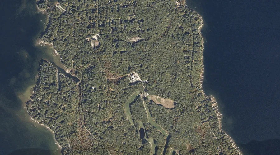
Frye Island — Islands 41.3 Miles SSE of Chapman Inn
Cumberland County, Maine · USGS Sebago Lake Quadrangle · GNIS 566632
Catalogued on the USGS Sebago Lake quadrangle in Cumberland County, Maine, Frye Island — a island — lies 41.3 miles south-southeast of Chapman Inn.
Wikidata short description: “island in Cumberland County, Maine, United States”
Landmark Profile
Classification & USGS reference
Catalogued under GNIS Feature ID 566632, Frye Island is recorded as a island on the USGS Sebago Lake quadrangle in Cumberland County, Maine (FIPS 23/005). Catalogued in GNIS since 09/30/1980.
Coordinates & physical setting
Frye Island sits at 43.83841° N, 70.52283° W (DMS 43°50′18″ N, 70°31′22″ W).
Other islands in Cumberland County, Maine
Cumberland County, ME contains 52 islands catalogued in the USGS Geographic Names Information System, counting Frye Island itself. The ones closest to Frye Island:
| Feature | USGS Quadrangle | Distance |
|---|---|---|
| Merrill Isle | North Windham | 1.5 mi |
| Papoose Island | North Windham | 1.5 mi |
| Blueberry Island | Naples | 2.9 mi |
| Rookies Island | Naples | 3.1 mi |
| Lindsay Island | North Windham | 3.1 mi |
| Indian Island | Sebago Lake | 3.5 mi |
| Battleship Island | Naples | 3.6 mi |
| Millstone Island | Naples | 3.9 mi |
| Gillman Island | North Windham | 4 mi |
| Outer Doctor Island | Naples | 4.2 mi |
Features on the USGS Sebago Lake Quadrangle
The Sebago Lake 7.5-minute topographic quadrangle holds 15 catalogued natural features alongside Frye Island. A sampling nearest to this location:
| Feature | Type | County | Offset |
|---|---|---|---|
| The Notch | Other Natural Features | Cumberland County, ME | 0.7 mi |
| Fryes Leap | Cliffs | Cumberland County, ME | 1 mi |
| Sebago Lake | Reservoirs | Cumberland County, ME | 1.8 mi |
| Raymond Neck | Capes | Cumberland County, ME | 2.3 mi |
| Indian Island | Islands | Cumberland County, ME | 3.5 mi |
| Rich Millpond | Reservoirs | Cumberland County, ME | 4 mi |
| Lower Bay | Bays | Cumberland County, ME | 4.3 mi |
| Duck Pond | Lakes | Cumberland County, ME | 4.8 mi |
| Sticky River | Streams | Cumberland County, ME | 4.8 mi |
| Rich Hill | Summits | Cumberland County, ME | 5 mi |
Visiting from Chapman Inn
Distance, bearing & drive time
A 71-minute drive along back roads separates the front door of Chapman Inn from Frye Island — 41.3 miles south-southeast as the crow flies, on compass bearing SSE.
Best time to visit
Late May through early October, when the water is safe for small-boat access. At this latitude (43.838°), the shoulder seasons are workable — April and November can be comfortable on mild years. At 41.3 miles from the Inn, block the full day — sunrise start, late return, packed meals. Conditions at Frye Island track the nearby The Notch natural feature (0.7 mi away) closely — if that is runnable, so is this.
Nearest features to Frye Island
| Feature | Type | County | Distance |
|---|---|---|---|
| The Notch | Other Natural Features | Cumberland County, ME | 0.7 mi |
| Fryes Leap | Cliffs | Cumberland County, ME | 1 mi |
| Camp Cove | Bays | Cumberland County, ME | 1.4 mi |
| Merrill Isle | Islands | Cumberland County, ME | 1.5 mi |
| Papoose Island | Islands | Cumberland County, ME | 1.5 mi |
Frequently Asked Questions
Where is Frye Island located?
Frye Island is in Cumberland County, Maine, approximately 41.3 miles south-southeast of Chapman Inn in Bethel, Maine. It appears on the USGS Sebago Lake topographic quadrangle.
How far is Frye Island from Chapman Inn?
The drive runs about 71 minutes, 41.3 miles south-southeast (bearing SSE) of the Inn.
What type of natural feature is Frye Island?
The U.S. Geological Survey classifies Frye Island as a island, catalogued under GNIS Feature ID 566632 on the Sebago Lake quadrangle.
When is the best time to visit Frye Island?
Late May through early October, when the water is safe for small-boat access.
How many other islands are in Cumberland County, Maine?
GNIS lists 51 other islands in Cumberland County, Maine.
Wikidata: Q49638567.