 Aerial imagery: USGS National Map (public domain)
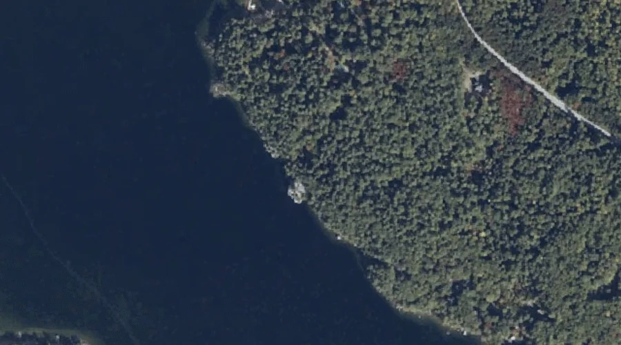
Fryes Leap — Cliffs 40.4 Miles SSE of Chapman Inn
Cumberland County, Maine · USGS Sebago Lake Quadrangle · GNIS 566639
Within Cumberland County, Maine, on the USGS Sebago Lake quadrangle, the cliff face known as Fryes Leap sits 40.4 miles south-southeast of Chapman Inn.
Wikidata short description: “cliff in Cumberland County, Maine, United States”
Landmark Profile
Classification & USGS reference
Within Cumberland County, Maine, the U.S. Geological Survey lists Fryes Leap as a cliff face on the Sebago Lake topographic quadrangle (FIPS 23/005), under Feature ID 566639. Catalogued in GNIS since 09/30/1980.
Coordinates & physical setting
Fryes Leap sits at 43.85258° N, 70.51867° W (DMS 43°51′09″ N, 70°31′07″ W).
Features on the USGS Sebago Lake Quadrangle
The Sebago Lake 7.5-minute topographic quadrangle holds 15 catalogued natural features alongside Fryes Leap. A sampling nearest to this location:
| Feature | Type | County | Offset |
|---|---|---|---|
| The Notch | Other Natural Features | Cumberland County, ME | 0.4 mi |
| Frye Island | Islands | Cumberland County, ME | 1 mi |
| Raymond Neck | Capes | Cumberland County, ME | 1.3 mi |
| Sebago Lake | Reservoirs | Cumberland County, ME | 1.5 mi |
| Indian Island | Islands | Cumberland County, ME | 4.5 mi |
| Rich Millpond | Reservoirs | Cumberland County, ME | 5 mi |
| Lower Bay | Bays | Cumberland County, ME | 5.3 mi |
| Duck Pond | Lakes | Cumberland County, ME | 5.7 mi |
| Sticky River | Streams | Cumberland County, ME | 5.8 mi |
| Rich Hill | Summits | Cumberland County, ME | 6 mi |
Visiting from Chapman Inn
Distance, bearing & drive time
Follow the compass bearing SSE out of Bethel for 40.4 miles (south-southeast) and you reach Fryes Leap; at typical rural speeds the trip runs roughly 69 minutes.
Best time to visit
Accessible May through November in most years. At this latitude (43.853°), the shoulder seasons are workable — April and November can be comfortable on mild years. At 40.4 miles from the Inn, block the full day — sunrise start, late return, packed meals. Conditions at Fryes Leap track the nearby The Notch natural feature (0.4 mi away) closely — if that is runnable, so is this.
Nearest features to Fryes Leap
| Feature | Type | County | Distance |
|---|---|---|---|
| The Notch | Other Natural Features | Cumberland County, ME | 0.4 mi |
| Frye Island | Islands | Cumberland County, ME | 1 mi |
| Raymond Cape | Capes | Cumberland County, ME | 1.1 mi |
| Camp Cove | Bays | Cumberland County, ME | 1.1 mi |
| Papoose Island | Islands | Cumberland County, ME | 1.1 mi |
Frequently Asked Questions
Where is Fryes Leap located?
Fryes Leap is in Cumberland County, Maine, approximately 40.4 miles south-southeast of Chapman Inn in Bethel, Maine. It appears on the USGS Sebago Lake topographic quadrangle.
How far is Fryes Leap from Chapman Inn?
The drive runs about 69 minutes, 40.4 miles south-southeast (bearing SSE) of the Inn.
What type of natural feature is Fryes Leap?
The U.S. Geological Survey classifies Fryes Leap as a cliff face, catalogued under GNIS Feature ID 566639 on the Sebago Lake quadrangle.
When is the best time to visit Fryes Leap?
Accessible May through November in most years.
Wikidata: Q49468748.