Days Ridge is a ridge in Oxford County, Maine, located about 5.5 miles east-northeast of Chapman Inn in Bethel, Maine. It appears on the USGS Bryant Pond topographic…
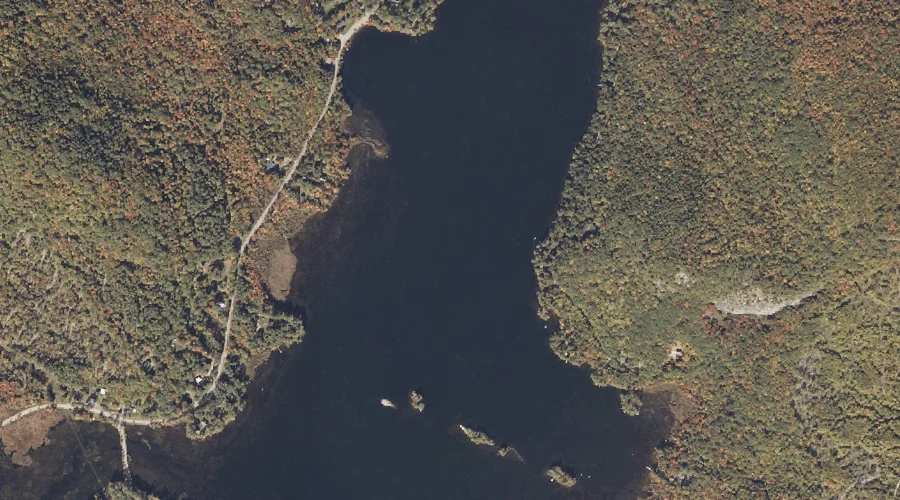
North Pond is a lake in Oxford County, Maine, located about 5.6 miles east of Chapman Inn in Bethel, Maine. It appears on the USGS Bryant Pond topographic…
Bacon Hill is a summit in Oxford County, Maine, located about 5.6 miles south-southeast of Chapman Inn in Bethel, Maine. It appears on the USGS East Stoneham topographic…
Bad Mountain is a summit in Oxford County, Maine, located about 5.6 miles southwest of Chapman Inn in Bethel, Maine. It appears on the USGS East Stoneham topographic…
Bear River is a stream in Oxford County, Maine, located about 5.6 miles north of Chapman Inn in Bethel, Maine. It appears on the USGS Bethel topographic quadrangle.
Kimball Hill is a summit in Oxford County, Maine, located about 5.7 miles east-northeast of Chapman Inn in Bethel, Maine. It appears on the USGS Bryant Pond topographic…
Stony Brook is a stream in Oxford County, Maine, located about 5.7 miles north of Chapman Inn in Bethel, Maine. It appears on the USGS Bethel topographic quadrangle.
Long Mountain is a summit in Oxford County, Maine, located about 5.8 miles southeast of Chapman Inn in Bethel, Maine. It appears on the USGS Greenwood topographic quadrangle.
Patte Hill is a summit in Oxford County, Maine, located about 5.8 miles south-southwest of Chapman Inn in Bethel, Maine. It appears on the USGS East Stoneham topographic…
Elwell Mountain is a summit in Oxford County, Maine, located about 5.9 miles southeast of Chapman Inn in Bethel, Maine. It appears on the USGS Greenwood topographic quadrangle.