 Aerial imagery: USGS National Map (public domain)
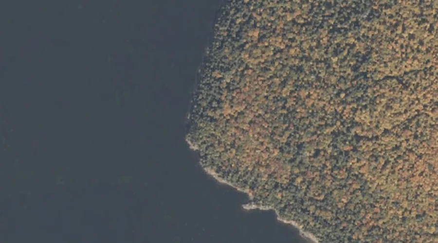
Tyler Point — Capes 27.1 Miles NNW of Chapman Inn
Coos County, New Hampshire · USGS Umbagog Lake North Quadrangle · GNIS 870561
27.1 miles north-northwest of Chapman Inn, on the USGS Umbagog Lake North topographic quadrangle, Tyler Point is a cape recorded in Coos County, New Hampshire by the federal Geographic Names Information System.
Landmark Profile
Classification & USGS reference
The USGS Umbagog Lake North 7.5-minute topographic quadrangle places Tyler Point in Coos County, New Hampshire (FIPS 33/007), classified as a cape in the federal GNIS (Feature ID 870561). Catalogued in GNIS since 08/27/1980.
Coordinates & physical setting
Tyler Point sits at 44.75366° N, 71.04008° W (DMS 44°45′13″ N, 71°02′24″ W).
Features on the USGS Umbagog Lake North Quadrangle
The Umbagog Lake North 7.5-minute topographic quadrangle holds 29 catalogued natural features alongside Tyler Point. A sampling nearest to this location:
| Feature | Type | County | Offset |
|---|---|---|---|
| Umbagog Lake | Lakes | Coos County, NH | 0.7 mi |
| B Brook Cove | Bays | Oxford County, ME | 0.7 mi |
| B Brook | Streams | Oxford County, ME | 0.8 mi |
| Black Island Cove | Bays | Coos County, NH | 1.1 mi |
| Pininsula Molls Rock | Pillars | Coos County, NH | 1.8 mi |
| Glassby Cove | Bays | Oxford County, ME | 1.9 mi |
| Spillman Cove | Bays | Oxford County, ME | 2.2 mi |
| Magalloway River | Streams | Oxford County, NH | 2.4 mi |
| Pine Point | Capes | Oxford County, ME | 2.5 mi |
| Mountain Pond | Lakes | Coos County, NH | 3 mi |
Visiting from Chapman Inn
Distance, bearing & drive time
Chapman Inn sits 27.1 miles north-northwest (bearing NNW) of Tyler Point. At moderate back-road speeds the drive runs about 46 minutes — comfortably inside a half-day outing window after breakfast.
Best time to visit
Generally accessible May through October; winter access depends on snow cover. Being this far north (lat 44.754°), first snows typically arrive by mid-October and linger into early May — narrow the window accordingly. At 27.1 miles from the Inn, block the full day — sunrise start, late return, packed meals. Conditions at Tyler Point track the nearby Metallak Island (0.6 mi away) closely — if that is runnable, so is this.
Nearest features to Tyler Point
| Feature | Type | County | Distance |
|---|---|---|---|
| Metallak Island | Islands | Coos County, NH | 0.6 mi |
| Umbagog Lake | Lakes | Coos County, NH | 0.7 mi |
| B Brook Cove | Bays | Oxford County, ME | 0.7 mi |
| B Brook | Streams | Oxford County, ME | 0.8 mi |
| Tyler Cove | Bays | Oxford County, ME | 0.8 mi |
Frequently Asked Questions
Where is Tyler Point located?
Tyler Point is in Coos County, New Hampshire, approximately 27.1 miles north-northwest of Chapman Inn in Bethel, Maine. It appears on the USGS Umbagog Lake North topographic quadrangle.
How far is Tyler Point from Chapman Inn?
The drive runs about 46 minutes, 27.1 miles north-northwest (bearing NNW) of the Inn.
What type of natural feature is Tyler Point?
The U.S. Geological Survey classifies Tyler Point as a cape, catalogued under GNIS Feature ID 870561 on the Umbagog Lake North quadrangle.
When is the best time to visit Tyler Point?
Generally accessible May through October; winter access depends on snow cover.