 Aerial imagery: USGS National Map (public domain)
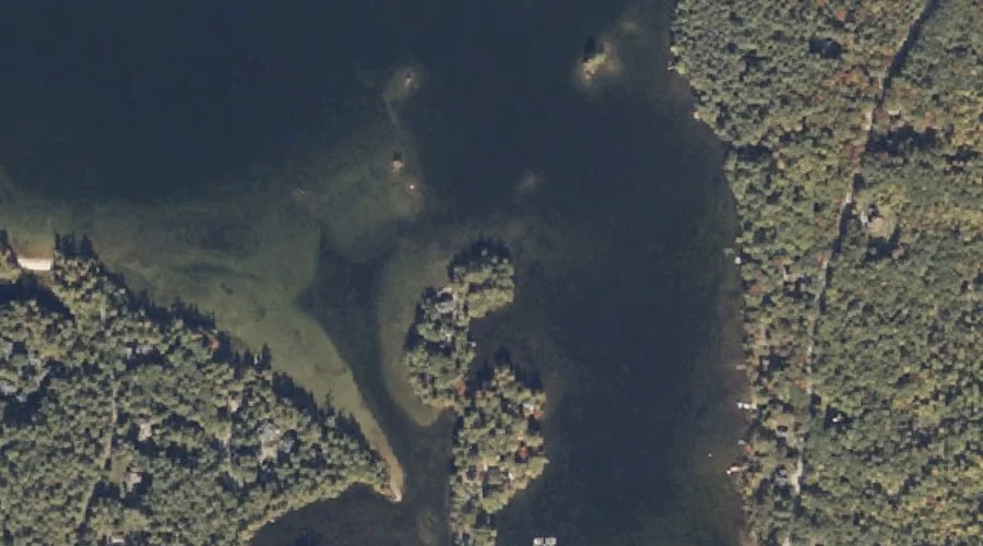
Parsons Point — Capes 30.6 Miles SSE of Chapman Inn
Cumberland County, Maine · USGS Mechanic Falls Quadrangle · GNIS 1912849
Catalogued on the USGS Mechanic Falls quadrangle in Cumberland County, Maine, Parsons Point — a cape — lies 30.6 miles south-southeast of Chapman Inn.
Landmark Profile
Classification & USGS reference
Catalogued under GNIS Feature ID 1912849, Parsons Point is recorded as a cape on the USGS Mechanic Falls quadrangle in Cumberland County, Maine (FIPS 23/005). Catalogued in GNIS since 05/08/2001.
Coordinates & physical setting
Parsons Point sits at 44.02368° N, 70.47450° W (DMS 44°01′25″ N, 70°28′28″ W).
Other capes in Cumberland County, Maine
Cumberland County, ME contains 35 capes catalogued in the USGS Geographic Names Information System, counting Parsons Point itself. The ones closest to Parsons Point:
| Feature | USGS Quadrangle | Distance |
|---|---|---|
| Birch Point | Naples | 7.1 mi |
| Bettys Neck | Raymond | 7.2 mi |
| Arrowhead Point | Naples | 7.3 mi |
| Keoka Point | Naples | 7.3 mi |
| Kelseys Point | Naples | 7.5 mi |
| Kellys Point | Bridgton | 7.7 mi |
| Breezy Point | Naples | 7.7 mi |
| Long Point | Bridgton | 8.1 mi |
| Stimpsons Point | North Sebago | 8.2 mi |
| Bear Point | Bridgton | 8.4 mi |
Features on the USGS Mechanic Falls Quadrangle
The Mechanic Falls 7.5-minute topographic quadrangle holds 48 catalogued natural features alongside Parsons Point. A sampling nearest to this location:
| Feature | Type | County | Offset |
|---|---|---|---|
| Heath Island | Islands | Cumberland County, ME | 0.4 mi |
| The Heath | Lakes | Cumberland County, ME | 0.7 mi |
| Pine Point | Capes | Androscoggin County, ME | 0.8 mi |
| Turtle Island | Islands | Oxford County, ME | 0.9 mi |
| Johnson Hill | Summits | Androscoggin County, ME | 1.1 mi |
| Squirrel Island | Islands | Oxford County, ME | 1.1 mi |
| Crescent Island | Islands | Oxford County, ME | 1.3 mi |
| Birch Island | Islands | Oxford County, ME | 1.3 mi |
| Edwards Cove | Bays | Cumberland County, ME | 1.4 mi |
| Wacipi Island | Islands | Oxford County, ME | 1.4 mi |
Visiting from Chapman Inn
Distance, bearing & drive time
A 52-minute drive along back roads separates the front door of Chapman Inn from Parsons Point — 30.6 miles south-southeast as the crow flies, on compass bearing SSE.
Best time to visit
Generally accessible May through October; winter access depends on snow cover. At this latitude (44.024°), the shoulder seasons are workable — April and November can be comfortable on mild years. At 30.6 miles from the Inn, block the full day — sunrise start, late return, packed meals. Conditions at Parsons Point track the nearby Heath Island (0.4 mi away) closely — if that is runnable, so is this.
Nearest features to Parsons Point
| Feature | Type | County | Distance |
|---|---|---|---|
| Heath Island | Islands | Cumberland County, ME | 0.4 mi |
| The Heath | Lakes | Cumberland County, ME | 0.7 mi |
| Pine Point | Capes | Androscoggin County, ME | 0.8 mi |
| Turtle Island | Islands | Oxford County, ME | 0.9 mi |
| Johnson Hill | Summits | Androscoggin County, ME | 1.1 mi |
Frequently Asked Questions
Where is Parsons Point located?
Parsons Point is in Cumberland County, Maine, approximately 30.6 miles south-southeast of Chapman Inn in Bethel, Maine. It appears on the USGS Mechanic Falls topographic quadrangle.
How far is Parsons Point from Chapman Inn?
The drive runs about 52 minutes, 30.6 miles south-southeast (bearing SSE) of the Inn.
What type of natural feature is Parsons Point?
The U.S. Geological Survey classifies Parsons Point as a cape, catalogued under GNIS Feature ID 1912849 on the Mechanic Falls quadrangle.
When is the best time to visit Parsons Point?
Generally accessible May through October; winter access depends on snow cover.
How many other capes are in Cumberland County, Maine?
GNIS lists 34 other capes in Cumberland County, Maine.