 Aerial imagery: USGS National Map (public domain)
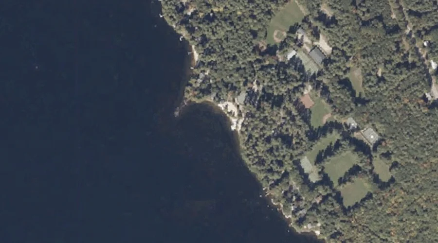
Keoka Point — Capes 29.6 Miles SSE of Chapman Inn
Cumberland County, Maine · USGS Naples Quadrangle · GNIS 1912617
29.6 miles south-southeast of Chapman Inn, on the USGS Naples topographic quadrangle, Keoka Point is a cape recorded in Cumberland County, Maine by the federal Geographic Names Information System.
Landmark Profile
Classification & USGS reference
The USGS Naples 7.5-minute topographic quadrangle places Keoka Point in Cumberland County, Maine (FIPS 23/005), classified as a cape in the federal GNIS (Feature ID 1912617). Catalogued in GNIS since 05/08/2001.
Coordinates & physical setting
Keoka Point sits at 43.99507° N, 70.61673° W (DMS 43°59′42″ N, 70°37′00″ W).
Other capes in Cumberland County, Maine
Cumberland County, ME contains 35 capes catalogued in the USGS Geographic Names Information System, counting Keoka Point itself. The ones closest to Keoka Point:
| Feature | USGS Quadrangle | Distance |
|---|---|---|
| Arrowhead Point | Naples | 0.4 mi |
| Kellys Point | Bridgton | 0.6 mi |
| Stimpsons Point | North Sebago | 0.9 mi |
| Long Point | Bridgton | 1.1 mi |
| Birch Point | Naples | 1.2 mi |
| Bear Point | Bridgton | 2.1 mi |
| Breezy Point | Naples | 3.8 mi |
| Abners Nose | Bridgton | 4.2 mi |
| Adams Point | Bridgton | 4.3 mi |
| Salmon Point | Bridgton | 4.9 mi |
Features on the USGS Naples Quadrangle
The Naples 7.5-minute topographic quadrangle holds 65 catalogued natural features alongside Keoka Point. A sampling nearest to this location:
| Feature | Type | County | Offset |
|---|---|---|---|
| Arrowhead Point | Capes | Cumberland County, ME | 0.4 mi |
| Birch Point | Capes | Cumberland County, ME | 1.2 mi |
| Chute River | Other Natural Features | Cumberland County, ME | 2 mi |
| Bartlett Brook | Streams | Cumberland County, ME | 2.3 mi |
| Mill Brook | Streams | Cumberland County, ME | 2.6 mi |
| Brandy Pond | Lakes | Cumberland County, ME | 3 mi |
| Jackson Cove | Bays | Cumberland County, ME | 3.2 mi |
| Decker Brook | Streams | Cumberland County, ME | 3.3 mi |
| Tenny Hill | Summits | Cumberland County, ME | 3.4 mi |
| Breezy Point | Capes | Cumberland County, ME | 3.8 mi |
Visiting from Chapman Inn
Distance, bearing & drive time
Chapman Inn sits 29.6 miles south-southeast (bearing SSE) of Keoka Point. At moderate back-road speeds the drive runs about 51 minutes — comfortably inside a half-day outing window after breakfast.
Best time to visit
Generally accessible May through October; winter access depends on snow cover. At this latitude (43.995°), the shoulder seasons are workable — April and November can be comfortable on mild years. At 29.6 miles from the Inn, block the full day — sunrise start, late return, packed meals. Conditions at Keoka Point track the nearby Arrowhead Point cape (0.4 mi away) closely — if that is runnable, so is this.
Nearest features to Keoka Point
| Feature | Type | County | Distance |
|---|---|---|---|
| Arrowhead Point | Capes | Cumberland County, ME | 0.4 mi |
| Kellys Point | Capes | Cumberland County, ME | 0.6 mi |
| Stimpsons Point | Capes | Cumberland County, ME | 0.9 mi |
| Pitts Meadow | Swamps | Cumberland County, ME | 1 mi |
| Long Point | Capes | Cumberland County, ME | 1.1 mi |
Frequently Asked Questions
Where is Keoka Point located?
Keoka Point is in Cumberland County, Maine, approximately 29.6 miles south-southeast of Chapman Inn in Bethel, Maine. It appears on the USGS Naples topographic quadrangle.
How far is Keoka Point from Chapman Inn?
The drive runs about 51 minutes, 29.6 miles south-southeast (bearing SSE) of the Inn.
What type of natural feature is Keoka Point?
The U.S. Geological Survey classifies Keoka Point as a cape, catalogued under GNIS Feature ID 1912617 on the Naples quadrangle.
When is the best time to visit Keoka Point?
Generally accessible May through October; winter access depends on snow cover.
How many other capes are in Cumberland County, Maine?
GNIS lists 34 other capes in Cumberland County, Maine.