 Aerial imagery: USGS National Map (public domain)
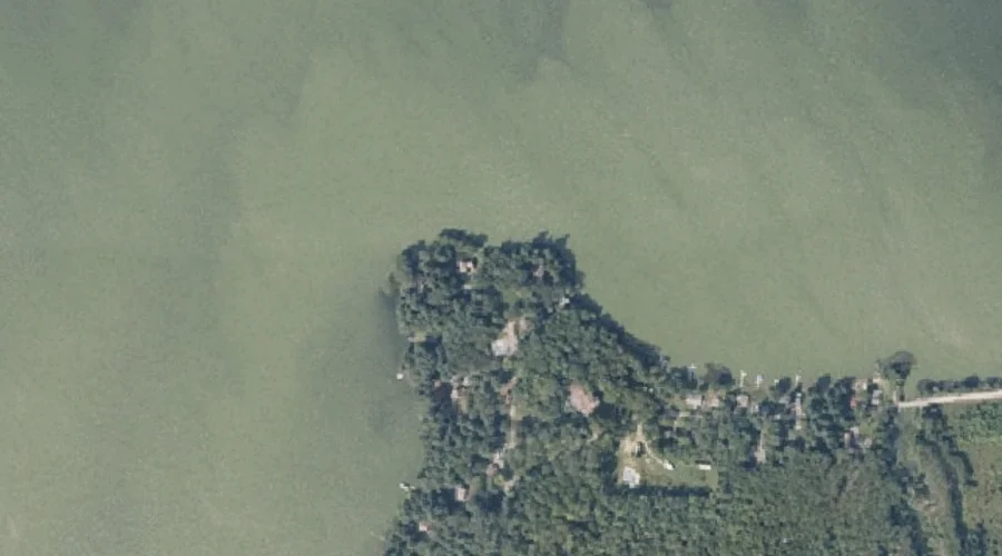
Marr Point — Capes 38.4 Miles ESE of Chapman Inn
Androscoggin County, Maine · USGS Monmouth Quadrangle · GNIS 570793
Catalogued on the USGS Monmouth quadrangle in Androscoggin County, Maine, Marr Point — a cape — lies 38.4 miles east-southeast of Chapman Inn.
Landmark Profile
Classification & USGS reference
Catalogued under GNIS Feature ID 570793, Marr Point is recorded as a cape on the USGS Monmouth quadrangle in Androscoggin County, Maine (FIPS 23/001). Catalogued in GNIS since 09/30/1980.
Coordinates & physical setting
Marr Point sits at 44.15563° N, 70.09478° W (DMS 44°09′20″ N, 70°05′41″ W).
Other capes in Androscoggin County, Maine
Androscoggin County, ME contains 6 capes catalogued in the USGS Geographic Names Information System, counting Marr Point itself. The ones closest to Marr Point:
| Feature | USGS Quadrangle | Distance |
|---|---|---|
| Martin Point | Monmouth | 2.2 mi |
| Salmon Point | Lake Auburn West | 7.8 mi |
| Pine Point | Lake Auburn West | 8.4 mi |
| Abrams Point | Mechanic Falls | 20.1 mi |
| Pine Point | Mechanic Falls | 21.4 mi |
Features on the USGS Monmouth Quadrangle
The Monmouth 7.5-minute topographic quadrangle holds 21 catalogued natural features alongside Marr Point. A sampling nearest to this location:
| Feature | Type | County | Offset |
|---|---|---|---|
| Custer Pond | Lakes | Androscoggin County, ME | 0.7 mi |
| Dead River | Streams | Androscoggin County, ME | 1.1 mi |
| Sabattus Mountain | Summits | Androscoggin County, ME | 1.2 mi |
| Hooper Brook | Streams | Androscoggin County, ME | 1.7 mi |
| Martin Point | Capes | Androscoggin County, ME | 2.2 mi |
| Maxwell Swamp | Swamps | Androscoggin County, ME | 2.7 mi |
| Hodgman Hill | Summits | Androscoggin County, ME | 3.1 mi |
| Thompson Hill | Summits | Kennebec County, ME | 3.3 mi |
| Oak Hill | Summits | Androscoggin County, ME | 3.5 mi |
| Oak Hill | Summits | Kennebec County, ME | 3.5 mi |
Visiting from Chapman Inn
Distance, bearing & drive time
A 66-minute drive along back roads separates the front door of Chapman Inn from Marr Point — 38.4 miles east-southeast as the crow flies, on compass bearing ESE.
Best time to visit
Generally accessible May through October; winter access depends on snow cover. At this latitude (44.156°), the shoulder seasons are workable — April and November can be comfortable on mild years. At 38.4 miles from the Inn, block the full day — sunrise start, late return, packed meals. Conditions at Marr Point track the nearby Custer Pond lake (0.7 mi away) closely — if that is runnable, so is this.
Nearest features to Marr Point
| Feature | Type | County | Distance |
|---|---|---|---|
| Custer Pond | Lakes | Androscoggin County, ME | 0.7 mi |
| Dead River | Streams | Androscoggin County, ME | 1.1 mi |
| Sabattus Mountain | Summits | Androscoggin County, ME | 1.2 mi |
| Hill Ridge | Ridges | Androscoggin County, ME | 1.7 mi |
| Hooper Brook | Streams | Androscoggin County, ME | 1.7 mi |
Frequently Asked Questions
Where is Marr Point located?
Marr Point is in Androscoggin County, Maine, approximately 38.4 miles east-southeast of Chapman Inn in Bethel, Maine. It appears on the USGS Monmouth topographic quadrangle.
How far is Marr Point from Chapman Inn?
The drive runs about 66 minutes, 38.4 miles east-southeast (bearing ESE) of the Inn.
What type of natural feature is Marr Point?
The U.S. Geological Survey classifies Marr Point as a cape, catalogued under GNIS Feature ID 570793 on the Monmouth quadrangle.
When is the best time to visit Marr Point?
Generally accessible May through October; winter access depends on snow cover.
How many other capes are in Androscoggin County, Maine?
GNIS lists 5 other capes in Androscoggin County, Maine.