 Aerial imagery: USGS National Map (public domain)
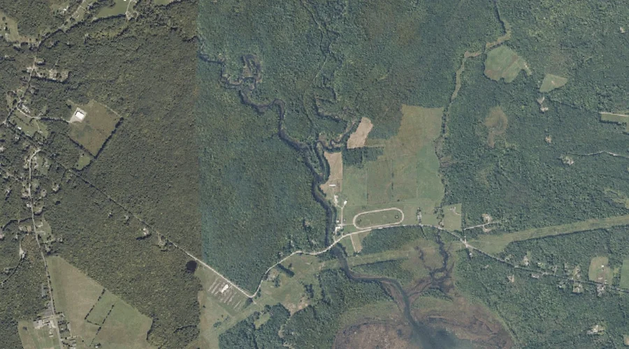
Hooper Brook — Streams 37.5 Miles ESE of Chapman Inn
Androscoggin County, Maine · USGS Monmouth Quadrangle · GNIS 568234
Catalogued on the USGS Monmouth quadrangle in Androscoggin County, Maine, Hooper Brook — a stream — lies 37.5 miles east-southeast of Chapman Inn.
Landmark Profile
Classification & USGS reference
Catalogued under GNIS Feature ID 568234, Hooper Brook is recorded as a stream on the USGS Monmouth quadrangle in Androscoggin County, Maine (FIPS 23/001). Catalogued in GNIS since 09/30/1980.
Coordinates & physical setting
Hooper Brook sits at 44.18007° N, 70.09866° W (DMS 44°10′48″ N, 70°05′55″ W).
As a linear feature its source lies near 44.24701° N, 70.13616° W (DMS 44°14′49″ N, 70°08′10″ W) — useful for anglers and paddlers tracing the upstream end.
Other streams in Androscoggin County, Maine
Androscoggin County, ME contains 62 streams catalogued in the USGS Geographic Names Information System, counting Hooper Brook itself. The ones closest to Hooper Brook:
| Feature | USGS Quadrangle | Distance |
|---|---|---|
| Dead River | Monmouth | 0.7 mi |
| Curtis Brook | Lisbon Falls North | 5.1 mi |
| Bradford Brook | Lake Auburn East | 5.8 mi |
| Stetson Brook | Lake Auburn East | 6.1 mi |
| Maxwell Brook | Lisbon Falls North | 6.2 mi |
| Jepson Brook | Lewiston | 7.1 mi |
| Allen Stream | Turner Center | 8 mi |
| Nezinscot River | Turner Center | 8.5 mi |
| Little Androscoggin River | Lewiston | 8.8 mi |
| Red Brook | Turner Center | 8.9 mi |
Features on the USGS Monmouth Quadrangle
The Monmouth 7.5-minute topographic quadrangle holds 21 catalogued natural features alongside Hooper Brook. A sampling nearest to this location:
| Feature | Type | County | Offset |
|---|---|---|---|
| Dead River | Streams | Androscoggin County, ME | 0.7 mi |
| Marr Point | Capes | Androscoggin County, ME | 1.7 mi |
| Custer Pond | Lakes | Androscoggin County, ME | 2.3 mi |
| Thompson Hill | Summits | Kennebec County, ME | 2.5 mi |
| Little Sabattus Mountain | Summits | Androscoggin County, ME | 2.6 mi |
| Sabattus Mountain | Summits | Androscoggin County, ME | 2.7 mi |
| Martin Point | Capes | Androscoggin County, ME | 3.8 mi |
| Maxwell Swamp | Swamps | Androscoggin County, ME | 3.9 mi |
| Monmouth Ridge | Ridges | Kennebec County, ME | 3.9 mi |
| Hodgman Hill | Summits | Androscoggin County, ME | 4.2 mi |
Visiting from Chapman Inn
Distance, bearing & drive time
A 64-minute drive along back roads separates the front door of Chapman Inn from Hooper Brook — 37.5 miles east-southeast as the crow flies, on compass bearing ESE.
Best time to visit
Best observed in late spring and early summer when flow is strong and banks are visible. At this latitude (44.180°), the shoulder seasons are workable — April and November can be comfortable on mild years. At 37.5 miles from the Inn, block the full day — sunrise start, late return, packed meals. Conditions at Hooper Brook track the nearby Dead River stream (0.7 mi away) closely — if that is runnable, so is this.
Nearest features to Hooper Brook
| Feature | Type | County | Distance |
|---|---|---|---|
| Dead River | Streams | Androscoggin County, ME | 0.7 mi |
| Marr Point | Capes | Androscoggin County, ME | 1.7 mi |
| Hill Ridge | Ridges | Androscoggin County, ME | 2.1 mi |
| Custer Pond | Lakes | Androscoggin County, ME | 2.3 mi |
| Thompson Hill | Summits | Kennebec County, ME | 2.5 mi |
Frequently Asked Questions
Where is Hooper Brook located?
Hooper Brook is in Androscoggin County, Maine, approximately 37.5 miles east-southeast of Chapman Inn in Bethel, Maine. It appears on the USGS Monmouth topographic quadrangle.
How far is Hooper Brook from Chapman Inn?
The drive runs about 64 minutes, 37.5 miles east-southeast (bearing ESE) of the Inn.
What type of natural feature is Hooper Brook?
The U.S. Geological Survey classifies Hooper Brook as a stream, catalogued under GNIS Feature ID 568234 on the Monmouth quadrangle.
When is the best time to visit Hooper Brook?
Best observed in late spring and early summer when flow is strong and banks are visible.
How many other streams are in Androscoggin County, Maine?
GNIS lists 61 other streams in Androscoggin County, Maine.