 Aerial imagery: USGS National Map (public domain)
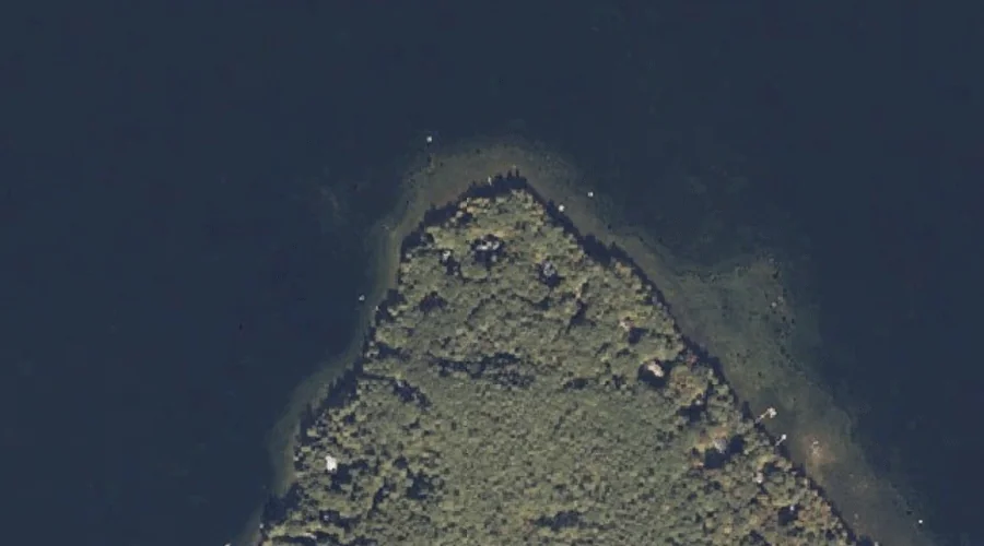
Abrams Point — Capes 29.2 Miles SSE of Chapman Inn
Androscoggin County, Maine · USGS Mechanic Falls Quadrangle · GNIS 561071
Within Androscoggin County, Maine, on the USGS Mechanic Falls quadrangle, the cape known as Abrams Point sits 29.2 miles south-southeast of Chapman Inn.
Wikidata short description: “cape in Androscoggin County, Maine, United States of America”
Landmark Profile
Classification & USGS reference
Within Androscoggin County, Maine, the U.S. Geological Survey lists Abrams Point as a cape on the Mechanic Falls topographic quadrangle (FIPS 23/001), under Feature ID 561071. Catalogued in GNIS since 09/30/1980.
Coordinates & physical setting
Abrams Point sits at 44.04924° N, 70.47145° W (DMS 44°02′57″ N, 70°28′17″ W).
Other capes in Androscoggin County, Maine
Androscoggin County, ME contains 6 capes catalogued in the USGS Geographic Names Information System, counting Abrams Point itself. The ones closest to Abrams Point:
| Feature | USGS Quadrangle | Distance |
|---|---|---|
| Pine Point | Mechanic Falls | 2.6 mi |
| Pine Point | Lake Auburn West | 12.1 mi |
| Salmon Point | Lake Auburn West | 13 mi |
| Martin Point | Monmouth | 18.9 mi |
| Marr Point | Monmouth | 20.1 mi |
Features on the USGS Mechanic Falls Quadrangle
The Mechanic Falls 7.5-minute topographic quadrangle holds 48 catalogued natural features alongside Abrams Point. A sampling nearest to this location:
| Feature | Type | County | Offset |
|---|---|---|---|
| Potash Cove | Bays | Androscoggin County, ME | 0.5 mi |
| Birch Island | Islands | Oxford County, ME | 1 mi |
| Potash Brook | Streams | Androscoggin County, ME | 1.1 mi |
| Squirrel Island | Islands | Oxford County, ME | 1.1 mi |
| Megquier Island | Islands | Androscoggin County, ME | 1.1 mi |
| Turtle Island | Islands | Oxford County, ME | 1.1 mi |
| Wacipi Island | Islands | Oxford County, ME | 1.1 mi |
| Crescent Island | Islands | Oxford County, ME | 1.2 mi |
| Black Island | Islands | Androscoggin County, ME | 1.3 mi |
| Megquier Hill | Summits | Androscoggin County, ME | 1.3 mi |
Historical record
The U.S. Board on Geographic Names recorded a Official (Board Decision) on January 1, 1947 for this name.
Visiting from Chapman Inn
Distance, bearing & drive time
Follow the compass bearing SSE out of Bethel for 29.2 miles (south-southeast) and you reach Abrams Point; at typical rural speeds the trip runs roughly 50 minutes.
Best time to visit
Generally accessible May through October; winter access depends on snow cover. At this latitude (44.049°), the shoulder seasons are workable — April and November can be comfortable on mild years. At 29.2 miles from the Inn, block the full day — sunrise start, late return, packed meals. Conditions at Abrams Point track the nearby Potash Cove bay (0.5 mi away) closely — if that is runnable, so is this.
Nearest features to Abrams Point
| Feature | Type | County | Distance |
|---|---|---|---|
| Potash Cove | Bays | Androscoggin County, ME | 0.5 mi |
| Birch Island | Islands | Oxford County, ME | 1 mi |
| Potash Brook | Streams | Androscoggin County, ME | 1.1 mi |
| Squirrel Island | Islands | Oxford County, ME | 1.1 mi |
| Megquier Island | Islands | Androscoggin County, ME | 1.1 mi |
Frequently Asked Questions
Where is Abrams Point located?
Abrams Point is in Androscoggin County, Maine, approximately 29.2 miles south-southeast of Chapman Inn in Bethel, Maine. It appears on the USGS Mechanic Falls topographic quadrangle.
How far is Abrams Point from Chapman Inn?
The drive runs about 50 minutes, 29.2 miles south-southeast (bearing SSE) of the Inn.
What type of natural feature is Abrams Point?
The U.S. Geological Survey classifies Abrams Point as a cape, catalogued under GNIS Feature ID 561071 on the Mechanic Falls quadrangle.
When is the best time to visit Abrams Point?
Generally accessible May through October; winter access depends on snow cover.
How many other capes are in Androscoggin County, Maine?
GNIS lists 5 other capes in Androscoggin County, Maine.
Wikidata: Q34638438.