 Aerial imagery: USGS National Map (public domain)
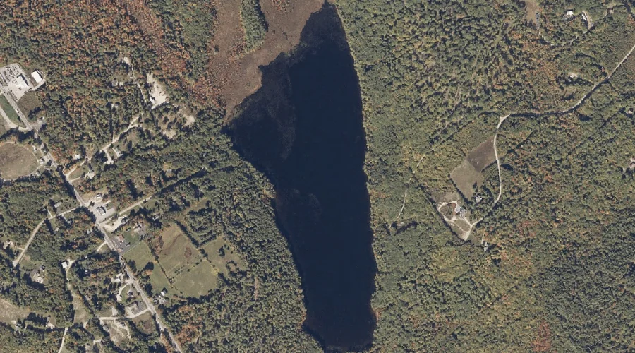
Otter Pond — Lakes 27.0 Miles SSE of Chapman Inn
Cumberland County, Maine · USGS Bridgton Quadrangle · GNIS 572846
Within Cumberland County, Maine, on the USGS Bridgton quadrangle, the lake known as Otter Pond sits 27.0 miles south-southeast of Chapman Inn.
Landmark Profile
Classification & USGS reference
Within Cumberland County, Maine, the U.S. Geological Survey lists Otter Pond as a lake on the Bridgton topographic quadrangle (FIPS 23/005), under Feature ID 572846. Last revised by the Board on Geographic Names on 05/15/2018.
Coordinates & physical setting
Otter Pond sits at 44.02192° N, 70.67709° W (DMS 44°01′19″ N, 70°40′38″ W).
Other lakes in Cumberland County, Maine
Cumberland County, ME contains 47 lakes catalogued in the USGS Geographic Names Information System, counting Otter Pond itself. The ones closest to Otter Pond:
| Feature | USGS Quadrangle | Distance |
|---|---|---|
| Long Lake | Bridgton | 1.6 mi |
| Holt Pond | North Sebago | 3.1 mi |
| Foster Pond | North Sebago | 3.9 mi |
| Beaver Pond | Pleasant Mountain | 5.6 mi |
| Brandy Pond | Naples | 6.3 mi |
| Cold Rain Pond | North Sebago | 6.4 mi |
| Trickey Pond | Naples | 6.6 mi |
| Bog Pond | Casco | 7.1 mi |
| Browns Pond | North Sebago | 7.9 mi |
| Parker Pond | Naples | 8.3 mi |
Features on the USGS Bridgton Quadrangle
The Bridgton 7.5-minute topographic quadrangle holds 49 catalogued natural features alongside Otter Pond. A sampling nearest to this location:
| Feature | Type | County | Offset |
|---|---|---|---|
| Packard Hill | Summits | Cumberland County, ME | 0.4 mi |
| Abners Nose | Capes | Cumberland County, ME | 1.3 mi |
| Choate Hill | Summits | Cumberland County, ME | 1.4 mi |
| Mount Henry | Summits | Cumberland County, ME | 1.4 mi |
| Sandy Cove | Bays | Cumberland County, ME | 1.5 mi |
| Long Lake | Lakes | Cumberland County, ME | 1.6 mi |
| Willett Brook | Reservoirs | Cumberland County, ME | 1.7 mi |
| Bear Point | Capes | Cumberland County, ME | 1.7 mi |
| Thomes Brook | Streams | Cumberland County, ME | 1.8 mi |
| Mosquito Island | Islands | Cumberland County, ME | 1.8 mi |
Visiting from Chapman Inn
Distance, bearing & drive time
Follow the compass bearing SSE out of Bethel for 27.0 miles (south-southeast) and you reach Otter Pond; at typical rural speeds the trip runs roughly 46 minutes.
Best time to visit
June through September for paddling and swimming; January through March for ice fishing. At this latitude (44.022°), the shoulder seasons are workable — April and November can be comfortable on mild years. At 27.0 miles from the Inn, block the full day — sunrise start, late return, packed meals. Conditions at Otter Pond track the nearby Packard Hill summit (0.4 mi away) closely — if that is runnable, so is this.
Nearest features to Otter Pond
| Feature | Type | County | Distance |
|---|---|---|---|
| Packard Hill | Summits | Cumberland County, ME | 0.4 mi |
| Abners Nose | Capes | Cumberland County, ME | 1.3 mi |
| Choate Hill | Summits | Cumberland County, ME | 1.4 mi |
| Mount Henry | Summits | Cumberland County, ME | 1.4 mi |
| Sandy Cove | Bays | Cumberland County, ME | 1.5 mi |
Frequently Asked Questions
Where is Otter Pond located?
Otter Pond is in Cumberland County, Maine, approximately 27.0 miles south-southeast of Chapman Inn in Bethel, Maine. It appears on the USGS Bridgton topographic quadrangle.
How far is Otter Pond from Chapman Inn?
The drive runs about 46 minutes, 27.0 miles south-southeast (bearing SSE) of the Inn.
What type of natural feature is Otter Pond?
The U.S. Geological Survey classifies Otter Pond as a lake, catalogued under GNIS Feature ID 572846 on the Bridgton quadrangle.
When is the best time to visit Otter Pond?
June through September for paddling and swimming; January through March for ice fishing.
How many other lakes are in Cumberland County, Maine?
GNIS lists 46 other lakes in Cumberland County, Maine.