 Aerial imagery: USGS National Map (public domain)
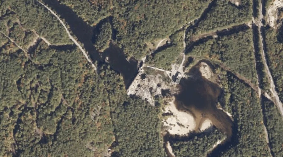
Great Falls — Waterfalls 38.2 Miles S of Chapman Inn
Oxford County, Maine · USGS Cornish Quadrangle · GNIS 567139
Catalogued on the USGS Cornish quadrangle in Oxford County, Maine, Great Falls — a waterfall — lies 38.2 miles south of Chapman Inn.
Landmark Profile
Classification & USGS reference
Catalogued under GNIS Feature ID 567139, Great Falls is recorded as a waterfall on the USGS Cornish quadrangle in Oxford County, Maine (FIPS 23/017). Catalogued in GNIS since 09/30/1980.
Coordinates & physical setting
Great Falls sits at 43.85257° N, 70.79673° W (DMS 43°51′09″ N, 70°47′48″ W).
As a linear feature its source lies near 0.00000° N, 0.00000° W — useful for anglers and paddlers tracing the upstream end.
Other waterfalls in Oxford County, Maine
Oxford County, ME contains 19 waterfalls catalogued in the USGS Geographic Names Information System, counting Great Falls itself. The ones closest to Great Falls:
| Feature | USGS Quadrangle | Distance |
|---|---|---|
| Swans Falls | Fryeburg | 15.8 mi |
| Kezar Falls | North Waterford | 23.9 mi |
| Steep Falls | Norway | 27.8 mi |
| Mad River Falls | Wild River | 31.9 mi |
| Bisco Falls | West Paris | 32.6 mi |
| Kees Falls | Speckled Mountain | 34.7 mi |
| Basin Falls | West Sumner | 36.2 mi |
| Rumford Falls | Rumford | 49.1 mi |
| Screw Auger Falls | Old Speck Mountain | 50 mi |
| Mother Walker Falls | Old Speck Mountain | 50.5 mi |
Features on the USGS Cornish Quadrangle
The Cornish 7.5-minute topographic quadrangle holds 31 catalogued natural features alongside Great Falls. A sampling nearest to this location:
| Feature | Type | County | Offset |
|---|---|---|---|
| Saco River Reservoir | Reservoirs | Oxford County, ME | 0 mi |
| Ingalls Pond | Lakes | Cumberland County, ME | 0.6 mi |
| Smalls Mountain | Summits | Oxford County, ME | 1.3 mi |
| Breakneck Brook | Streams | Cumberland County, ME | 1.4 mi |
| Flints Mountain | Summits | Cumberland County, ME | 1.7 mi |
| Peaked Mountain | Summits | Oxford County, ME | 1.7 mi |
| Mount Cutler | Summits | Oxford County, ME | 2 mi |
| Dug Hill Brook | Streams | Cumberland County, ME | 2.2 mi |
| Gould Mountain | Summits | Oxford County, ME | 2.2 mi |
| Ossipee River | Streams | York County, NH | 2.8 mi |
Visiting from Chapman Inn
Distance, bearing & drive time
A 65-minute drive along back roads separates the front door of Chapman Inn from Great Falls — 38.2 miles south as the crow flies, on compass bearing S.
Best time to visit
Peak flow runs mid-April through June after snowmelt; late summer can be thin or dry. At this latitude (43.853°), the shoulder seasons are workable — April and November can be comfortable on mild years. At 38.2 miles from the Inn, block the full day — sunrise start, late return, packed meals. Conditions at Great Falls track the nearby Saco River Reservoir (essentially adjacent) closely — if that is runnable, so is this.
Nearest features to Great Falls
| Feature | Type | County | Distance |
|---|---|---|---|
| Saco River Reservoir | Reservoirs | Oxford County, ME | 0 mi |
| Ingalls Pond | Lakes | Cumberland County, ME | 0.6 mi |
| Smalls Mountain | Summits | Oxford County, ME | 1.3 mi |
| Breakneck Brook | Streams | Cumberland County, ME | 1.4 mi |
| Flints Mountain | Summits | Cumberland County, ME | 1.7 mi |
Frequently Asked Questions
Where is Great Falls located?
Great Falls is in Oxford County, Maine, approximately 38.2 miles south of Chapman Inn in Bethel, Maine. It appears on the USGS Cornish topographic quadrangle.
How far is Great Falls from Chapman Inn?
The drive runs about 65 minutes, 38.2 miles south (bearing S) of the Inn.
What type of natural feature is Great Falls?
The U.S. Geological Survey classifies Great Falls as a waterfall, catalogued under GNIS Feature ID 567139 on the Cornish quadrangle.
When is the best time to visit Great Falls?
Peak flow runs mid-April through June after snowmelt; late summer can be thin or dry.
How many other waterfalls are in Oxford County, Maine?
GNIS lists 18 other waterfalls in Oxford County, Maine.