 Aerial imagery: USGS National Map (public domain)
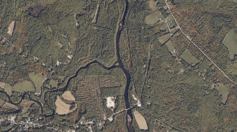
Ossipee River — Streams 40.9 Miles S of Chapman Inn
York County, New Hampshire · USGS Cornish Quadrangle · GNIS 868940
Within York County, New Hampshire, on the USGS Cornish quadrangle, the stream known as Ossipee River sits 40.9 miles south of Chapman Inn.
Landmark Profile
Classification & USGS reference
Within York County, New Hampshire, the U.S. Geological Survey lists Ossipee River as a stream on the Cornish topographic quadrangle (FIPS 23/031), under Feature ID 868940. Last revised by the Board on Geographic Names on 06/22/2021.
Coordinates & physical setting
Ossipee River sits at 43.81364° N, 70.78301° W (DMS 43°48′49″ N, 70°46′59″ W).
As a linear feature its source lies near 43.78430° N, 71.11185° W (DMS 43°47′03″ N, 71°06′43″ W) — useful for anglers and paddlers tracing the upstream end.
Features on the USGS Cornish Quadrangle
The Cornish 7.5-minute topographic quadrangle holds 31 catalogued natural features alongside Ossipee River. A sampling nearest to this location:
| Feature | Type | County | Offset |
|---|---|---|---|
| Dug Hill Brook | Streams | Cumberland County, ME | 0.7 mi |
| Harding Hill | Summits | Cumberland County, ME | 0.8 mi |
| Little River | Streams | York County, ME | 1 mi |
| Breakneck Brook | Streams | Cumberland County, ME | 1.4 mi |
| Pease Brook | Streams | York County, ME | 1.9 mi |
| Merrifield Brook | Streams | York County, ME | 2.3 mi |
| Pugsley Brook | Streams | York County, ME | 2.4 mi |
| Smalls Hill | Summits | York County, ME | 2.4 mi |
| Peaked Mountain | Summits | Oxford County, ME | 2.7 mi |
| Pike Hill | Summits | York County, ME | 2.7 mi |
Visiting from Chapman Inn
Distance, bearing & drive time
Follow the compass bearing S out of Bethel for 40.9 miles (south) and you reach Ossipee River; at typical rural speeds the trip runs roughly 70 minutes.
Best time to visit
Best observed in late spring and early summer when flow is strong and banks are visible. At this latitude (43.814°), the shoulder seasons are workable — April and November can be comfortable on mild years. At 40.9 miles from the Inn, block the full day — sunrise start, late return, packed meals. Conditions at Ossipee River track the nearby Dug Hill Brook stream (0.7 mi away) closely — if that is runnable, so is this.
Nearest features to Ossipee River
| Feature | Type | County | Distance |
|---|---|---|---|
| Dug Hill Brook | Streams | Cumberland County, ME | 0.7 mi |
| Harding Hill | Summits | Cumberland County, ME | 0.8 mi |
| Little River | Streams | York County, ME | 1 mi |
| Breakneck Brook | Streams | Cumberland County, ME | 1.4 mi |
| Pease Brook | Streams | York County, ME | 1.9 mi |
Frequently Asked Questions
Where is Ossipee River located?
Ossipee River is in York County, New Hampshire, approximately 40.9 miles south of Chapman Inn in Bethel, Maine. It appears on the USGS Cornish topographic quadrangle.
How far is Ossipee River from Chapman Inn?
The drive runs about 70 minutes, 40.9 miles south (bearing S) of the Inn.
What type of natural feature is Ossipee River?
The U.S. Geological Survey classifies Ossipee River as a stream, catalogued under GNIS Feature ID 868940 on the Cornish quadrangle.
When is the best time to visit Ossipee River?
Best observed in late spring and early summer when flow is strong and banks are visible.