 Aerial imagery: USGS National Map (public domain)
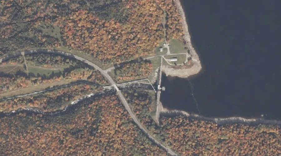
Aziscohos Falls (historical) — Waterfalls 38.7 Miles NNW of Chapman Inn
Oxford County, Maine · USGS Richardson Pond Quadrangle · GNIS 2677992
38.7 miles north-northwest of Chapman Inn, on the USGS Richardson Pond topographic quadrangle, Aziscohos Falls (historical) is a waterfall recorded in Oxford County, Maine by the federal Geographic Names Information System.
Landmark Profile
Classification & USGS reference
The USGS Richardson Pond 7.5-minute topographic quadrangle places Aziscohos Falls (historical) in Oxford County, Maine (FIPS 23/017), classified as a waterfall in the federal GNIS (Feature ID 2677992). Last revised by the Board on Geographic Names on 06/12/2013.
Coordinates & physical setting
Aziscohos Falls (historical) sits at 44.94444° N, 70.99806° W (DMS 44°56′40″ N, 70°59′53″ W).
As a linear feature its source lies near 0.00000° N, 0.00000° W — useful for anglers and paddlers tracing the upstream end.
Other waterfalls in Oxford County, Maine
Oxford County, ME contains 19 waterfalls catalogued in the USGS Geographic Names Information System, counting Aziscohos Falls (historical) itself. The ones closest to Aziscohos Falls (historical):
| Feature | USGS Quadrangle | Distance |
|---|---|---|
| Little Falls | Kennebago | 9.2 mi |
| Big Falls | Lincoln Pond | 10.8 mi |
| Dunn Falls | B Pond | 20.1 mi |
| Silver Ripple Cascade | Ellis Pond | 21.9 mi |
| The Cataracts | Andover | 22.2 mi |
| Ellis Falls | Ellis Pond | 25.2 mi |
| Mother Walker Falls | Old Speck Mountain | 25.6 mi |
| Screw Auger Falls | Old Speck Mountain | 26.1 mi |
| The Falls | Dixfield | 35.3 mi |
| Rumford Falls | Rumford | 35.8 mi |
Features on the USGS Richardson Pond Quadrangle
The Richardson Pond 7.5-minute topographic quadrangle holds 20 catalogued natural features alongside Aziscohos Falls (historical). A sampling nearest to this location:
| Feature | Type | County | Offset |
|---|---|---|---|
| Sunday Pond (historical) | Lakes | Oxford County, ME | 0.1 mi |
| Black Brook Cove | Bays | Oxford County, ME | 1.2 mi |
| Low Aziscohos Mountain | Summits | Oxford County, ME | 1.9 mi |
| Beaver Brook | Streams | Oxford County, ME | 2.1 mi |
| Barney Brook | Streams | Oxford County, ME | 2.5 mi |
| Observatory Mountain | Summits | Oxford County, ME | 2.7 mi |
| Aziscohos Pond | Lakes | Oxford County, ME | 3.4 mi |
| Little Beaver Pond | Lakes | Oxford County, ME | 3.6 mi |
| Deer Mountain Stream | Streams | Oxford County, ME | 4.2 mi |
| Beaver Pond | Lakes | Oxford County, ME | 4.4 mi |
Visiting from Chapman Inn
Distance, bearing & drive time
Chapman Inn sits 38.7 miles north-northwest (bearing NNW) of Aziscohos Falls (historical). At moderate back-road speeds the drive runs about 66 minutes — comfortably inside a half-day outing window after breakfast.
Best time to visit
Peak flow runs mid-April through June after snowmelt; late summer can be thin or dry. Being this far north (lat 44.944°), first snows typically arrive by mid-October and linger into early May — narrow the window accordingly. At 38.7 miles from the Inn, block the full day — sunrise start, late return, packed meals. Conditions at Aziscohos Falls (historical) track the nearby Sunday Pond (historical) lake (essentially adjacent) closely — if that is runnable, so is this.
Nearest features to Aziscohos Falls (historical)
| Feature | Type | County | Distance |
|---|---|---|---|
| Sunday Pond (historical) | Lakes | Oxford County, ME | 0.1 mi |
| Parker Hill | Summits | Oxford County, ME | 1.2 mi |
| Black Brook Cove | Bays | Oxford County, ME | 1.2 mi |
| Little Abbott Brook | Streams | Oxford County, ME | 1.6 mi |
| Abbott Brook | Streams | Oxford County, NH | 1.6 mi |
Frequently Asked Questions
Where is Aziscohos Falls (historical) located?
Aziscohos Falls (historical) is in Oxford County, Maine, approximately 38.7 miles north-northwest of Chapman Inn in Bethel, Maine. It appears on the USGS Richardson Pond topographic quadrangle.
How far is Aziscohos Falls (historical) from Chapman Inn?
The drive runs about 66 minutes, 38.7 miles north-northwest (bearing NNW) of the Inn.
What type of natural feature is Aziscohos Falls (historical)?
The U.S. Geological Survey classifies Aziscohos Falls (historical) as a waterfall, catalogued under GNIS Feature ID 2677992 on the Richardson Pond quadrangle.
When is the best time to visit Aziscohos Falls (historical)?
Peak flow runs mid-April through June after snowmelt; late summer can be thin or dry.
How many other waterfalls are in Oxford County, Maine?
GNIS lists 18 other waterfalls in Oxford County, Maine.