 Aerial imagery: USGS National Map (public domain)
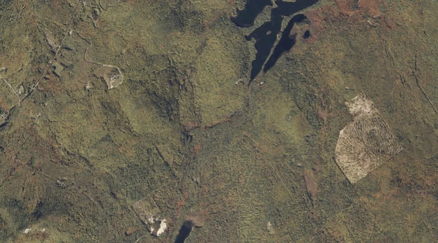
Kezar Falls Gorge — Valleys 14.6 Miles S of Chapman Inn
Oxford County, Maine · USGS North Waterford Quadrangle · GNIS 1908060
14.6 miles south of Chapman Inn, on the USGS North Waterford topographic quadrangle, Kezar Falls Gorge is a valley recorded in Oxford County, Maine by the federal Geographic Names Information System.
Landmark Profile
Classification & USGS reference
The USGS North Waterford 7.5-minute topographic quadrangle places Kezar Falls Gorge in Oxford County, Maine (FIPS 23/017), classified as a valley in the federal GNIS (Feature ID 1908060). Last revised by the Board on Geographic Names on 03/07/2017.
Coordinates & physical setting
Kezar Falls Gorge sits at 44.19485° N, 70.82032° W (DMS 44°11′41″ N, 70°49′13″ W).
Other valleys in Oxford County, Maine
Oxford County, ME contains 6 valleys catalogued in the USGS Geographic Names Information System, counting Kezar Falls Gorge itself. The ones closest to Kezar Falls Gorge:
| Feature | USGS Quadrangle | Distance |
|---|---|---|
| Snow Falls Gorge | West Paris | 15.8 mi |
| Coon Hollow | East Andover | 23.4 mi |
| Screw Auger Falls Gorge | Old Speck Mountain | 26.3 mi |
| Mother Walker Falls Gorge | Old Speck Mountain | 26.4 mi |
| Moose Cave Gorge | Old Speck Mountain | 27.4 mi |
Features on the USGS North Waterford Quadrangle
The North Waterford 7.5-minute topographic quadrangle holds 57 catalogued natural features alongside Kezar Falls Gorge. A sampling nearest to this location:
| Feature | Type | County | Offset |
|---|---|---|---|
| Kezar Falls | Waterfalls | Oxford County, ME | 0.4 mi |
| Kezar Falls Hill | Summits | Oxford County, ME | 0.4 mi |
| Stone Hill | Summits | Oxford County, ME | 0.7 mi |
| Oak Hill | Summits | Oxford County, ME | 0.7 mi |
| Dan Charles Pond | Lakes | Oxford County, ME | 1 mi |
| Five Kezar Ponds | Lakes | Oxford County, ME | 1 mi |
| Patterson Hill | Summits | Oxford County, ME | 1 mi |
| Green Brook | Streams | Oxford County, ME | 1.2 mi |
| Skillings Hill | Summits | Oxford County, ME | 1.3 mi |
| Patterson Brook | Streams | Oxford County, ME | 1.7 mi |
Visiting from Chapman Inn
Distance, bearing & drive time
Chapman Inn sits 14.6 miles south (bearing S) of Kezar Falls Gorge. At moderate back-road speeds the drive runs about 25 minutes — comfortably inside a half-day outing window after breakfast.
Best time to visit
Late May through October; avoid black-fly peak in late May. At this latitude (44.195°), the shoulder seasons are workable — April and November can be comfortable on mild years. At 14.6 miles from the Inn, plan on a comfortable day trip with time for lunch on the road. Conditions at Kezar Falls Gorge track the nearby Kezar Falls waterfall (0.4 mi away) closely — if that is runnable, so is this.
Nearest features to Kezar Falls Gorge
| Feature | Type | County | Distance |
|---|---|---|---|
| Kezar Falls | Waterfalls | Oxford County, ME | 0.4 mi |
| Kezar Falls Hill | Summits | Oxford County, ME | 0.4 mi |
| Stone Hill | Summits | Oxford County, ME | 0.7 mi |
| Oak Hill | Summits | Oxford County, ME | 0.7 mi |
| Dan Charles Pond | Lakes | Oxford County, ME | 1 mi |
Frequently Asked Questions
Where is Kezar Falls Gorge located?
Kezar Falls Gorge is in Oxford County, Maine, approximately 14.6 miles south of Chapman Inn in Bethel, Maine. It appears on the USGS North Waterford topographic quadrangle.
How far is Kezar Falls Gorge from Chapman Inn?
The drive runs about 25 minutes, 14.6 miles south (bearing S) of the Inn.
What type of natural feature is Kezar Falls Gorge?
The U.S. Geological Survey classifies Kezar Falls Gorge as a valley, catalogued under GNIS Feature ID 1908060 on the North Waterford quadrangle.
When is the best time to visit Kezar Falls Gorge?
Late May through October; avoid black-fly peak in late May.
How many other valleys are in Oxford County, Maine?
GNIS lists 5 other valleys in Oxford County, Maine.