 Aerial imagery: USGS National Map (public domain)
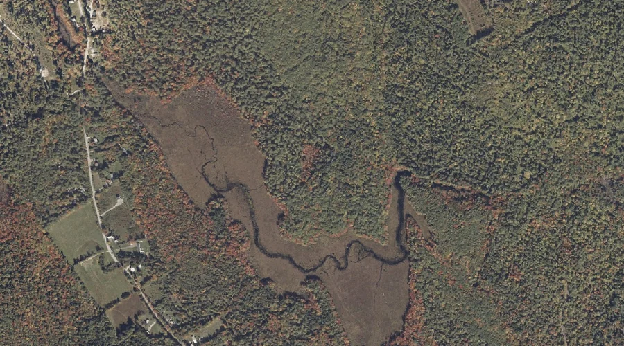
Perley Meadow — Swamps 30.3 Miles SSE of Chapman Inn
Cumberland County, Maine · USGS North Sebago Quadrangle · GNIS 1912867
Catalogued on the USGS North Sebago quadrangle in Cumberland County, Maine, Perley Meadow — a swamp — lies 30.3 miles south-southeast of Chapman Inn.
Wikidata short description: “swamp in Cumberland County, Maine, United States of America”
Landmark Profile
Classification & USGS reference
Catalogued under GNIS Feature ID 1912867, Perley Meadow is recorded as a swamp on the USGS North Sebago quadrangle in Cumberland County, Maine (FIPS 23/005). Catalogued in GNIS since 05/08/2001.
Coordinates & physical setting
Perley Meadow sits at 43.97646° N, 70.66062° W (DMS 43°58′35″ N, 70°39′38″ W).
Other swamps in Cumberland County, Maine
Cumberland County, ME contains 9 swamps catalogued in the USGS Geographic Names Information System, counting Perley Meadow itself. The ones closest to Perley Meadow:
| Feature | USGS Quadrangle | Distance |
|---|---|---|
| Pitts Meadow | Casco | 3.3 mi |
| Ted Swamp | Casco | 5.1 mi |
| Biglow Swamp | Casco | 10.4 mi |
| Moose Meadow | Raymond | 12.7 mi |
| Morgan Meadow | Raymond | 13.1 mi |
| Boody Meadow | North Windham | 14.3 mi |
| Brandy Bog | Gray | 17.6 mi |
| Gray Meadow | Cumberland Center | 18.5 mi |
Features on the USGS North Sebago Quadrangle
The North Sebago 7.5-minute topographic quadrangle holds 59 catalogued natural features alongside Perley Meadow. A sampling nearest to this location:
| Feature | Type | County | Offset |
|---|---|---|---|
| Skid Hill | Summits | Cumberland County, ME | 0.5 mi |
| Perley Hill | Summits | Cumberland County, ME | 0.6 mi |
| Holt Pond | Lakes | Cumberland County, ME | 0.9 mi |
| Gristmill Brook | Streams | Cumberland County, ME | 1.1 mi |
| Mast Cove | Bays | Cumberland County, ME | 1.3 mi |
| Tingley Brook | Streams | Cumberland County, ME | 1.4 mi |
| Byrons Hill | Summits | Cumberland County, ME | 1.4 mi |
| Foster Pond | Lakes | Cumberland County, ME | 1.5 mi |
| Pine Island | Islands | Cumberland County, ME | 1.5 mi |
| Town Farm Brook | Streams | Cumberland County, ME | 1.5 mi |
Visiting from Chapman Inn
Distance, bearing & drive time
A 52-minute drive along back roads separates the front door of Chapman Inn from Perley Meadow — 30.3 miles south-southeast as the crow flies, on compass bearing SSE.
Best time to visit
Late May through October; avoid black-fly peak in late May. At this latitude (43.976°), the shoulder seasons are workable — April and November can be comfortable on mild years. At 30.3 miles from the Inn, block the full day — sunrise start, late return, packed meals. Conditions at Perley Meadow track the nearby Skid Hill summit (0.5 mi away) closely — if that is runnable, so is this.
Nearest features to Perley Meadow
| Feature | Type | County | Distance |
|---|---|---|---|
| Skid Hill | Summits | Cumberland County, ME | 0.5 mi |
| Perley Hill | Summits | Cumberland County, ME | 0.6 mi |
| Holt Pond | Lakes | Cumberland County, ME | 0.9 mi |
| Gristmill Brook | Streams | Cumberland County, ME | 1.1 mi |
| Mast Cove | Bays | Cumberland County, ME | 1.3 mi |
Frequently Asked Questions
Where is Perley Meadow located?
Perley Meadow is in Cumberland County, Maine, approximately 30.3 miles south-southeast of Chapman Inn in Bethel, Maine. It appears on the USGS North Sebago topographic quadrangle.
How far is Perley Meadow from Chapman Inn?
The drive runs about 52 minutes, 30.3 miles south-southeast (bearing SSE) of the Inn.
What type of natural feature is Perley Meadow?
The U.S. Geological Survey classifies Perley Meadow as a swamp, catalogued under GNIS Feature ID 1912867 on the North Sebago quadrangle.
When is the best time to visit Perley Meadow?
Late May through October; avoid black-fly peak in late May.
How many other swamps are in Cumberland County, Maine?
GNIS lists 8 other swamps in Cumberland County, Maine.
Wikidata: Q33176160.