 Aerial imagery: USGS National Map (public domain)
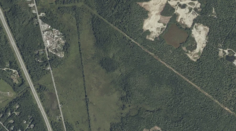
Gray Meadow — Swamps 43.5 Miles SSE of Chapman Inn
Cumberland County, Maine · USGS Cumberland Center Quadrangle · GNIS 567104
Within Cumberland County, Maine, on the USGS Cumberland Center quadrangle, the swamp known as Gray Meadow sits 43.5 miles south-southeast of Chapman Inn.
Wikidata short description: “swamp in Cumberland County, Maine, United States of America”
Landmark Profile
Classification & USGS reference
Within Cumberland County, Maine, the U.S. Geological Survey lists Gray Meadow as a swamp on the Cumberland Center topographic quadrangle (FIPS 23/005), under Feature ID 567104. Catalogued in GNIS since 09/30/1980.
Coordinates & physical setting
Gray Meadow sits at 43.87285° N, 70.31866° W (DMS 43°52′22″ N, 70°19′07″ W).
Other swamps in Cumberland County, Maine
Cumberland County, ME contains 9 swamps catalogued in the USGS Geographic Names Information System, counting Gray Meadow itself. The ones closest to Gray Meadow:
| Feature | USGS Quadrangle | Distance |
|---|---|---|
| Brandy Bog | Gray | 5.8 mi |
| Boody Meadow | North Windham | 6 mi |
| Morgan Meadow | Raymond | 6.4 mi |
| Moose Meadow | Raymond | 7.3 mi |
| Ted Swamp | Casco | 15.9 mi |
| Pitts Meadow | Casco | 17.3 mi |
| Perley Meadow | North Sebago | 18.5 mi |
| Biglow Swamp | Casco | 22.2 mi |
Features on the USGS Cumberland Center Quadrangle
The Cumberland Center 7.5-minute topographic quadrangle holds 20 catalogued natural features alongside Gray Meadow. A sampling nearest to this location:
| Feature | Type | County | Offset |
|---|---|---|---|
| Wiggins Brook | Streams | Cumberland County, ME | 0.5 mi |
| Hunt Hill | Summits | Cumberland County, ME | 1.5 mi |
| Thayer Brook | Streams | Cumberland County, ME | 1.8 mi |
| Dutton Hill | Summits | Cumberland County, ME | 2 mi |
| Varney Hill | Summits | Cumberland County, ME | 3 mi |
| Verrills Ledges | Benches | Cumberland County, ME | 3 mi |
| Deer Brook | Streams | Cumberland County, ME | 3.1 mi |
| Walnut Hill | Summits | Cumberland County, ME | 3.8 mi |
| Atherton Hill | Summits | Cumberland County, ME | 3.9 mi |
| Bruce Hill | Summits | Cumberland County, ME | 4.1 mi |
Visiting from Chapman Inn
Distance, bearing & drive time
Follow the compass bearing SSE out of Bethel for 43.5 miles (south-southeast) and you reach Gray Meadow; at typical rural speeds the trip runs roughly 75 minutes.
Best time to visit
Late May through October; avoid black-fly peak in late May. At this latitude (43.873°), the shoulder seasons are workable — April and November can be comfortable on mild years. At 43.5 miles from the Inn, block the full day — sunrise start, late return, packed meals. Conditions at Gray Meadow track the nearby Wiggins Brook stream (0.5 mi away) closely — if that is runnable, so is this.
Nearest features to Gray Meadow
| Feature | Type | County | Distance |
|---|---|---|---|
| Wiggins Brook | Streams | Cumberland County, ME | 0.5 mi |
| Hunt Hill | Summits | Cumberland County, ME | 1.5 mi |
| Thayer Brook | Streams | Cumberland County, ME | 1.8 mi |
| Dutton Hill | Summits | Cumberland County, ME | 2 mi |
| Collyer Brook | Streams | Cumberland County, ME | 2.4 mi |
Frequently Asked Questions
Where is Gray Meadow located?
Gray Meadow is in Cumberland County, Maine, approximately 43.5 miles south-southeast of Chapman Inn in Bethel, Maine. It appears on the USGS Cumberland Center topographic quadrangle.
How far is Gray Meadow from Chapman Inn?
The drive runs about 75 minutes, 43.5 miles south-southeast (bearing SSE) of the Inn.
What type of natural feature is Gray Meadow?
The U.S. Geological Survey classifies Gray Meadow as a swamp, catalogued under GNIS Feature ID 567104 on the Cumberland Center quadrangle.
When is the best time to visit Gray Meadow?
Late May through October; avoid black-fly peak in late May.
How many other swamps are in Cumberland County, Maine?
GNIS lists 8 other swamps in Cumberland County, Maine.
Wikidata: Q33174933.